![](/images/other/stat-length.png)
![Tocht Paardrijden Guerstling - Guerstling sans frontière - Photo](https://media.geolcdn.com/t/1900/400/4bf23c49-bc0d-4904-82e5-78c7b2bef01a.jpg&format=pjpeg&maxdim=2)
Guerstling sans frontière
claude-aei
Gebruiker
![Lengte](/images/other/stat-length.png)
Lengte
19,5 km
![Max. hoogte](https://static1.geolcdn.com/siteimages/upload/files/1508320355ic_sort_altitude_max_24dp.png)
Max. hoogte
306 m
![Positief hoogteverschil](https://static1.geolcdn.com/siteimages/upload/files/1508320355ic_sort_den_pos_24dp.png)
Positief hoogteverschil
415 m
![Km-Effort](/images/other/stat-length.png)
Km-Effort
25 km
![Min. hoogte](https://static1.geolcdn.com/siteimages/upload/files/1508320355ic_sort_altitude_min_24dp.png)
Min. hoogte
180 m
![Negatief hoogteverschil](https://static1.geolcdn.com/siteimages/upload/files/1508320355ic_sort_den_neg_24dp.png)
Negatief hoogteverschil
414 m
![Boucle](https://static1.geolcdn.com/siteimages/upload/files/16400158638029165_repeat_loop_refresh_sync_direction_icon.png)
Boucle
Ja
Datum van aanmaak :
2023-04-16 08:22:49.82
Laatste wijziging :
2023-05-04 19:59:16.287
![Paardrijden](https://static1.geolcdn.com/sitytour/trail-icons/301.png)
3h17
Moeilijkheid : Medium
![Scan deze QR-code om de tocht te openen in de SityTrail-applicatie](https://capi.geolives.com/qq0zvz2zws4bq2lad0pu/sitytour/trails/3625504/qr.png?size=200)
Gratisgps-wandelapplicatie
Over ons
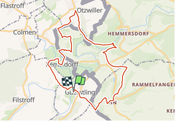
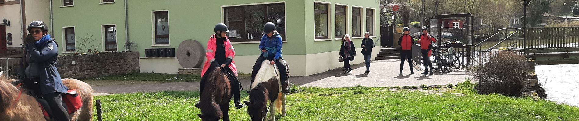
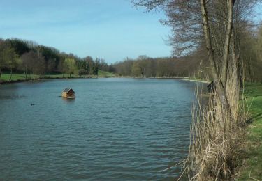
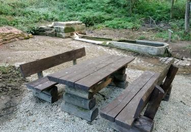
Tocht Paardrijden van 19,5 km beschikbaar op Grand Est, Moselle, Guerstling. Deze tocht wordt voorgesteld door claude-aei.
Beschrijving
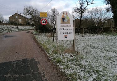
Départ au bord de la Nied, la balade sans frontière, au profil vallonné, nous permis de découvrir une grande diversité de paysages. Pause restauration Zur Wackenmühle
Plaatsbepaling
Land:
France
Regio :
Grand Est
Departement/Provincie :
Moselle
Gemeente :
Guerstling
Locatie:
Unknown
Vertrek:(Dec)
Vertrek:(UTM)
323948 ; 5466726 (32U) N.
Opmerkingen
Wandeltochten in de omgeving
![Tocht Te voet Wallerfangen - Grenzblickweg - Photo](https://media.geolcdn.com/t/375/260/d871565d-7bd5-4de8-9b5a-aeebe8ecae11.jpeg&format=jpg&maxdim=2)
![Te voet Te voet](https://static1.geolcdn.com/sitytour/trail-icons/100.png)
Grenzblickweg
Te voet
Gemakkelijk
Wallerfangen,
Saarland,
Landkreis Saarlouis,
Germany
![](/images/other/stat-length.png)
13,5 km | 17,2 km-effort
3h 54min
![](https://static1.geolcdn.com/siteimages/upload/files/16400158638029165_repeat_loop_refresh_sync_direction_icon.png)
Ja
![Tocht Te voet Wallerfangen - Hirn-Gallenberg-Tour - Photo](https://media.geolcdn.com/t/375/260/fc418177-c538-484c-a820-26a14192aa4f.jpeg&format=jpg&maxdim=2)
![Te voet Te voet](https://static1.geolcdn.com/sitytour/trail-icons/100.png)
Hirn-Gallenberg-Tour
Te voet
Gemakkelijk
Wallerfangen,
Saarland,
Landkreis Saarlouis,
Germany
![](/images/other/stat-length.png)
7,4 km | 9,8 km-effort
2h 14min
![](https://static1.geolcdn.com/siteimages/upload/files/16400158638029165_repeat_loop_refresh_sync_direction_icon.png)
Ja
![Tocht Mountainbike Filstroff - vallée de la Nied. franco-allemande - Photo](https://media.geolcdn.com/t/375/260/1dff51d1-3314-4162-b9d4-1010bdfc9dfe.jpg&format=jpg&maxdim=2)
![Mountainbike Mountainbike](https://static1.geolcdn.com/sitytour/trail-icons/202.png)
vallée de la Nied. franco-allemande
Mountainbike
Zeer moeilijk
Filstroff,
Grand Est,
Moselle,
France
![](/images/other/stat-length.png)
35 km | 44 km-effort
2h 45min
![](https://static1.geolcdn.com/siteimages/upload/files/16400158638029165_repeat_loop_refresh_sync_direction_icon.png)
Ja
![Tocht Te voet Rehlingen-Siersburg - Druidenpfad - Photo](https://media.geolcdn.com/t/375/260/0604d071-5d0d-4e1d-9759-fa288fc5141a.jpeg&format=jpg&maxdim=2)
![Te voet Te voet](https://static1.geolcdn.com/sitytour/trail-icons/100.png)
Druidenpfad
Te voet
Gemakkelijk
Rehlingen-Siersburg,
Saarland,
Landkreis Saarlouis,
Germany
![](/images/other/stat-length.png)
6 km | 7,9 km-effort
1h 47min
![](https://static1.geolcdn.com/siteimages/upload/files/16400158638029165_repeat_loop_refresh_sync_direction_icon.png)
Ja
![Tocht Stappen Heining-lès-Bouzonville - leiding - Photo](https://media.geolcdn.com/t/375/260/465c9325-42a7-4de8-8a95-50d5c2eca3aa.jpg&format=jpg&maxdim=2)
![Stappen Stappen](https://static1.geolcdn.com/sitytour/trail-icons/101.png)
leiding
Stappen
Heel gemakkelijk
Heining-lès-Bouzonville,
Grand Est,
Moselle,
France
![](/images/other/stat-length.png)
10,1 km | 12,5 km-effort
1h 41min
![](https://static1.geolcdn.com/siteimages/upload/files/16400158638029165_repeat_loop_refresh_sync_direction_icon.png)
Ja
![Tocht Stappen Schwerdorff - les fermes - Photo](https://media.geolcdn.com/t/375/260/ext.jpg?maxdim=2&url=https%3A%2F%2Fservices.sitytrail.com%2FGeolivesWS%2FDownloadMedia.ashx%3FTrailID%3D196189%26Media%3D20130605161444.jpg)
![Stappen Stappen](https://static1.geolcdn.com/sitytour/trail-icons/101.png)
les fermes
Stappen
Heel gemakkelijk
Schwerdorff,
Grand Est,
Moselle,
France
![](/images/other/stat-length.png)
12,2 km | 15 km-effort
3h 0min
![](https://static1.geolcdn.com/siteimages/upload/files/16400158638029165_repeat_loop_refresh_sync_direction_icon.png)
Ja
![Tocht Andere activiteiten Bouzonville - Au fil de l'eau sur la Nied - Photo](https://media.geolcdn.com/t/375/260/ext.jpg?maxdim=2&url=https%3A%2F%2Fservices.sitytrail.com%2FGeolivesWS%2FDownloadMedia.ashx%3FTrailID%3D110510%26Media%3D6048_2.jpg)
![Andere activiteiten Andere activiteiten](https://static1.geolcdn.com/sitytour/trail-icons/900.png)
Au fil de l'eau sur la Nied
Andere activiteiten
Medium
Bouzonville,
Grand Est,
Moselle,
France
![](/images/other/stat-length.png)
10,6 km | 11,6 km-effort
4h 0min
![](https://static1.geolcdn.com/siteimages/upload/files/16400158638029165_repeat_loop_refresh_sync_direction_icon.png)
Neen
![Tocht Stappen Bouzonville - bouzonville - Photo](https://media.geolcdn.com/t/375/260/ext.jpg?maxdim=2&url=https%3A%2F%2Fstatic1.geolcdn.com%2Fsiteimages%2Fupload%2Ffiles%2F1553511878bg_sport_marche.png)
![Stappen Stappen](https://static1.geolcdn.com/sitytour/trail-icons/101.png)
bouzonville
Stappen
Heel gemakkelijk
Bouzonville,
Grand Est,
Moselle,
France
![](/images/other/stat-length.png)
9,6 km | 11,2 km-effort
Onbekend
![](https://static1.geolcdn.com/siteimages/upload/files/16400158638029165_repeat_loop_refresh_sync_direction_icon.png)
Neen
![Tocht Paardrijden Schwerdorff - 2015-08-22-01 Schwerdorff - Photo](https://media.geolcdn.com/t/375/260/ext.jpg?maxdim=2&url=https%3A%2F%2Fstatic1.geolcdn.com%2Fsiteimages%2Fupload%2Ffiles%2F1524743154cheval.jpg)
![Paardrijden Paardrijden](https://static1.geolcdn.com/sitytour/trail-icons/301.png)
2015-08-22-01 Schwerdorff
Paardrijden
Heel gemakkelijk
Schwerdorff,
Grand Est,
Moselle,
France
![](/images/other/stat-length.png)
33 km | 41 km-effort
Onbekend
![](https://static1.geolcdn.com/siteimages/upload/files/16400158638029165_repeat_loop_refresh_sync_direction_icon.png)
Ja