![](/images/other/stat-length.png)
![Tocht Mountainbike Baudreix - Saint Abit 2018 Perso - 38 Km - Photo](https://media.geolcdn.com/t/1900/400/ext.pjpeg?maxdim=2&url=https%3A%2F%2Fstatic1.geolcdn.com%2Fsiteimages%2Fupload%2Ffiles%2F1524743154velo.jpg)
Saint Abit 2018 Perso - 38 Km
potofe
Gebruiker
![Lengte](/images/other/stat-length.png)
Lengte
38 km
![Max. hoogte](https://static1.geolcdn.com/siteimages/upload/files/1508320355ic_sort_altitude_max_24dp.png)
Max. hoogte
420 m
![Positief hoogteverschil](https://static1.geolcdn.com/siteimages/upload/files/1508320355ic_sort_den_pos_24dp.png)
Positief hoogteverschil
597 m
![Km-Effort](/images/other/stat-length.png)
Km-Effort
46 km
![Min. hoogte](https://static1.geolcdn.com/siteimages/upload/files/1508320355ic_sort_altitude_min_24dp.png)
Min. hoogte
196 m
![Negatief hoogteverschil](https://static1.geolcdn.com/siteimages/upload/files/1508320355ic_sort_den_neg_24dp.png)
Negatief hoogteverschil
593 m
![Boucle](https://static1.geolcdn.com/siteimages/upload/files/16400158638029165_repeat_loop_refresh_sync_direction_icon.png)
Boucle
Ja
Datum van aanmaak :
2023-04-08 10:08:51.0
Laatste wijziging :
2023-04-12 11:11:14.907
![Mountainbike](https://static1.geolcdn.com/sitytour/trail-icons/202.png)
3h11
Moeilijkheid : Zeer moeilijk
![Scan deze QR-code om de tocht te openen in de SityTrail-applicatie](https://capi.geolives.com/qq0zvz2zws4bq2lad0pu/sitytour/trails/3613661/qr.png?size=200)
Gratisgps-wandelapplicatie
Over ons
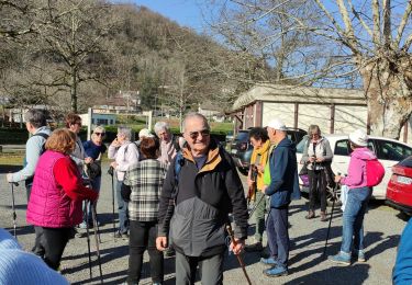
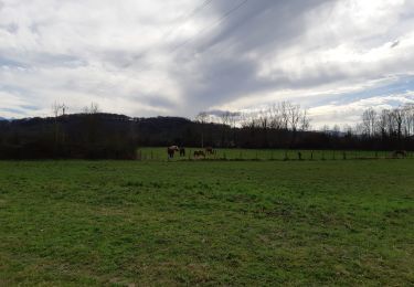
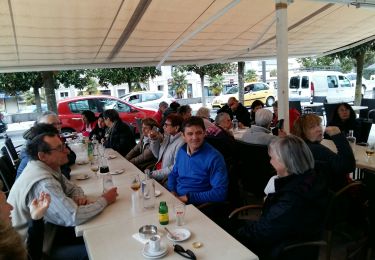
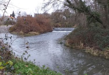
Tocht Mountainbike van 38 km beschikbaar op Nieuw-Aquitanië, Pyrénées-Atlantiques, Baudreix. Deze tocht wordt voorgesteld door potofe.
Beschrijving
08/04/2023
Alternative à la rando "Saint Abit 2018 Perso - 42 Km" en attendant que le pont sur l'Escoutte soit réparé.
Plaatsbepaling
Land:
France
Regio :
Nieuw-Aquitanië
Departement/Provincie :
Pyrénées-Atlantiques
Gemeente :
Baudreix
Locatie:
Unknown
Vertrek:(Dec)
Vertrek:(UTM)
722411 ; 4787169 (30T) N.
Opmerkingen
Wandeltochten in de omgeving
![Tocht Mountainbike Bordères - Petite boucle rapide - Photo](https://media.geolcdn.com/t/375/260/ext.jpg?maxdim=2&url=https%3A%2F%2Fstatic1.geolcdn.com%2Fsiteimages%2Fupload%2Ffiles%2F1524743154velo.jpg)
![Mountainbike Mountainbike](https://static1.geolcdn.com/sitytour/trail-icons/202.png)
Petite boucle rapide
Mountainbike
Gemakkelijk
(1)
Bordères,
Nieuw-Aquitanië,
Pyrénées-Atlantiques,
France
![](/images/other/stat-length.png)
9,4 km | 11,9 km-effort
46min
![](https://static1.geolcdn.com/siteimages/upload/files/16400158638029165_repeat_loop_refresh_sync_direction_icon.png)
Ja
![Tocht Stappen Baliros - BALIROS RS](https://media.geolcdn.com/t/375/260/31690ab5-5d02-4c9a-a234-d556a720ad25.jpg&format=jpg&maxdim=2)
![Stappen Stappen](https://static1.geolcdn.com/sitytour/trail-icons/101.png)
BALIROS RS "3933114"
Stappen
Gemakkelijk
Baliros,
Nieuw-Aquitanië,
Pyrénées-Atlantiques,
France
![](/images/other/stat-length.png)
5 km | 5,5 km-effort
2h 27min
![](https://static1.geolcdn.com/siteimages/upload/files/16400158638029165_repeat_loop_refresh_sync_direction_icon.png)
Ja
![Tocht Stappen Baudreix - BAUDREIX RS Le tour de la saligue](https://media.geolcdn.com/t/375/260/eb1b4863-415e-4c07-bbee-331e0d538026.jpg&format=jpg&maxdim=2)
![Stappen Stappen](https://static1.geolcdn.com/sitytour/trail-icons/101.png)
BAUDREIX RS Le tour de la saligue "3592973"
Stappen
Gemakkelijk
Baudreix,
Nieuw-Aquitanië,
Pyrénées-Atlantiques,
France
![](/images/other/stat-length.png)
4,7 km | 5,2 km-effort
1h 39min
![](https://static1.geolcdn.com/siteimages/upload/files/16400158638029165_repeat_loop_refresh_sync_direction_icon.png)
Ja
![Tocht Stappen Nay - NAY RS la passerelle de Baburet 6eme anniversaire](https://media.geolcdn.com/t/375/260/0aa9d3b3-16d3-4637-8599-4384d873f734.jpg&format=jpg&maxdim=2)
![Stappen Stappen](https://static1.geolcdn.com/sitytour/trail-icons/101.png)
NAY RS la passerelle de Baburet 6eme anniversaire "3185234"
Stappen
Medium
Nay,
Nieuw-Aquitanië,
Pyrénées-Atlantiques,
France
![](/images/other/stat-length.png)
5,5 km | 6,2 km-effort
1h 35min
![](https://static1.geolcdn.com/siteimages/upload/files/16400158638029165_repeat_loop_refresh_sync_direction_icon.png)
Ja
![Tocht Stappen Boeil-Bezing - boeyRSFait - Photo](https://media.geolcdn.com/t/375/260/4ea6dea9-f877-4408-ad28-c91b13f58f73.jpg&format=jpg&maxdim=2)
![Stappen Stappen](https://static1.geolcdn.com/sitytour/trail-icons/101.png)
boeyRSFait
Stappen
Heel gemakkelijk
Boeil-Bezing,
Nieuw-Aquitanië,
Pyrénées-Atlantiques,
France
![](/images/other/stat-length.png)
5,4 km | 5,8 km-effort
2h 22min
![](https://static1.geolcdn.com/siteimages/upload/files/16400158638029165_repeat_loop_refresh_sync_direction_icon.png)
Ja
![Tocht Stappen Beuste - Forêt de Beuste et de Boeil-Bezing - Photo](https://media.geolcdn.com/t/375/260/ext.jpg?maxdim=2&url=https%3A%2F%2Fservices.sitytrail.com%2FGeolivesWS%2FDownloadMedia.ashx%3FTrailID%3D103255%26Media%3D5209_4.jpg)
![Stappen Stappen](https://static1.geolcdn.com/sitytour/trail-icons/101.png)
Forêt de Beuste et de Boeil-Bezing
Stappen
Medium
Beuste,
Nieuw-Aquitanië,
Pyrénées-Atlantiques,
France
![](/images/other/stat-length.png)
9,4 km | 13,1 km-effort
2h 30min
![](https://static1.geolcdn.com/siteimages/upload/files/16400158638029165_repeat_loop_refresh_sync_direction_icon.png)
Ja
![Tocht Stappen Igon - Boucle de l'Ouzom à Asson - Photo](https://media.geolcdn.com/t/375/260/ext.jpg?maxdim=2&url=https%3A%2F%2Fservices.sitytrail.com%2FGeolivesWS%2FDownloadMedia.ashx%3FTrailID%3D103230%26Media%3D5117_6.jpg)
![Stappen Stappen](https://static1.geolcdn.com/sitytour/trail-icons/101.png)
Boucle de l'Ouzom à Asson
Stappen
Medium
Igon,
Nieuw-Aquitanië,
Pyrénées-Atlantiques,
France
![](/images/other/stat-length.png)
13 km | 16,4 km-effort
3h 30min
![](https://static1.geolcdn.com/siteimages/upload/files/16400158638029165_repeat_loop_refresh_sync_direction_icon.png)
Ja
![Tocht Stappen Baudreix - RS BAUDREIX 2024 - Photo](https://media.geolcdn.com/t/375/260/ext.jpg?maxdim=2&url=https%3A%2F%2Fstatic1.geolcdn.com%2Fsiteimages%2Fupload%2Ffiles%2F1553511878bg_sport_marche.png)
![Stappen Stappen](https://static1.geolcdn.com/sitytour/trail-icons/101.png)
RS BAUDREIX 2024
Stappen
Gemakkelijk
Baudreix,
Nieuw-Aquitanië,
Pyrénées-Atlantiques,
France
![](/images/other/stat-length.png)
3,9 km | 4,3 km-effort
2h 9min
![](https://static1.geolcdn.com/siteimages/upload/files/16400158638029165_repeat_loop_refresh_sync_direction_icon.png)
Ja
![Tocht Stappen Baudreix - BAUDREIX RS - Photo](https://media.geolcdn.com/t/375/260/4560e2e0-4c13-4d55-9668-d837d9c3a8d5.jpg&format=jpg&maxdim=2)
![Stappen Stappen](https://static1.geolcdn.com/sitytour/trail-icons/101.png)
BAUDREIX RS
Stappen
Gemakkelijk
Baudreix,
Nieuw-Aquitanië,
Pyrénées-Atlantiques,
France
![](/images/other/stat-length.png)
2,7 km | 3 km-effort
56min
![](https://static1.geolcdn.com/siteimages/upload/files/16400158638029165_repeat_loop_refresh_sync_direction_icon.png)
Ja