![](/images/other/stat-length.png)
![Tocht Te voet Sainte-Croix - The gorges of Covatannaz - Photo](https://media.geolcdn.com/t/1900/400/ext.pjpeg?maxdim=2&url=https%3A%2F%2Fstatic1.geolcdn.com%2Fsiteimages%2Fupload%2Ffiles%2F1545311037marcheuse_200dpi.jpg)
The gorges of Covatannaz
famiski
Gebruiker
![Lengte](/images/other/stat-length.png)
![Max. hoogte](https://static1.geolcdn.com/siteimages/upload/files/1508320355ic_sort_altitude_max_24dp.png)
![Positief hoogteverschil](https://static1.geolcdn.com/siteimages/upload/files/1508320355ic_sort_den_pos_24dp.png)
![Km-Effort](/images/other/stat-length.png)
![Min. hoogte](https://static1.geolcdn.com/siteimages/upload/files/1508320355ic_sort_altitude_min_24dp.png)
![Negatief hoogteverschil](https://static1.geolcdn.com/siteimages/upload/files/1508320355ic_sort_den_neg_24dp.png)
![Boucle](https://static1.geolcdn.com/siteimages/upload/files/16400158638029165_repeat_loop_refresh_sync_direction_icon.png)
![Te voet](https://static1.geolcdn.com/sitytour/trail-icons/100.png)
1h40
Moeilijkheid : Gemakkelijk
![Scan deze QR-code om de tocht te openen in de SityTrail-applicatie](https://capi.geolives.com/qq0zvz2zws4bq2lad0pu/sitytour/trails/3596685/qr.png?size=200)
Gratisgps-wandelapplicatie
Over ons
Tocht Te voet van 5,5 km beschikbaar op Waadland, District du Jura-Nord vaudois, Sainte-Croix. Deze tocht wordt voorgesteld door famiski.
Beschrijving
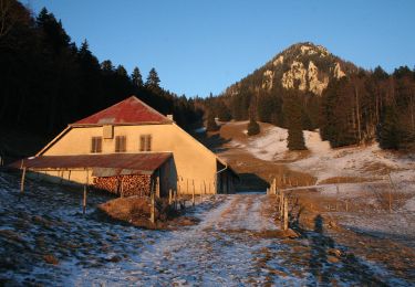
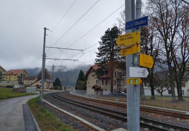
Leaving from the station of Sainte-Croix, the hike starts by following the marked route alongside the railway line. The hike continues across open pastures before leading into the midst of the forest running alongside the river Arnon. Over the course of time, this river that shaped the gorges of Covatannaz and its impressive cliffs. The trail then leads downward, keeping pace with large and sets of rapids and cascades before arriving at the site of Fontanet with its vast clearing, an ideal place to appreciate while having a picnic.
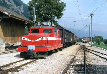
A few metres higher up, walkers will come to a road junction giving access to Baulmes after an extra 2 km, or follow the signs to Vuiteboeuf. From there, the panoramic train ‘Travys’ takes the hikers back to Sainte-Croix via Baulmes, or Yverdon-les-Bains.
Plaatsbepaling
Opmerkingen
Wandeltochten in de omgeving
![Tocht Te voet La Côte-aux-Fées - La Côte-aux-Fées - Buttes - Photo](https://media.geolcdn.com/t/375/260/4ddaa482-5cf5-46b7-b784-db7dcb3959dd.jpeg&format=jpg&maxdim=2)
![Te voet Te voet](https://static1.geolcdn.com/sitytour/trail-icons/100.png)
Te voet
![](/images/other/stat-length.png)
![](https://static1.geolcdn.com/siteimages/upload/files/16400158638029165_repeat_loop_refresh_sync_direction_icon.png)
![Tocht Te voet Sainte-Croix - La Gittaz-Col de l'Aigullon - Photo](https://media.geolcdn.com/t/375/260/6946b4e0-6068-4cfa-bbe6-24c55651ec09.jpeg&format=jpg&maxdim=2)
![Te voet Te voet](https://static1.geolcdn.com/sitytour/trail-icons/100.png)
Te voet
![](/images/other/stat-length.png)
![](https://static1.geolcdn.com/siteimages/upload/files/16400158638029165_repeat_loop_refresh_sync_direction_icon.png)
![Tocht Te voet Sainte-Croix - Sainte Croix-La Gittaz - Photo](https://media.geolcdn.com/t/375/260/7c0dcc60-9777-42cd-b5f3-05d60f03159f.jpeg&format=jpg&maxdim=2)
![Te voet Te voet](https://static1.geolcdn.com/sitytour/trail-icons/100.png)
Te voet
![](/images/other/stat-length.png)
![](https://static1.geolcdn.com/siteimages/upload/files/16400158638029165_repeat_loop_refresh_sync_direction_icon.png)
![Tocht Te voet Sainte-Croix - Chemin de la Gare - Photo](https://media.geolcdn.com/t/375/260/1c01c3b8-df2a-4423-9b92-ab96556853c0.jpeg&format=jpg&maxdim=2)
![Te voet Te voet](https://static1.geolcdn.com/sitytour/trail-icons/100.png)
Te voet
![](/images/other/stat-length.png)
![](https://static1.geolcdn.com/siteimages/upload/files/16400158638029165_repeat_loop_refresh_sync_direction_icon.png)
![Tocht Stappen Jougne - Aiguilles de Baulmes - Suisse - Photo](https://media.geolcdn.com/t/375/260/ext.jpg?maxdim=2&url=https%3A%2F%2Fstatic1.geolcdn.com%2Fsiteimages%2Fupload%2Ffiles%2F1553511878bg_sport_marche.png)
![Stappen Stappen](https://static1.geolcdn.com/sitytour/trail-icons/101.png)
Stappen
![](/images/other/stat-length.png)
![](https://static1.geolcdn.com/siteimages/upload/files/16400158638029165_repeat_loop_refresh_sync_direction_icon.png)
![Tocht Stappen Sainte-Croix - le Chasseron par les avattes - Photo](https://media.geolcdn.com/t/375/260/ext.jpg?maxdim=2&url=https%3A%2F%2Fservices.sitytrail.com%2FGeolivesWS%2FDownloadMedia.ashx%3FTrailID%3D966325%26Media%3Dfix__20180507162134.jpg)
![Stappen Stappen](https://static1.geolcdn.com/sitytour/trail-icons/101.png)
Stappen
![](/images/other/stat-length.png)
![](https://static1.geolcdn.com/siteimages/upload/files/16400158638029165_repeat_loop_refresh_sync_direction_icon.png)
![Tocht Stappen Jougne - aiguilles de Baulmes et retour Suchet - Photo](https://media.geolcdn.com/t/375/260/c17e4977-34fe-43ba-93d4-0a17ab33486a.jpg&format=jpg&maxdim=2)
![Stappen Stappen](https://static1.geolcdn.com/sitytour/trail-icons/101.png)
Stappen
![](/images/other/stat-length.png)
![](https://static1.geolcdn.com/siteimages/upload/files/16400158638029165_repeat_loop_refresh_sync_direction_icon.png)
![Tocht Sneeuwschoenen Sainte-Croix - Col des Etroits Le Chasseron CAF - Photo](https://media.geolcdn.com/t/375/260/73c05fda-b10e-4eb7-8c51-21af8620a72d.jpg&format=jpg&maxdim=2)
![Sneeuwschoenen Sneeuwschoenen](https://static1.geolcdn.com/sitytour/trail-icons/504.png)
Sneeuwschoenen
![](/images/other/stat-length.png)
![](https://static1.geolcdn.com/siteimages/upload/files/16400158638029165_repeat_loop_refresh_sync_direction_icon.png)
![Tocht Stappen Sainte-Croix - Sentier des bornes sud - Photo](https://media.geolcdn.com/t/375/260/f42e42f4-9b7b-4ade-8d19-3d5cc767500a.jpg&format=jpg&maxdim=2)
![Stappen Stappen](https://static1.geolcdn.com/sitytour/trail-icons/101.png)
Stappen
![](/images/other/stat-length.png)
![](https://static1.geolcdn.com/siteimages/upload/files/16400158638029165_repeat_loop_refresh_sync_direction_icon.png)