


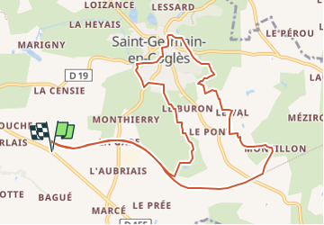

5,9 km | 7,1 km-effort


Gebruiker


Gratisgps-wandelapplicatie
 SityTrail
IGN / Geografische instituten
SityTrail World
De wereld gaat voor u open
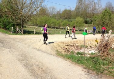
Tocht Noords wandelen van 12,2 km beschikbaar op Bretagne, Ille-et-Vilaine, Saint-Germain-en-Coglès. Deze tocht wordt voorgesteld door coglais.
départ de la croix triquet vers montillon par la voie verte puis circuit des légendes par st germain et retour par le rocher jacquot puis voie verte vers croix triquet.
Te voet
Stappen

Noords wandelen
Noords wandelen

Noords wandelen
Noords wandelen
Noords wandelen

Noords wandelen

Noords wandelen