4,3 km | 5,8 km-effort
St Jean Leblanc
gr1346
Gebruiker
Lengte
7,1 km
Max. hoogte
240 m
Positief hoogteverschil
175 m
Km-Effort
9,4 km
Min. hoogte
138 m
Negatief hoogteverschil
172 m
Boucle
Ja
Datum van aanmaak :
2017-11-03 00:00:00.0
Laatste wijziging :
2017-11-03 00:00:00.0
2h02
Moeilijkheid : Medium
Gratisgps-wandelapplicatie
Over ons
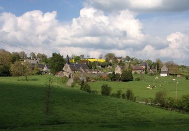
Tocht Stappen van 7,1 km beschikbaar op Normandië, Calvados, Terres de Druance. Deze tocht wordt voorgesteld door gr1346.
Plaatsbepaling
Land:
France
Regio :
Normandië
Departement/Provincie :
Calvados
Gemeente :
Terres de Druance
Locatie:
Saint-Jean-le-Blanc
Vertrek:(Dec)
Vertrek:(UTM)
671859 ; 5422941 (30U) N.
Opmerkingen
Wandeltochten in de omgeving
La Chapelle Engerbold
Te voet
Gemakkelijk
Condé-en-Normandie,
Normandië,
Calvados,
France
1h 18min
Ja
mt pincon trois monts
Stappen
Moeilijk
Les Monts d'Aunay,
Normandië,
Calvados,
France
29 km | 36 km-effort
6h 0min
Neen
2022-02-25 balade nous samy danvou la ferrière gîte
Stappen
Gemakkelijk
Les Monts d'Aunay,
Normandië,
Calvados,
France
5,3 km | 6,6 km-effort
1h 29min
Ja
Le Mont Pinçon
Te voet
Gemakkelijk
Les Monts d'Aunay,
Normandië,
Calvados,
France
8,2 km | 10,2 km-effort
2h 18min
Ja
Le Moulin du Boeuf
Te voet
Gemakkelijk
Terres de Druance,
Normandië,
Calvados,
France
6,1 km | 7,9 km-effort
1h 47min
Ja
Tour du Bourg
Te voet
Gemakkelijk
Terres de Druance,
Normandië,
Calvados,
France
3,3 km | 4,2 km-effort
57min
Ja
Les Ferrières de Danvou
Te voet
Gemakkelijk
Les Monts d'Aunay,
Normandië,
Calvados,
France
6,4 km | 7,8 km-effort
1h 46min
Neen
Chemins Creux E
Te voet
Gemakkelijk
Condé-en-Normandie,
Normandië,
Calvados,
France
6,6 km | 8,2 km-effort
1h 51min
Ja
Chemins Creux C
Te voet
Gemakkelijk
Périgny,
Normandië,
Calvados,
France
4,2 km | 5,1 km-effort
1h 10min
Ja