![](/images/other/stat-length.png)
![Tocht Stappen Courpalay - SityTrail - J 96 - Randonnées des lavoirs - 19 km - Photo](https://media.geolcdn.com/t/1900/400/fa54443c-4720-4cee-9756-9184d788307c.jpg&format=pjpeg&maxdim=2)
SityTrail - J 96 - Randonnées des lavoirs - 19 km
Les 1000 pattes
Club randonnées SERVON
![Lengte](/images/other/stat-length.png)
Lengte
19,2 km
![Max. hoogte](https://static1.geolcdn.com/siteimages/upload/files/1508320355ic_sort_altitude_max_24dp.png)
Max. hoogte
113 m
![Positief hoogteverschil](https://static1.geolcdn.com/siteimages/upload/files/1508320355ic_sort_den_pos_24dp.png)
Positief hoogteverschil
199 m
![Km-Effort](/images/other/stat-length.png)
Km-Effort
22 km
![Min. hoogte](https://static1.geolcdn.com/siteimages/upload/files/1508320355ic_sort_altitude_min_24dp.png)
Min. hoogte
75 m
![Negatief hoogteverschil](https://static1.geolcdn.com/siteimages/upload/files/1508320355ic_sort_den_neg_24dp.png)
Negatief hoogteverschil
197 m
![Boucle](https://static1.geolcdn.com/siteimages/upload/files/16400158638029165_repeat_loop_refresh_sync_direction_icon.png)
Boucle
Ja
Datum van aanmaak :
2023-03-01 08:09:48.245
Laatste wijziging :
2023-10-27 15:37:01.009
![Stappen](https://static1.geolcdn.com/sitytour/trail-icons/101.png)
4h58
Moeilijkheid : Moeilijk
![Scan deze QR-code om de tocht te openen in de SityTrail-applicatie](https://capi.geolives.com/qq0zvz2zws4bq2lad0pu/sitytour/trails/3569060/qr.png?size=200)
Gratisgps-wandelapplicatie
Over ons
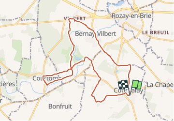
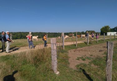
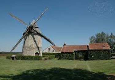
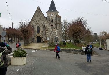
Tocht Stappen van 19,2 km beschikbaar op Île-de-France, Seine-et-Marne, Courpalay. Deze tocht wordt voorgesteld door Les 1000 pattes.
Beschrijving
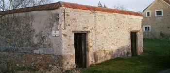
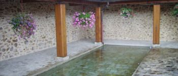
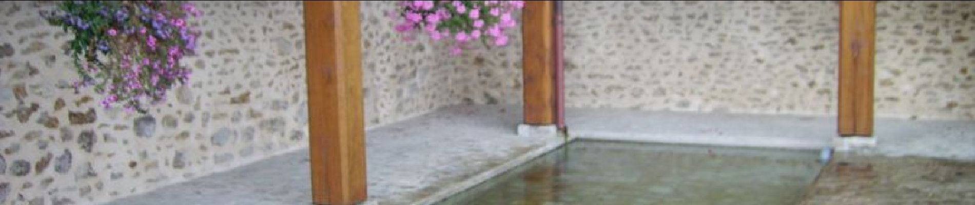
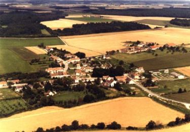
Randonnées des lavoirs au départ du parking de l'école de Courpalay
POI's
Plaatsbepaling
Land:
France
Regio :
Île-de-France
Departement/Provincie :
Seine-et-Marne
Gemeente :
Courpalay
Locatie:
Unknown
Vertrek:(Dec)
Vertrek:(UTM)
497238 ; 5388252 (31U) N.
Opmerkingen
Wandeltochten in de omgeving
![Tocht Stappen Courtomer - Boucle Courtomer - chaumes en Brie - - Photo](https://media.geolcdn.com/t/375/260/4c724cf3-58fd-4de3-a054-aacb416cef6c.jpg&format=jpg&maxdim=2)
![Stappen Stappen](https://static1.geolcdn.com/sitytour/trail-icons/101.png)
Boucle Courtomer - chaumes en Brie -
Stappen
Gemakkelijk
Courtomer,
Île-de-France,
Seine-et-Marne,
France
![](/images/other/stat-length.png)
20 km | 23 km-effort
4h 34min
![](https://static1.geolcdn.com/siteimages/upload/files/16400158638029165_repeat_loop_refresh_sync_direction_icon.png)
Ja
![Tocht Stappen Bernay-Vilbert - Boucle de Bernay - Photo](https://media.geolcdn.com/t/375/260/0badd9bc-4790-4ce2-8ad5-41233d0a2e71.jpg&format=jpg&maxdim=2)
![Stappen Stappen](https://static1.geolcdn.com/sitytour/trail-icons/101.png)
Boucle de Bernay
Stappen
Medium
Bernay-Vilbert,
Île-de-France,
Seine-et-Marne,
France
![](/images/other/stat-length.png)
7,9 km | 9 km-effort
2h 6min
![](https://static1.geolcdn.com/siteimages/upload/files/16400158638029165_repeat_loop_refresh_sync_direction_icon.png)
Ja
![Tocht Stappen La Chapelle-Iger - Les côteaux Capelligérois - La Chapelle-Iger - Photo](https://media.geolcdn.com/t/375/260/ext.jpg?maxdim=2&url=https%3A%2F%2Fservices.sitytrail.com%2FGeolivesWS%2FDownloadMedia.ashx%3FTrailID%3D111434%26Media%3D7247_3.jpg)
![Stappen Stappen](https://static1.geolcdn.com/sitytour/trail-icons/101.png)
Les côteaux Capelligérois - La Chapelle-Iger
Stappen
Moeilijk
La Chapelle-Iger,
Île-de-France,
Seine-et-Marne,
France
![](/images/other/stat-length.png)
13,5 km | 15,3 km-effort
3h 19min
![](https://static1.geolcdn.com/siteimages/upload/files/16400158638029165_repeat_loop_refresh_sync_direction_icon.png)
Ja
![Tocht Stappen Courpalay - courpalay - Photo](https://media.geolcdn.com/t/375/260/ext.jpg?maxdim=2&url=https%3A%2F%2Fstatic1.geolcdn.com%2Fsiteimages%2Fupload%2Ffiles%2F1553511878bg_sport_marche.png)
![Stappen Stappen](https://static1.geolcdn.com/sitytour/trail-icons/101.png)
courpalay
Stappen
Gemakkelijk
(1)
Courpalay,
Île-de-France,
Seine-et-Marne,
France
![](/images/other/stat-length.png)
13,7 km | 15,3 km-effort
3h 20min
![](https://static1.geolcdn.com/siteimages/upload/files/16400158638029165_repeat_loop_refresh_sync_direction_icon.png)
Ja
![Tocht Stappen Courpalay - Courpalay - Photo](https://media.geolcdn.com/t/375/260/8b75a87c-9af5-4c3b-a34c-55caf118b693.jpg&format=jpg&maxdim=2)
![Stappen Stappen](https://static1.geolcdn.com/sitytour/trail-icons/101.png)
Courpalay
Stappen
Medium
Courpalay,
Île-de-France,
Seine-et-Marne,
France
![](/images/other/stat-length.png)
8,6 km | 9,8 km-effort
2h 39min
![](https://static1.geolcdn.com/siteimages/upload/files/16400158638029165_repeat_loop_refresh_sync_direction_icon.png)
Ja
![Tocht Stappen La Chapelle-Iger - Chapelle Iger - Photo](https://media.geolcdn.com/t/375/260/94ccf62d-3c42-4d7c-83a6-5d59eec3bc13.jpg&format=jpg&maxdim=2)
![Stappen Stappen](https://static1.geolcdn.com/sitytour/trail-icons/101.png)
Chapelle Iger
Stappen
Medium
La Chapelle-Iger,
Île-de-France,
Seine-et-Marne,
France
![](/images/other/stat-length.png)
10,2 km | 11,4 km-effort
2h 3min
![](https://static1.geolcdn.com/siteimages/upload/files/16400158638029165_repeat_loop_refresh_sync_direction_icon.png)
Ja
![Tocht Stappen La Chapelle-Iger - la chapelle Iger - Photo](https://media.geolcdn.com/t/375/260/a5724690-204d-473f-ab68-a5fbec7ba8ce.jpg&format=jpg&maxdim=2)
![Stappen Stappen](https://static1.geolcdn.com/sitytour/trail-icons/101.png)
la chapelle Iger
Stappen
Moeilijk
La Chapelle-Iger,
Île-de-France,
Seine-et-Marne,
France
![](/images/other/stat-length.png)
18,8 km | 21 km-effort
4h 18min
![](https://static1.geolcdn.com/siteimages/upload/files/16400158638029165_repeat_loop_refresh_sync_direction_icon.png)
Ja
![Tocht Andere activiteiten Courpalay - courpalay - Photo](https://media.geolcdn.com/t/375/260/ext.jpg?maxdim=2&url=https%3A%2F%2Fservices.sitytrail.com%2FGeolivesWS%2FDownloadMedia.ashx%3FTrailID%3D689301%26Media%3Dfix__20170125141357.jpg)
![Andere activiteiten Andere activiteiten](https://static1.geolcdn.com/sitytour/trail-icons/900.png)
courpalay
Andere activiteiten
Heel gemakkelijk
Courpalay,
Île-de-France,
Seine-et-Marne,
France
![](/images/other/stat-length.png)
16,1 km | 18,3 km-effort
3h 51min
![](https://static1.geolcdn.com/siteimages/upload/files/16400158638029165_repeat_loop_refresh_sync_direction_icon.png)
Ja
![Tocht Stappen Bernay-Vilbert - Le long de l'Yerres autour de Bernay-Vilbert - Photo](https://media.geolcdn.com/t/375/260/ext.jpg?maxdim=2&url=https%3A%2F%2Fstatic1.geolcdn.com%2Fsiteimages%2Fupload%2Ffiles%2F1553511878bg_sport_marche.png)
![Stappen Stappen](https://static1.geolcdn.com/sitytour/trail-icons/101.png)
Le long de l'Yerres autour de Bernay-Vilbert
Stappen
Medium
Bernay-Vilbert,
Île-de-France,
Seine-et-Marne,
France
![](/images/other/stat-length.png)
7,5 km | 8,6 km-effort
1h 57min
![](https://static1.geolcdn.com/siteimages/upload/files/16400158638029165_repeat_loop_refresh_sync_direction_icon.png)
Ja