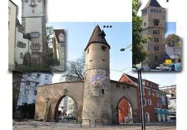
Tocht Stappen Mulhouse - JD 16/20 Mulhouse : canal, Fonderie, Illberg, bords de l'Ill 6km 40m - Photo

JD 16/20 Mulhouse : canal, Fonderie, Illberg, bords de l'Ill 6km 40m

 argonneuweg
argonneuweg

Gebruiker

© OpenStreetMap contributors
Lengte
Lengte
9,8 km
Max. hoogte
Max. hoogte
291 m
Positief hoogteverschil
116 m
Km-Effort
Km-Effort  
11,3 km
Min. hoogte
Min. hoogte
231 m
Negatief hoogteverschil
109 m
Boucle
Boucle
Ja
Datum van aanmaak :
2023-02-04 13:12:49.0
Laatste wijziging :
2023-03-04 19:06:04.16

(0 Bericht)

Stappen
Stappen
1h39
Moeilijkheid : Medium

Scan deze QR-code om de tocht te openen in de SityTrail-applicatie

Gratisgps-wandelapplicatie

Logo SityTrail SityTrail

IGN / Geografische instituten

SityTrail uit de App Store downloaden SityTrail uit Google Play downloaden

Logo SityTrail SityTrail World

De wereld gaat voor u open

SityTrail uit de App Store downloaden SityTrail uit Google Play downloaden SityTrail op Huawei AppGallery downloaden

Over ons

Tocht Stappen van 9,8 km beschikbaar op Grand Est, Haut-Rhin, Mulhouse. Deze tocht wordt voorgesteld door argonneuweg.

Beschrijving

Départ du parking de la CCI

Hoogteprofiel

Plaatsbepaling

Land:
France
Regio :
Grand Est
Departement/Provincie :
Haut-Rhin
Gemeente :
Mulhouse
Locatie:
Unknown
Vertrek:(Dec)
Vertrek:(UTM)
375613 ; 5289058 (32T) N.

Wandeltochten in de omgeving

Tocht Stappen Mulhouse - 20230904 - Mulhouse - Visite  - Photo
Stappen
GUIDE
pierreh01

Stappen

Gemakkelijk
(1)
Mulhouse, Grand Est, Haut-Rhin, France
4,2 km | 4,6 km-effort
1h 23min
Ja
Tocht Te voet Lutterbach - Promenade circulaire - Noennenbruch - Anneau rouge - Photo
Te voet
GUIDE+

Te voet

Gemakkelijk
Lutterbach, Grand Est, Haut-Rhin, France
6,6 km | 7,3 km-effort
1h 39min
Neen
Tocht Te voet Mulhouse - Anneau rouge - Photo
Te voet
GUIDE+

Te voet

Gemakkelijk
Mulhouse, Grand Est, Haut-Rhin, France
7,4 km | 9,7 km-effort
2h 11min
Ja
Tocht Stappen Riedisheim - Mulhouse / Ferrette..02/05/2024..les Marcheurs - Photo
Stappen
boubou68

Stappen

Zeer moeilijk
Riedisheim, Grand Est, Haut-Rhin, France
37 km | 48 km-effort
4h 9min
Neen
Tocht Stappen Riedisheim - circuit circulaire du Rothlaub - Photo
Stappen
selevrich

Stappen

Heel gemakkelijk
Riedisheim, Grand Est, Haut-Rhin, France
8,3 km | 10,7 km-effort
1h 45min
Ja
Tocht Andere activiteiten Rixheim - promenade champêtre - Photo
Andere activiteiten
bemurix

Andere activiteiten

Heel gemakkelijk
Rixheim, Grand Est, Haut-Rhin, France
6,4 km | 8 km-effort
1h 50min
Ja
Tocht Andere activiteiten Mulhouse - Grand Est - Ligne 4 - Paris Mulhouse (section de :Montreux-Vieux à Mulhouse) - Photo
Andere activiteiten
mich54

Andere activiteiten

Heel gemakkelijk
Mulhouse, Grand Est, Haut-Rhin, France
36 km | 39 km-effort
5min
Neen
Tocht Stappen Rixheim - JD 17/20 Collines de Habsheim - Photo
Stappen
argonneuweg

Stappen

Rixheim, Grand Est, Haut-Rhin, France
7,7 km | 9,7 km-effort
2h 0min
Ja
Tocht Fiets Mulhouse - waldeck - Photo
Fiets
olivier5960

Fiets

Heel gemakkelijk
Mulhouse, Grand Est, Haut-Rhin, France
12,2 km | 16,1 km-effort
1h 12min
Neen


Sluiten
Mijn abonnementen