![](/images/other/stat-length.png)
![Tocht Stappen Acquigny - Le Becdal Acquigny (37) - Photo](https://media.geolcdn.com/t/1900/400/ext.pjpeg?maxdim=2&url=https%3A%2F%2Fstatic1.geolcdn.com%2Fsiteimages%2Fupload%2Ffiles%2F1553511878bg_sport_marche.png)
Le Becdal Acquigny (37)
randovivi
Gebruiker
![Lengte](/images/other/stat-length.png)
Lengte
13,4 km
![Max. hoogte](https://static1.geolcdn.com/siteimages/upload/files/1508320355ic_sort_altitude_max_24dp.png)
Max. hoogte
139 m
![Positief hoogteverschil](https://static1.geolcdn.com/siteimages/upload/files/1508320355ic_sort_den_pos_24dp.png)
Positief hoogteverschil
206 m
![Km-Effort](/images/other/stat-length.png)
Km-Effort
16,2 km
![Min. hoogte](https://static1.geolcdn.com/siteimages/upload/files/1508320355ic_sort_altitude_min_24dp.png)
Min. hoogte
13 m
![Negatief hoogteverschil](https://static1.geolcdn.com/siteimages/upload/files/1508320355ic_sort_den_neg_24dp.png)
Negatief hoogteverschil
206 m
![Boucle](https://static1.geolcdn.com/siteimages/upload/files/16400158638029165_repeat_loop_refresh_sync_direction_icon.png)
Boucle
Ja
Datum van aanmaak :
2016-01-15 00:00:00.0
Laatste wijziging :
2016-01-15 00:00:00.0
![Stappen](https://static1.geolcdn.com/sitytour/trail-icons/101.png)
4h00
Moeilijkheid : Medium
![Scan deze QR-code om de tocht te openen in de SityTrail-applicatie](https://capi.geolives.com/qq0zvz2zws4bq2lad0pu/sitytour/trails/352551/qr.png?size=200)
Gratisgps-wandelapplicatie
Over ons
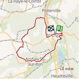
Tocht Stappen van 13,4 km beschikbaar op Normandië, Eure, Acquigny. Deze tocht wordt voorgesteld door randovivi.
Beschrijving
Faire Attention au lieu de parking: Une Gare, un moulin,une maison, le chateau d'Acquigny et son parc, l'église st. Cécile le manoir de BECDAL et autres sites et monuments vous attendent
Plaatsbepaling
Land:
France
Regio :
Normandië
Departement/Provincie :
Eure
Gemeente :
Acquigny
Locatie:
Unknown
Vertrek:(Dec)
Vertrek:(UTM)
367316 ; 5448151 (31U) N.
Opmerkingen
Wandeltochten in de omgeving
![Tocht Stappen La Haye-le-Comte - La Haye le Comte - Photo](https://media.geolcdn.com/t/375/260/ext.jpg?maxdim=2&url=https%3A%2F%2Fstatic1.geolcdn.com%2Fsiteimages%2Fupload%2Ffiles%2F1553511878bg_sport_marche.png)
![Stappen Stappen](https://static1.geolcdn.com/sitytour/trail-icons/101.png)
La Haye le Comte
Stappen
Medium
(1)
La Haye-le-Comte,
Normandië,
Eure,
France
![](/images/other/stat-length.png)
12 km | 14,7 km-effort
3h 0min
![](https://static1.geolcdn.com/siteimages/upload/files/16400158638029165_repeat_loop_refresh_sync_direction_icon.png)
Ja
![Stappen Stappen](https://static1.geolcdn.com/sitytour/trail-icons/101.png)
20231012-Amfreville sur Iton
Stappen
Medium
(1)
Amfreville-sur-Iton,
Normandië,
Eure,
France
![](/images/other/stat-length.png)
11,6 km | 14,4 km-effort
3h 17min
![](https://static1.geolcdn.com/siteimages/upload/files/16400158638029165_repeat_loop_refresh_sync_direction_icon.png)
Ja
![Tocht Wegfiets Pinterville - Pinterville aller retour - Photo](https://media.geolcdn.com/t/375/260/8eeb09f6-87db-4d49-a311-8b1c5c1f2921.jpg&format=jpg&maxdim=2)
![Wegfiets Wegfiets](https://static1.geolcdn.com/sitytour/trail-icons/201.png)
Pinterville aller retour
Wegfiets
Heel gemakkelijk
Pinterville,
Normandië,
Eure,
France
![](/images/other/stat-length.png)
59 km | 65 km-effort
3h 44min
![](https://static1.geolcdn.com/siteimages/upload/files/16400158638029165_repeat_loop_refresh_sync_direction_icon.png)
Ja
![Tocht Stappen Amfreville-sur-Iton - rando amfreville sur iton - Photo](https://media.geolcdn.com/t/375/260/1ae1478e-8362-45f5-95df-868478733425.jpg&format=jpg&maxdim=2)
![Stappen Stappen](https://static1.geolcdn.com/sitytour/trail-icons/101.png)
rando amfreville sur iton
Stappen
Medium
Amfreville-sur-Iton,
Normandië,
Eure,
France
![](/images/other/stat-length.png)
12,5 km | 15,4 km-effort
3h 18min
![](https://static1.geolcdn.com/siteimages/upload/files/16400158638029165_repeat_loop_refresh_sync_direction_icon.png)
Ja
![Tocht Stappen Heudebouville - 20230202-Heudebouville - Photo](https://media.geolcdn.com/t/375/260/9a040f26-251c-4887-9b11-b6efcdf3ee8d.jpg&format=jpg&maxdim=2)
![Stappen Stappen](https://static1.geolcdn.com/sitytour/trail-icons/101.png)
20230202-Heudebouville
Stappen
Medium
Heudebouville,
Normandië,
Eure,
France
![](/images/other/stat-length.png)
12,1 km | 15,1 km-effort
3h 55min
![](https://static1.geolcdn.com/siteimages/upload/files/16400158638029165_repeat_loop_refresh_sync_direction_icon.png)
Ja
![Stappen Stappen](https://static1.geolcdn.com/sitytour/trail-icons/101.png)
20220628-Heudreville le Jardin de René
Stappen
Medium
Heudreville-sur-Eure,
Normandië,
Eure,
France
![](/images/other/stat-length.png)
12 km | 14,1 km-effort
3h 37min
![](https://static1.geolcdn.com/siteimages/upload/files/16400158638029165_repeat_loop_refresh_sync_direction_icon.png)
Ja
![Stappen Stappen](https://static1.geolcdn.com/sitytour/trail-icons/101.png)
20220129-Amfreville sur Iton
Stappen
Medium
Amfreville-sur-Iton,
Normandië,
Eure,
France
![](/images/other/stat-length.png)
11,4 km | 14,2 km-effort
3h 5min
![](https://static1.geolcdn.com/siteimages/upload/files/16400158638029165_repeat_loop_refresh_sync_direction_icon.png)
Ja
![Tocht Wegfiets Acquigny - Acquis y rando vélo - Photo](https://media.geolcdn.com/t/375/260/ef4ceab2-1345-4b6b-a40a-ecfa46ab375d.jpg&format=jpg&maxdim=2)
![Wegfiets Wegfiets](https://static1.geolcdn.com/sitytour/trail-icons/201.png)
![Tocht Stappen Acquigny - Acquigny -Vers le Becdal par la mare Hermier - Photo](https://media.geolcdn.com/t/375/260/ef76d62e-c014-482a-b5da-dbf90d427cbf.jpg&format=jpg&maxdim=2)
![Stappen Stappen](https://static1.geolcdn.com/sitytour/trail-icons/101.png)
Acquigny -Vers le Becdal par la mare Hermier
Stappen
Medium
Acquigny,
Normandië,
Eure,
France
![](/images/other/stat-length.png)
13,3 km | 16 km-effort
3h 41min
![](https://static1.geolcdn.com/siteimages/upload/files/16400158638029165_repeat_loop_refresh_sync_direction_icon.png)
Ja