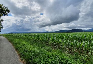
Tocht Stappen Clarac - Clarac, evelyne - Photo
 Jeanne Pene
Jeanne Pene

Gebruiker

© OpenStreetMap contributors
Lengte
Lengte
8,5 km
Max. hoogte
Max. hoogte
514 m
Positief hoogteverschil
145 m
Km-Effort
Km-Effort  
10,7 km
Min. hoogte
Min. hoogte
421 m
Negatief hoogteverschil
219 m
Boucle
Boucle
Neen
Datum van aanmaak :
2023-01-12 12:55:49.166
Laatste wijziging :
2023-01-12 15:10:03.151

(0 Bericht)

Stappen
Stappen
2h13
Moeilijkheid : Heel gemakkelijk

Scan deze QR-code om de tocht te openen in de SityTrail-applicatie

Gratisgps-wandelapplicatie

Logo SityTrail SityTrail

IGN / Geografische instituten

SityTrail uit de App Store downloaden SityTrail uit Google Play downloaden

Logo SityTrail SityTrail World

De wereld gaat voor u open

SityTrail uit de App Store downloaden SityTrail uit Google Play downloaden SityTrail op Huawei AppGallery downloaden

Over ons

Tocht Stappen van 8,5 km beschikbaar op Occitanië, Haute-Garonne, Clarac. Deze tocht wordt voorgesteld door Jeanne Pene.

Hoogteprofiel

Plaatsbepaling

Land:
France
Regio :
Occitanië
Departement/Provincie :
Haute-Garonne
Gemeente :
Clarac
Locatie:
Unknown
Vertrek:(Dec)
Vertrek:(UTM)
306201 ; 4777526 (31T) N.

Wandeltochten in de omgeving

Tocht Stappen Labarthe-Rivière - Camon - Photo
Stappen
jloger

Stappen

Gemakkelijk
Labarthe-Rivière, Occitanië, Haute-Garonne, France
7,5 km | 8 km-effort
1h 40min
Ja
Tocht Stappen Gourdan-Polignan - tour autour de Montréjeau  - Photo
Stappen
GUIDE
lhomme.ph

Stappen

Gemakkelijk
Gourdan-Polignan, Occitanië, Haute-Garonne, France
7,2 km | 8 km-effort
1h 41min
Ja
Tocht Wegfiets Villeneuve-de-Rivière - boucle au départ de Villeneuve  de  riviere  - Photo
Wegfiets
martoche

Wegfiets

Medium
Villeneuve-de-Rivière, Occitanië, Haute-Garonne, France
61 km | 71 km-effort
3h 55min
Ja
Tocht Stappen Le Cuing - boucle forêt de Cardeilhac  - Photo
Stappen
GUIDE
lhomme.ph

Stappen

Gemakkelijk
Le Cuing, Occitanië, Haute-Garonne, France
10,3 km | 12,1 km-effort
3h 37min
Ja
Tocht Wegfiets Villeneuve-de-Rivière - boucle dans le Comminges - Photo
Wegfiets
martoche

Wegfiets

Medium
Villeneuve-de-Rivière, Occitanië, Haute-Garonne, France
68 km | 80 km-effort
3h 58min
Neen
Tocht Wegfiets Villeneuve-de-Rivière - boucle commingeoise - Photo
Wegfiets
martoche

Wegfiets

Medium
Villeneuve-de-Rivière, Occitanië, Haute-Garonne, France
61 km | 71 km-effort
3h 9min
Ja
Tocht sport Bordes-de-Rivière - 2021-10-31_09h01m59_Cirkwi-Bordes_de_Rivière_Plaine__Les_canaux_d_irrigation_ - Photo
sport
jojo1412

sport

Heel gemakkelijk
Bordes-de-Rivière, Occitanië, Haute-Garonne, France
3,6 km | 3,9 km-effort
Onbekend
Ja
Tocht Stappen Ponlat-Taillebourg - chapelle st jean ponlat - Photo
Stappen
martoche

Stappen

Gemakkelijk
Ponlat-Taillebourg, Occitanië, Haute-Garonne, France
6,5 km | 7,9 km-effort
1h 47min
Ja
Tocht Wegfiets Villeneuve-de-Rivière - Villeneuve, Latoue, St Marcet , L'alouet,  lodes. - Photo
Wegfiets
martoche

Wegfiets

Medium
Villeneuve-de-Rivière, Occitanië, Haute-Garonne, France
43 km | 51 km-effort
2h 21min
Ja


Sluiten
Mijn abonnementen