6,8 km | 9,6 km-effort
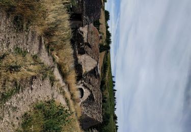
ruine
Gregory Bonhomme
Gebruiker
Lengte
83 km
Max. hoogte
1506 m
Positief hoogteverschil
3984 m
Km-Effort
140 km
Min. hoogte
62 m
Negatief hoogteverschil
5249 m
Boucle
Neen
Datum van aanmaak :
2021-09-18 10:14:45.844
Laatste wijziging :
2023-01-07 14:21:00.258
2h45
Moeilijkheid : Heel gemakkelijk
Gratisgps-wandelapplicatie
Over ons
Tocht Stappen van 83 km beschikbaar op Occitanië, Lozère, Les Bondons. Deze tocht wordt voorgesteld door Gregory Bonhomme .
Plaatsbepaling
Land:
France
Regio :
Occitanië
Departement/Provincie :
Lozère
Gemeente :
Les Bondons
Locatie:
Unknown
Vertrek:(Dec)
Vertrek:(UTM)
553340 ; 4919076 (31T) N.
Opmerkingen
Wandeltochten in de omgeving
les laubies à st etienne du valdonnez
Elektrische fiets
Gemakkelijk
Saint-Étienne-du-Valdonnez,
Occitanië,
Lozère,
France
34 km | 46 km-effort
4h 0min
Ja
Roc de Montal
Stappen
Medium
Pont de Montvert - Sud Mont Lozère,
Occitanië,
Lozère,
France
5,7 km | 8,6 km-effort
2h 30min
Ja
Balbosc -Malaval
Stappen
Zeer moeilijk
Les Bondons,
Occitanië,
Lozère,
France
17,5 km | 25 km-effort
6h 29min
Neen
Les Bondons
Stappen
Zeer moeilijk
Les Bondons,
Occitanië,
Lozère,
France
14,3 km | 21 km-effort
5h 53min
Ja
Cévennes Laubies Cx MeVidal Etg. Barrandon
Stappen
Gemakkelijk
Saint-Étienne-du-Valdonnez,
Occitanië,
Lozère,
France
5,6 km | 7 km-effort
1h 30min
Ja
Cevennes avec anes 3/6
Stappen
Medium
Pont de Montvert - Sud Mont Lozère,
Occitanië,
Lozère,
France
17,4 km | 21 km-effort
4h 29min
Neen
Laubies Barandon a l’envers
Stappen
Gemakkelijk
Saint-Étienne-du-Valdonnez,
Occitanië,
Lozère,
France
9,7 km | 13 km-effort
2h 30min
Ja
baand
Stappen
Zeer moeilijk
Saint-Étienne-du-Valdonnez,
Occitanië,
Lozère,
France
16,2 km | 22 km-effort
6h 4min
Ja