


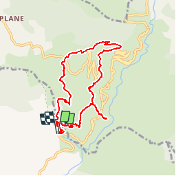

9,7 km | 18,3 km-effort


Gebruiker


Gratisgps-wandelapplicatie
 SityTrail
IGN / Geografische instituten
SityTrail World
De wereld gaat voor u open
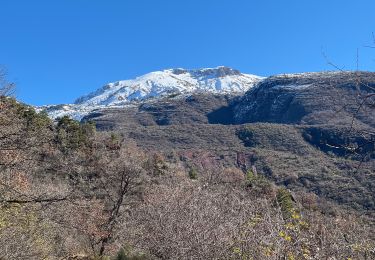
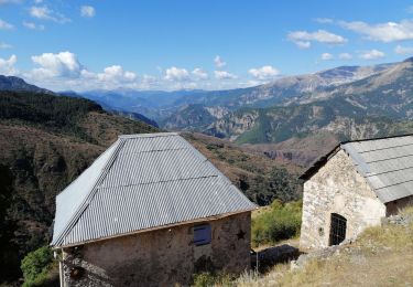
Tocht Stappen van 8,9 km beschikbaar op Provence-Alpes-Côte d'Azur, Alpes-Maritimes, Daluis. Deze tocht wordt voorgesteld door franquen.
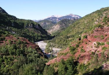
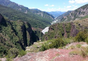
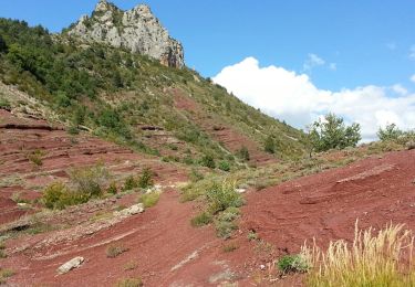
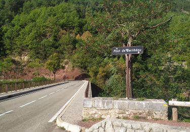
boucle à partir du pont Berthéou en passant d'abord par la Saussette et en revenant par les gorges et le point sublime. roches rouges et vertes, vue extraordinaire. panneaux zxplicatifs
Te voet
Te voet
Stappen
Stappen
Sneeuwschoenen
Stappen
Stappen

Te voet
Stappen
belle randonnée, attention le départ n'est pas très précis, prendre le chemin à droite du pont et non pas à gauche
C'est très beau. Mais il ne s'agit pas des gorges du Daluis, mais des gorges de Daluis. Daluis, n'est pas une rivière, mais un village en aval des gorges dans lesquelles coule le Var.
Une appli que j'utilise tout le temps. En trail, randonnées, ski de randonnée. ...... Top.