Tocht Stappen Torres del Paine - Glacier GREY  - Photo
 GOHIER
GOHIER

Gebruiker

© OpenStreetMap contributors
Lengte
Lengte
12,9 km
Max. hoogte
Max. hoogte
461 m
Positief hoogteverschil
511 m
Km-Effort
Km-Effort  
19,7 km
Min. hoogte
Min. hoogte
72 m
Negatief hoogteverschil
513 m
Boucle
Boucle
Ja
Datum van aanmaak :
2022-12-09 12:27:23.0
Laatste wijziging :
2022-12-10 20:27:10.629

(0 Bericht)

Stappen
Stappen
9h19
Moeilijkheid : Medium

Scan deze QR-code om de tocht te openen in de SityTrail-applicatie

Gratisgps-wandelapplicatie

Logo SityTrail SityTrail

IGN / Geografische instituten

SityTrail uit de App Store downloaden SityTrail uit Google Play downloaden

Logo SityTrail SityTrail World

De wereld gaat voor u open

SityTrail uit de App Store downloaden SityTrail uit Google Play downloaden SityTrail op Huawei AppGallery downloaden

Over ons

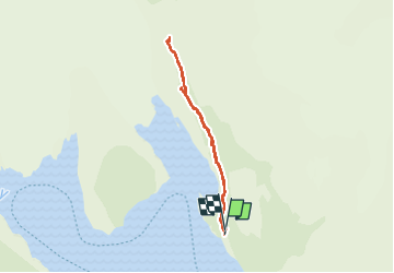
Tocht Stappen van 12,9 km beschikbaar op Magallanes y la Antártica Chilena, Provincia de Última Esperanza, Torres del Paine. Deze tocht wordt voorgesteld door GOHIER.

Beschrijving

Montée depuis Camp Grey à la troisième passerelle. Absolument sublime avec un temps magnifique.
Magique !

Hoogteprofiel

Plaatsbepaling

Land:
Chile
Regio :
Magallanes y la Antártica Chilena
Departement/Provincie :
Provincia de Última Esperanza
Gemeente :
Torres del Paine
Locatie:
Unknown
Vertrek:(UTM)
627947 ; 4347720 (18F) Z.

Wandeltochten in de omgeving

Tocht Motorboot Torres del Paine - Lago Grey - Photo
Motorboot
GOHIER

Motorboot

Heel gemakkelijk
Torres del Paine, Magallanes y la Antártica Chilena, Provincia de Última Esperanza, Chile
34 km | 38 km-effort
3h 39min
Neen


Sluiten
Mijn abonnementen