![](/images/other/stat-length.png)
![Tocht Stappen Grandfontaine - 2022-11-12 Marche Grandfontaine Tête Mathis Col de Praye La Corbeille - Photo](https://media.geolcdn.com/t/1900/400/b167e9d9-cb78-437f-9a9a-00585292dbd2.jpg&format=pjpeg&maxdim=2)
2022-11-12 Marche Grandfontaine Tête Mathis Col de Praye La Corbeille
holtzv
Gebruiker GUIDE
![Lengte](/images/other/stat-length.png)
Lengte
15,3 km
![Max. hoogte](https://static1.geolcdn.com/siteimages/upload/files/1508320355ic_sort_altitude_max_24dp.png)
Max. hoogte
909 m
![Positief hoogteverschil](https://static1.geolcdn.com/siteimages/upload/files/1508320355ic_sort_den_pos_24dp.png)
Positief hoogteverschil
605 m
![Km-Effort](/images/other/stat-length.png)
Km-Effort
23 km
![Min. hoogte](https://static1.geolcdn.com/siteimages/upload/files/1508320355ic_sort_altitude_min_24dp.png)
Min. hoogte
610 m
![Negatief hoogteverschil](https://static1.geolcdn.com/siteimages/upload/files/1508320355ic_sort_den_neg_24dp.png)
Negatief hoogteverschil
594 m
![Boucle](https://static1.geolcdn.com/siteimages/upload/files/16400158638029165_repeat_loop_refresh_sync_direction_icon.png)
Boucle
Ja
Datum van aanmaak :
2022-11-12 10:05:36.765
Laatste wijziging :
2022-11-14 12:15:47.884
![Stappen](https://static1.geolcdn.com/sitytour/trail-icons/101.png)
4h34
Moeilijkheid : Medium
![Scan deze QR-code om de tocht te openen in de SityTrail-applicatie](https://capi.geolives.com/qq0zvz2zws4bq2lad0pu/sitytour/trails/3454666/qr.png?size=200)
Gratisgps-wandelapplicatie
Over ons
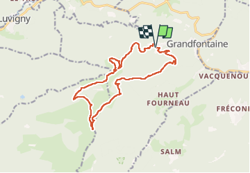
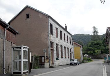
Tocht Stappen van 15,3 km beschikbaar op Grand Est, Bas-Rhin, Grandfontaine. Deze tocht wordt voorgesteld door holtzv.
Beschrijving
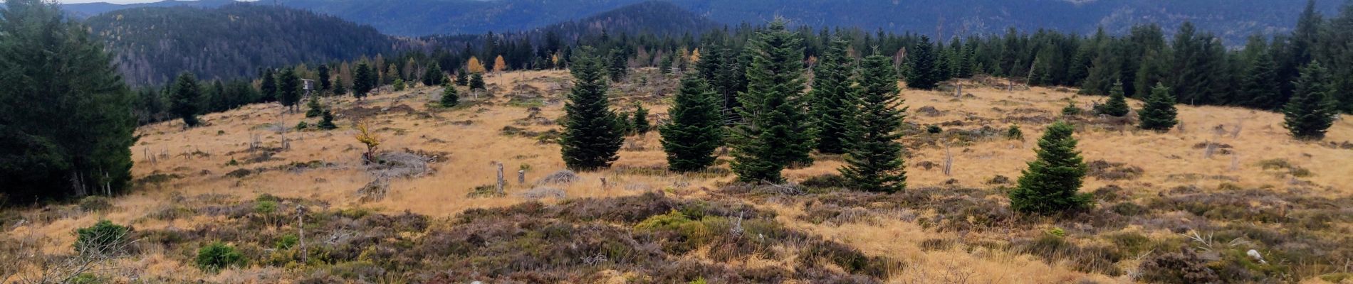
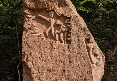
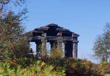
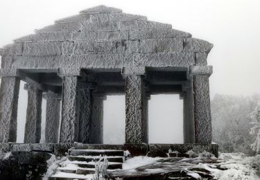
Boucle au départ des Minières derrière Grandfontaine en passant par la Tête Mathis, le col de Prayé, la Tête de Bipierre, la Tête des Roches blanches et les pierres à cupules, et les chaumes de la Corbeille.
Plaatsbepaling
Land:
France
Regio :
Grand Est
Departement/Provincie :
Bas-Rhin
Gemeente :
Grandfontaine
Locatie:
Unknown
Vertrek:(Dec)
Vertrek:(UTM)
362667 ; 5372660 (32U) N.
Opmerkingen
Wandeltochten in de omgeving
![Tocht Stappen Grandfontaine - Donon sentier des casemates - sud - Photo](https://media.geolcdn.com/t/375/260/ext.jpg?maxdim=2&url=https%3A%2F%2Fservices.sitytrail.com%2FGeolivesWS%2FDownloadMedia.ashx%3FTrailID%3D425613%26Media%3Dfix__20150525151051.jpg)
![Stappen Stappen](https://static1.geolcdn.com/sitytour/trail-icons/101.png)
Donon sentier des casemates - sud
Stappen
Medium
(1)
Grandfontaine,
Grand Est,
Bas-Rhin,
France
![](/images/other/stat-length.png)
12,6 km | 16,9 km-effort
4h 13min
![](https://static1.geolcdn.com/siteimages/upload/files/16400158638029165_repeat_loop_refresh_sync_direction_icon.png)
Ja
![Tocht Stappen Grandfontaine - Le site des 2 Donons - Photo](https://media.geolcdn.com/t/375/260/ext.jpg?maxdim=2&url=https%3A%2F%2Fservices.sitytrail.com%2FGeolivesWS%2FDownloadMedia.ashx%3FTrailID%3D201800%26Media%3Db0bd3bee-6dac-4758-b3d3-2df255aa81ea.jpeg)
![Stappen Stappen](https://static1.geolcdn.com/sitytour/trail-icons/101.png)
Le site des 2 Donons
Stappen
Medium
(4)
Grandfontaine,
Grand Est,
Bas-Rhin,
France
![](/images/other/stat-length.png)
12,6 km | 19,4 km-effort
4h 52min
![](https://static1.geolcdn.com/siteimages/upload/files/16400158638029165_repeat_loop_refresh_sync_direction_icon.png)
Ja
![Tocht Stappen Moussey - Col de Prayé - Photo](https://media.geolcdn.com/t/375/260/ext.jpg?maxdim=2&url=https%3A%2F%2Fservices.sitytrail.com%2FGeolivesWS%2FDownloadMedia.ashx%3FTrailID%3D199313%26Media%3D9ff361be-ea22-414c-86b5-f009d7dbf8c7.jpeg)
![Stappen Stappen](https://static1.geolcdn.com/sitytour/trail-icons/101.png)
Col de Prayé
Stappen
Moeilijk
(1)
Moussey,
Grand Est,
Vogezen,
France
![](/images/other/stat-length.png)
16,8 km | 23 km-effort
6h 55min
![](https://static1.geolcdn.com/siteimages/upload/files/16400158638029165_repeat_loop_refresh_sync_direction_icon.png)
Ja
![Tocht Stappen La Broque - 2013-05-18 Marche Ruines de Salm - Photo](https://media.geolcdn.com/t/375/260/ext.jpg?maxdim=2&url=https%3A%2F%2Fstatic1.geolcdn.com%2Fsiteimages%2Fupload%2Ffiles%2F1553511878bg_sport_marche.png)
![Stappen Stappen](https://static1.geolcdn.com/sitytour/trail-icons/101.png)
2013-05-18 Marche Ruines de Salm
Stappen
Heel gemakkelijk
(2)
La Broque,
Grand Est,
Bas-Rhin,
France
![](/images/other/stat-length.png)
6,9 km | 10,6 km-effort
2h 38min
![](https://static1.geolcdn.com/siteimages/upload/files/16400158638029165_repeat_loop_refresh_sync_direction_icon.png)
Ja
![Tocht Stappen Grandfontaine - 2023-05-29 Marche Les Minières Lac de la Maix - Photo](https://media.geolcdn.com/t/375/260/eeaa3a18-ae90-480e-a19f-08ce9b6e70fb.jpg&format=jpg&maxdim=2)
![Stappen Stappen](https://static1.geolcdn.com/sitytour/trail-icons/101.png)
2023-05-29 Marche Les Minières Lac de la Maix
Stappen
Medium
Grandfontaine,
Grand Est,
Bas-Rhin,
France
![](/images/other/stat-length.png)
22 km | 34 km-effort
7h 43min
![](https://static1.geolcdn.com/siteimages/upload/files/16400158638029165_repeat_loop_refresh_sync_direction_icon.png)
Ja
![Tocht Stappen La Broque - 2023-05-13 Marche Sentier des Passeurs Salm - Photo](https://media.geolcdn.com/t/375/260/5fba6e5d-653d-4695-ac41-35482508dcd1.jpg&format=jpg&maxdim=2)
![Stappen Stappen](https://static1.geolcdn.com/sitytour/trail-icons/101.png)
2023-05-13 Marche Sentier des Passeurs Salm
Stappen
Medium
La Broque,
Grand Est,
Bas-Rhin,
France
![](/images/other/stat-length.png)
25 km | 36 km-effort
7h 49min
![](https://static1.geolcdn.com/siteimages/upload/files/16400158638029165_repeat_loop_refresh_sync_direction_icon.png)
Ja
![Tocht Te voet Grandfontaine - Circuit du Chemin d'Allemagne - Photo](https://media.geolcdn.com/t/375/260/d97b757e-2993-4139-a2d2-59b8ba5b2377.jpeg&format=jpg&maxdim=2)
![Te voet Te voet](https://static1.geolcdn.com/sitytour/trail-icons/100.png)
Circuit du Chemin d'Allemagne
Te voet
Gemakkelijk
Grandfontaine,
Grand Est,
Bas-Rhin,
France
![](/images/other/stat-length.png)
8,7 km | 13,9 km-effort
3h 10min
![](https://static1.geolcdn.com/siteimages/upload/files/16400158638029165_repeat_loop_refresh_sync_direction_icon.png)
Neen
![Tocht Stappen Grandfontaine - 2020-09-20 Marche Donon Petit Donon Casemates - Photo](https://media.geolcdn.com/t/375/260/2db16bda-ff7d-4e64-8ae1-49b9c77c7df1.jpg&format=jpg&maxdim=2)
![Stappen Stappen](https://static1.geolcdn.com/sitytour/trail-icons/101.png)
2020-09-20 Marche Donon Petit Donon Casemates
Stappen
Heel gemakkelijk
(1)
Grandfontaine,
Grand Est,
Bas-Rhin,
France
![](/images/other/stat-length.png)
13,4 km | 20 km-effort
4h 17min
![](https://static1.geolcdn.com/siteimages/upload/files/16400158638029165_repeat_loop_refresh_sync_direction_icon.png)
Ja
![Tocht Stappen Grandfontaine - 2019-01-05 Marche Temple du Donon - Photo](https://media.geolcdn.com/t/375/260/4d10af06-75fc-4752-bbdb-0324344fa64e.jpg&format=jpg&maxdim=2)
![Stappen Stappen](https://static1.geolcdn.com/sitytour/trail-icons/101.png)
2019-01-05 Marche Temple du Donon
Stappen
Medium
Grandfontaine,
Grand Est,
Bas-Rhin,
France
![](/images/other/stat-length.png)
5,6 km | 9,3 km-effort
1h 54min
![](https://static1.geolcdn.com/siteimages/upload/files/16400158638029165_repeat_loop_refresh_sync_direction_icon.png)
Ja