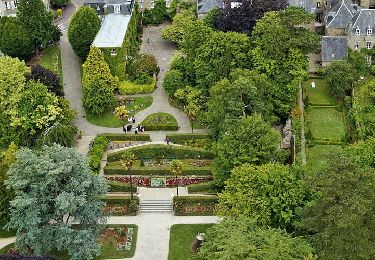
Tocht Te voet Quettreville-sur-Sienne - La tournée des Manoirs au départ de Hyenville - Photo

La tournée des Manoirs au départ de Hyenville

 enoitna
enoitna

Gebruiker

© OpenStreetMap contributors
Lengte
Lengte
9,8 km
Max. hoogte
Max. hoogte
49 m
Positief hoogteverschil
104 m
Km-Effort
Km-Effort  
11,2 km
Min. hoogte
Min. hoogte
12 m
Negatief hoogteverschil
104 m
Boucle
Boucle
Ja
Datum van aanmaak :
2022-11-11 09:55:01.506
Laatste wijziging :
2022-11-11 09:57:29.123

(0 Bericht)

Te voet
Te voet
2h33
Moeilijkheid : Gemakkelijk

Scan deze QR-code om de tocht te openen in de SityTrail-applicatie

Gratisgps-wandelapplicatie

Logo SityTrail SityTrail

IGN / Geografische instituten

SityTrail uit de App Store downloaden SityTrail uit Google Play downloaden

Logo SityTrail SityTrail World

De wereld gaat voor u open

SityTrail uit de App Store downloaden SityTrail uit Google Play downloaden SityTrail op Huawei AppGallery downloaden

Over ons

Tocht Te voet van 9,8 km beschikbaar op Normandië, Manche, Quettreville-sur-Sienne. Deze tocht wordt voorgesteld door enoitna.

Hoogteprofiel

POI's

POI Quettreville-sur-Sienne - Croisement de la boucle - Photo
enoitna
QUETTREVILLE-SUR-SIENNE 
POI Quettreville-sur-Sienne - Intersection - Photo
enoitna
QUETTREVILLE-SUR-SIENNE 
POI Orval-sur-Sienne - Jonction route - Photo
enoitna
ORVAL-SUR-SIENNE 
POI Orval-sur-Sienne - Les Vallées - Photo
enoitna
ORVAL-SUR-SIENNE 
POI Montmartin-sur-Mer - Route D356 - Photo
enoitna
MONTMARTIN-SUR-MER 
POI Quettreville-sur-Sienne - Route D49 - Photo
enoitna
QUETTREVILLE-SUR-SIENNE 
POI Quettreville-sur-Sienne - La Martinière - Photo
enoitna
QUETTREVILLE-SUR-SIENNE 
POI Quettreville-sur-Sienne - Virage - Départ de sentier à gauche - Photo
enoitna
QUETTREVILLE-SUR-SIENNE 

Plaatsbepaling

Land:
France
Regio :
Normandië
Departement/Provincie :
Manche
Gemeente :
Quettreville-sur-Sienne
Locatie:
Hyenville
Vertrek:(UTM)
612161 ; 5427935 (30U) N.

Wandeltochten in de omgeving

Tocht Mountainbike Montmartin-sur-Mer - 30 Km de VTT sur la côte - Montmartin sur Mer  - Photo
Mountainbike
tracegps

Mountainbike

Medium
(3)
Montmartin-sur-Mer, Normandië, Manche, France
29 km | 33 km-effort
2h 0min
Neen
Tocht Noords wandelen Orval-sur-Sienne - Monchaton  - Photo
Noords wandelen
yvesportier

Noords wandelen

Gemakkelijk
(1)
Orval-sur-Sienne, Normandië, Manche, France
11,2 km | 12,6 km-effort
2h 18min
Ja
Tocht Stappen Nicorps - Pédestre - Les trois vallées - Photo
Stappen
neoroll44

Stappen

Medium
Nicorps, Normandië, Manche, France
12,4 km | 15,3 km-effort
3h 30min
Ja
Tocht Stappen Bricqueville-la-Blouette - Montchaton 25 juillet 2022 - Photo
Stappen
mykeluce

Stappen

Medium
Bricqueville-la-Blouette, Normandië, Manche, France
7,7 km | 9 km-effort
1h 40min
Neen
Tocht Elektrische fiets Nicorps - boucle Nicorps - Le Pont de la Roque - Photo
Elektrische fiets
EricVIBERT

Elektrische fiets

Medium
Nicorps, Normandië, Manche, France
15,9 km | 18,2 km-effort
1h 32min
Ja
Tocht Andere activiteiten Orval-sur-Sienne - Basse Normandie - Ligne 416 - Orval - Hyenville - Regnéville-sur-Mer - Photo
Andere activiteiten
mich54

Andere activiteiten

Heel gemakkelijk
Orval-sur-Sienne, Normandië, Manche, France
7,8 km | 8,7 km-effort
5min
Neen
Tocht Paard Orval-sur-Sienne - montmartin-hyenville - Photo
Paard
pleviautre

Paard

Heel gemakkelijk
Orval-sur-Sienne, Normandië, Manche, France
15,2 km | 16,7 km-effort
1h 30min
Neen
Tocht Mountainbike Quettreville-sur-Sienne - Autour de Trelly - Photo
Mountainbike
tracegps

Mountainbike

Moeilijk
Quettreville-sur-Sienne, Normandië, Manche, France
39 km | 46 km-effort
3h 30min
Ja
Tocht Stappen Coutances - tour Coutances 2 - Photo
Stappen
lionelnottat

Stappen

Moeilijk
Coutances, Normandië, Manche, France
11,5 km | 14,3 km-effort
3h 18min
Ja


Sluiten
Mijn abonnementen