![](/images/other/stat-length.png)
![Tocht Lopen Saint-Alban-d'Hurtières - grand chat - Photo](https://media.geolcdn.com/t/1900/400/ext.pjpeg?maxdim=2&url=https%3A%2F%2Fstatic1.geolcdn.com%2Fsiteimages%2Fupload%2Ffiles%2F1524743154running.jpg)
grand chat
tophe73
Gebruiker
![Lengte](/images/other/stat-length.png)
Lengte
8,2 km
![Max. hoogte](https://static1.geolcdn.com/siteimages/upload/files/1508320355ic_sort_altitude_max_24dp.png)
Max. hoogte
1988 m
![Positief hoogteverschil](https://static1.geolcdn.com/siteimages/upload/files/1508320355ic_sort_den_pos_24dp.png)
Positief hoogteverschil
503 m
![Km-Effort](/images/other/stat-length.png)
Km-Effort
14,9 km
![Min. hoogte](https://static1.geolcdn.com/siteimages/upload/files/1508320355ic_sort_altitude_min_24dp.png)
Min. hoogte
1522 m
![Negatief hoogteverschil](https://static1.geolcdn.com/siteimages/upload/files/1508320355ic_sort_den_neg_24dp.png)
Negatief hoogteverschil
504 m
![Boucle](https://static1.geolcdn.com/siteimages/upload/files/16400158638029165_repeat_loop_refresh_sync_direction_icon.png)
Boucle
Ja
Datum van aanmaak :
2014-12-10 00:00:00.0
Laatste wijziging :
2014-12-10 00:00:00.0
![Lopen](https://static1.geolcdn.com/sitytour/trail-icons/103.png)
1h37
Moeilijkheid : Medium
![Scan deze QR-code om de tocht te openen in de SityTrail-applicatie](https://capi.geolives.com/qq0zvz2zws4bq2lad0pu/sitytour/trails/344971/qr.png?size=200)
Gratisgps-wandelapplicatie
Over ons
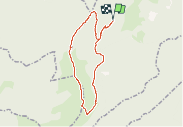
Tocht Lopen van 8,2 km beschikbaar op Auvergne-Rhône-Alpes, Savoie, Saint-Alban-d'Hurtières. Deze tocht wordt voorgesteld door tophe73.
Beschrijving
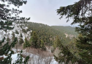
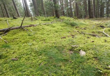
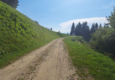
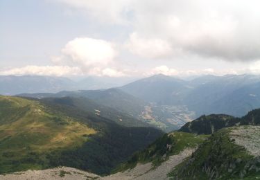
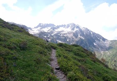
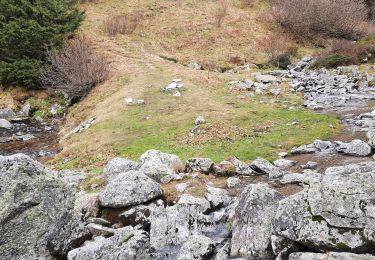
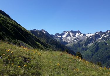
départ depuis la Jasse pour retrouver la crête du grand chat et descente sur le lac des grenouilles puis un passage au-dessus du refuge de barbeloup pour revenir au parking de la Jasse
Plaatsbepaling
Land:
France
Regio :
Auvergne-Rhône-Alpes
Departement/Provincie :
Savoie
Gemeente :
Saint-Alban-d'Hurtières
Locatie:
Unknown
Vertrek:(Dec)
Vertrek:(UTM)
283257 ; 5037753 (32T) N.
Opmerkingen
Wandeltochten in de omgeving
![Tocht Stappen Arvillard - Les Grands Moulins 2495m - Photo](https://media.geolcdn.com/t/375/260/ext.jpg?maxdim=2&url=https%3A%2F%2Fservices.sitytrail.com%2FGeolivesWS%2FDownloadMedia.ashx%3FTrailID%3D102590%26Media%3D3501_1.jpg)
![Stappen Stappen](https://static1.geolcdn.com/sitytour/trail-icons/101.png)
Les Grands Moulins 2495m
Stappen
Moeilijk
(1)
Arvillard,
Auvergne-Rhône-Alpes,
Savoie,
France
![](/images/other/stat-length.png)
9 km | 20 km-effort
5h 0min
![](https://static1.geolcdn.com/siteimages/upload/files/16400158638029165_repeat_loop_refresh_sync_direction_icon.png)
Ja
![Tocht Stappen Saint-Alban-d'Hurtières - Col Clampet, Le Grand Chat, Col d'alarmant - Photo](https://media.geolcdn.com/t/375/260/1d513b6f-1761-484e-9270-d816dd50c7b3.jpg&format=jpg&maxdim=2)
![Stappen Stappen](https://static1.geolcdn.com/sitytour/trail-icons/101.png)
Col Clampet, Le Grand Chat, Col d'alarmant
Stappen
Gemakkelijk
Saint-Alban-d'Hurtières,
Auvergne-Rhône-Alpes,
Savoie,
France
![](/images/other/stat-length.png)
8,4 km | 15,5 km-effort
3h 15min
![](https://static1.geolcdn.com/siteimages/upload/files/16400158638029165_repeat_loop_refresh_sync_direction_icon.png)
Ja
![Tocht Stappen Presle - tour du chapoté - Photo](https://media.geolcdn.com/t/375/260/60fd499a-f8ff-490d-892e-e5c9e4e4a7a6.jpg&format=jpg&maxdim=2)
![Stappen Stappen](https://static1.geolcdn.com/sitytour/trail-icons/101.png)
tour du chapoté
Stappen
Zeer moeilijk
Presle,
Auvergne-Rhône-Alpes,
Savoie,
France
![](/images/other/stat-length.png)
13,2 km | 24 km-effort
3h 50min
![](https://static1.geolcdn.com/siteimages/upload/files/16400158638029165_repeat_loop_refresh_sync_direction_icon.png)
Ja
![Tocht Stappen Presle - Le chapotet au départ de Prodin - Photo](https://media.geolcdn.com/t/375/260/4998ab41-5166-4f21-a80b-af21151571f7.jpg&format=jpg&maxdim=2)
![Stappen Stappen](https://static1.geolcdn.com/sitytour/trail-icons/101.png)
Le chapotet au départ de Prodin
Stappen
Medium
Presle,
Auvergne-Rhône-Alpes,
Savoie,
France
![](/images/other/stat-length.png)
12,1 km | 23 km-effort
5h 0min
![](https://static1.geolcdn.com/siteimages/upload/files/16400158638029165_repeat_loop_refresh_sync_direction_icon.png)
Ja
![Tocht Stappen Saint-Pierre-de-Belleville - poste optique Rognaix lac vert Rognaix 2 - Photo](https://media.geolcdn.com/t/375/260/216b496d-a5a0-4c7a-8310-3d07a2bdb162.jpg&format=jpg&maxdim=2)
![Stappen Stappen](https://static1.geolcdn.com/sitytour/trail-icons/101.png)
poste optique Rognaix lac vert Rognaix 2
Stappen
Moeilijk
Saint-Pierre-de-Belleville,
Auvergne-Rhône-Alpes,
Savoie,
France
![](/images/other/stat-length.png)
16,8 km | 38 km-effort
6h 4min
![](https://static1.geolcdn.com/siteimages/upload/files/16400158638029165_repeat_loop_refresh_sync_direction_icon.png)
Ja
![Tocht Stappen Presle - 2023-06-15 Prodin -Col de la Perche en boucle - Photo](https://media.geolcdn.com/t/375/260/fea8337f-6305-49a4-963c-b11328735eeb.jpg&format=jpg&maxdim=2)
![Stappen Stappen](https://static1.geolcdn.com/sitytour/trail-icons/101.png)
2023-06-15 Prodin -Col de la Perche en boucle
Stappen
Medium
Presle,
Auvergne-Rhône-Alpes,
Savoie,
France
![](/images/other/stat-length.png)
12 km | 22 km-effort
4h 34min
![](https://static1.geolcdn.com/siteimages/upload/files/16400158638029165_repeat_loop_refresh_sync_direction_icon.png)
Ja
![Tocht Stappen Presle - crete du Gargoton - Photo](https://media.geolcdn.com/t/375/260/da8655d9-7f77-42d9-9a84-6293f6cd1682.jpg&format=jpg&maxdim=2)
![Stappen Stappen](https://static1.geolcdn.com/sitytour/trail-icons/101.png)
crete du Gargoton
Stappen
Medium
Presle,
Auvergne-Rhône-Alpes,
Savoie,
France
![](/images/other/stat-length.png)
8,8 km | 20 km-effort
3h 26min
![](https://static1.geolcdn.com/siteimages/upload/files/16400158638029165_repeat_loop_refresh_sync_direction_icon.png)
Ja
![Tocht Stappen Arvillard - Crete du Gargoton - Photo](https://media.geolcdn.com/t/375/260/c9c62c49-770b-457d-b723-13784f4fc8a6.jpg&format=jpg&maxdim=2)
![Stappen Stappen](https://static1.geolcdn.com/sitytour/trail-icons/101.png)
Crete du Gargoton
Stappen
Moeilijk
Arvillard,
Auvergne-Rhône-Alpes,
Savoie,
France
![](/images/other/stat-length.png)
10 km | 19,8 km-effort
7h 18min
![](https://static1.geolcdn.com/siteimages/upload/files/16400158638029165_repeat_loop_refresh_sync_direction_icon.png)
Ja
![Tocht Stappen Arvillard - val pelouse - Photo](https://media.geolcdn.com/t/375/260/ext.jpg?maxdim=2&url=https%3A%2F%2Fstatic1.geolcdn.com%2Fsiteimages%2Fupload%2Ffiles%2F1553511878bg_sport_marche.png)
![Stappen Stappen](https://static1.geolcdn.com/sitytour/trail-icons/101.png)
val pelouse
Stappen
Heel gemakkelijk
(1)
Arvillard,
Auvergne-Rhône-Alpes,
Savoie,
France
![](/images/other/stat-length.png)
7,7 km | 14,3 km-effort
3h 48min
![](https://static1.geolcdn.com/siteimages/upload/files/16400158638029165_repeat_loop_refresh_sync_direction_icon.png)
Neen