


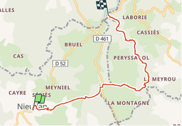

39 km | 50 km-effort


Gebruiker


Gratisgps-wandelapplicatie
 SityTrail
IGN / Geografische instituten
SityTrail World
De wereld gaat voor u open
Tocht Stappen van 6,9 km beschikbaar op Auvergne-Rhône-Alpes, Cantal, Nieudan. Deze tocht wordt voorgesteld door delzonsgeraud.
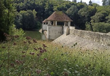
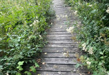
Promenade un peu acrobatique. Passage dans des bois touffus, De nombreuses traversées de rivières, à ne pas faire quand les ruisseaux sont hauts
Wegfiets
Stappen
Stappen

Stappen
Stappen
Stappen
Stappen
Stappen
Stappen