![](/images/other/stat-length.png)
![Tocht Stappen Vendôme - Petit parcours dans la partie Sud-est du Bois de l'Oratoire - Photo](https://media.geolcdn.com/t/1900/400/d2231777-d069-4086-bb9e-9c65df795eb8.jpg&format=pjpeg&maxdim=2)
Petit parcours dans la partie Sud-est du Bois de l'Oratoire
guydu41
Gebruiker
![Lengte](/images/other/stat-length.png)
![Max. hoogte](https://static1.geolcdn.com/siteimages/upload/files/1508320355ic_sort_altitude_max_24dp.png)
![Positief hoogteverschil](https://static1.geolcdn.com/siteimages/upload/files/1508320355ic_sort_den_pos_24dp.png)
![Km-Effort](/images/other/stat-length.png)
![Min. hoogte](https://static1.geolcdn.com/siteimages/upload/files/1508320355ic_sort_altitude_min_24dp.png)
![Negatief hoogteverschil](https://static1.geolcdn.com/siteimages/upload/files/1508320355ic_sort_den_neg_24dp.png)
![Boucle](https://static1.geolcdn.com/siteimages/upload/files/16400158638029165_repeat_loop_refresh_sync_direction_icon.png)
![Stappen](https://static1.geolcdn.com/sitytour/trail-icons/101.png)
1h13
Moeilijkheid : Gemakkelijk
![Scan deze QR-code om de tocht te openen in de SityTrail-applicatie](https://capi.geolives.com/qq0zvz2zws4bq2lad0pu/sitytour/trails/3428026/qr.png?size=200)
Gratisgps-wandelapplicatie
Over ons
Tocht Stappen van 4,2 km beschikbaar op Centre-Val de Loire, Loir-et-Cher, Vendôme. Deze tocht wordt voorgesteld door guydu41.
Beschrijving
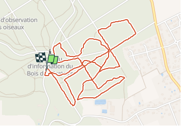
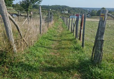
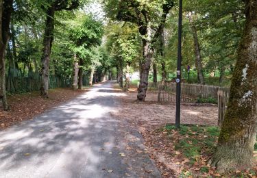
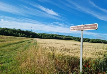
Petit parcours essentiellement sur des chemins de terre et des sentiers étroits et tortueux dans une partie du Bois de l'Oratoire.
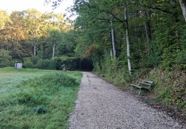
Le circuit se coupe et se recoupe en différents endroits.
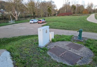
Le départ se fait depuis le parking au lieu-dit les Fontaines dans la partie basse du bois.
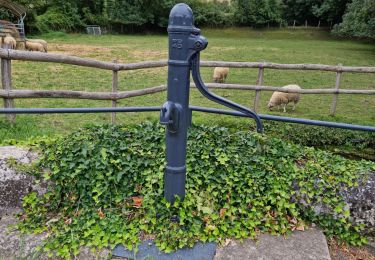
Plaatsbepaling
Opmerkingen
Wandeltochten in de omgeving
![Tocht Te voet Villiers-sur-Loir - Circuit des Côteaux - Photo](https://media.geolcdn.com/t/375/260/25cb373c-e85b-47b3-b4c8-0c4c4213b15c.jpeg&format=jpg&maxdim=2)
![Te voet Te voet](https://static1.geolcdn.com/sitytour/trail-icons/100.png)
Te voet
![](/images/other/stat-length.png)
![](https://static1.geolcdn.com/siteimages/upload/files/16400158638029165_repeat_loop_refresh_sync_direction_icon.png)
![Tocht Stappen Vendôme - Voie de Tours - Poiriers - Vendôme - Prunay Cassereau - Photo](https://media.geolcdn.com/t/375/260/e1f85ff8-5dc9-4860-aac3-2c0f20ccd4d1.jpg&format=jpg&maxdim=2)
![Stappen Stappen](https://static1.geolcdn.com/sitytour/trail-icons/101.png)
Stappen
![](/images/other/stat-length.png)
![](https://static1.geolcdn.com/siteimages/upload/files/16400158638029165_repeat_loop_refresh_sync_direction_icon.png)
![Tocht Stappen Marcilly-en-Beauce - Varennes - Photo](https://media.geolcdn.com/t/375/260/e5fe1065-d10c-4b43-96c8-69a926a5b2c1.jpg&format=jpg&maxdim=2)
![Stappen Stappen](https://static1.geolcdn.com/sitytour/trail-icons/101.png)
Stappen
![](/images/other/stat-length.png)
![](https://static1.geolcdn.com/siteimages/upload/files/16400158638029165_repeat_loop_refresh_sync_direction_icon.png)
![Tocht Stappen Naveil - Naveil - Photo](https://media.geolcdn.com/t/375/260/37d67a4f-f628-4e03-8093-029fa7b56966.jpg&format=jpg&maxdim=2)
![Stappen Stappen](https://static1.geolcdn.com/sitytour/trail-icons/101.png)
Stappen
![](/images/other/stat-length.png)
![](https://static1.geolcdn.com/siteimages/upload/files/16400158638029165_repeat_loop_refresh_sync_direction_icon.png)
![Tocht Stappen Vendôme - Vendôme - Villiers-sur-Loir - Photo](https://media.geolcdn.com/t/375/260/e66027b3-088b-4b5f-b5f5-ac0b8671fb02.jpg&format=jpg&maxdim=2)
![Stappen Stappen](https://static1.geolcdn.com/sitytour/trail-icons/101.png)
Stappen
![](/images/other/stat-length.png)
![](https://static1.geolcdn.com/siteimages/upload/files/16400158638029165_repeat_loop_refresh_sync_direction_icon.png)
![Tocht Stappen Vendôme - Vendôme Sud - Photo](https://media.geolcdn.com/t/375/260/824e66f3-05ad-4135-a662-4e0a98e9afaa.jpg&format=jpg&maxdim=2)
![Stappen Stappen](https://static1.geolcdn.com/sitytour/trail-icons/101.png)
Stappen
![](/images/other/stat-length.png)
![](https://static1.geolcdn.com/siteimages/upload/files/16400158638029165_repeat_loop_refresh_sync_direction_icon.png)
![Tocht Stappen Vendôme - Vendôme Nord - Photo](https://media.geolcdn.com/t/375/260/8467046a-0d6b-4c3c-968e-b82cf7fdf11f.jpg&format=jpg&maxdim=2)
![Stappen Stappen](https://static1.geolcdn.com/sitytour/trail-icons/101.png)
Stappen
![](/images/other/stat-length.png)
![](https://static1.geolcdn.com/siteimages/upload/files/16400158638029165_repeat_loop_refresh_sync_direction_icon.png)
![Tocht Stappen Azé - Azé - Bois et Champs - Photo](https://media.geolcdn.com/t/375/260/44a3f911-e175-4e0d-800f-03edf6856465.jpg&format=jpg&maxdim=2)
![Stappen Stappen](https://static1.geolcdn.com/sitytour/trail-icons/101.png)
Stappen
![](/images/other/stat-length.png)
![](https://static1.geolcdn.com/siteimages/upload/files/16400158638029165_repeat_loop_refresh_sync_direction_icon.png)
![Tocht Stappen Naveil - Circuit au lieu-dit Bordebeure Marcilly-en-Beauce - Photo](https://media.geolcdn.com/t/375/260/6cc52240-c522-4ad6-a3c9-9972a995f3df.jpg&format=jpg&maxdim=2)
![Stappen Stappen](https://static1.geolcdn.com/sitytour/trail-icons/101.png)
Stappen
![](/images/other/stat-length.png)
![](https://static1.geolcdn.com/siteimages/upload/files/16400158638029165_repeat_loop_refresh_sync_direction_icon.png)