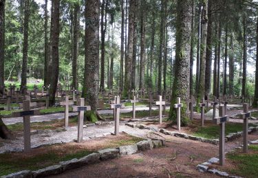
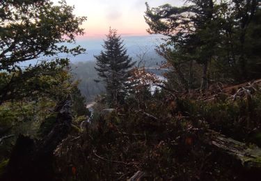
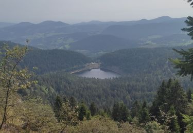
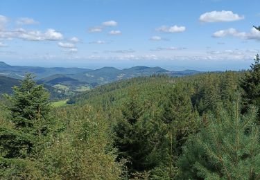
Tocht Noords wandelen Le Bonhomme - La Tête des Faux et l'Étang du Devin depuis Le Bonhomme - Photo

La Tête des Faux et l'Étang du Devin depuis Le Bonhomme

 daniel_2w
daniel_2w

Gebruiker

© OpenStreetMap contributors
Lengte
Lengte
9,3 km
Max. hoogte
Max. hoogte
1215 m
Positief hoogteverschil
583 m
Km-Effort
Km-Effort  
17 km
Min. hoogte
Min. hoogte
685 m
Negatief hoogteverschil
583 m
Boucle
Boucle
Ja
Datum van aanmaak :
2022-10-13 18:14:51.848
Laatste wijziging :
2022-10-13 18:14:51.848

(0 Bericht)

Noords wandelen
Noords wandelen
--
Moeilijkheid : Onbekend

Scan deze QR-code om de tocht te openen in de SityTrail-applicatie

Gratisgps-wandelapplicatie

Logo SityTrail SityTrail

IGN / Geografische instituten

SityTrail uit de App Store downloaden SityTrail uit Google Play downloaden

Logo SityTrail SityTrail World

De wereld gaat voor u open

SityTrail uit de App Store downloaden SityTrail uit Google Play downloaden SityTrail op Huawei AppGallery downloaden

Over ons

Tocht Noords wandelen van 9,3 km beschikbaar op Grand Est, Haut-Rhin, Le Bonhomme. Deze tocht wordt voorgesteld door daniel_2w.

Hoogteprofiel

POI's

POI Le Bonhomme - Le Bonhomme - Parking église - Photo
daniel_2w
POI Lapoutroie - Cimetière militaire allemand - Photo
daniel_2w
POI Lapoutroie - Étang du Devin - Photo
daniel_2w
LAPOUTROIE 
POI Orbey - Roche du Corbeau - Photo
daniel_2w
POI Orbey - Tête des faux - Photo
daniel_2w
POI Le Bonhomme - Cimetière Duchesne - Photo
daniel_2w
LE BONHOMME 
POI Le Bonhomme - Carrefour de chemins - Photo
daniel_2w
POI Le Bonhomme - Carrefour de la boucle - Photo
daniel_2w
POI Le Bonhomme - Sentier pierreux entre 2 clôtures - Photo
daniel_2w
POI Le Bonhomme - Mairie. Pont sur la - Photo
daniel_2w
LE BONHOMME 
POI Le Bonhomme - Le Bonhomme - Parking église - Photo
daniel_2w

Plaatsbepaling

Land:
France
Regio :
Grand Est
Departement/Provincie :
Haut-Rhin
Gemeente :
Le Bonhomme
Locatie:
Unknown
Vertrek:(UTM)
359782 ; 5337224 (32U) N.

Wandeltochten in de omgeving

Tocht Stappen Le Bonhomme - Tête des faux . - Photo
Stappen
heurtinpatrick

Stappen

Medium
(1)
Le Bonhomme, Grand Est, Haut-Rhin, France
11,9 km | 16,6 km-effort
3h 46min
Ja
Tocht Stappen Lapoutroie - 2012-06-16 Marche aux Alisiers Orbey - Photo
Stappen
GUIDE
holtzv

Stappen

Gemakkelijk
(2)
Lapoutroie, Grand Est, Haut-Rhin, France
11,1 km | 16,6 km-effort
2h 49min
Ja
Tocht Mountainbike Orbey - Lac Blanc  - Têtes des Faux - Photo
Mountainbike
tracegps

Mountainbike

Medium
(1)
Orbey, Grand Est, Haut-Rhin, France
15,3 km | 21 km-effort
1h 0min
Ja
Tocht Stappen Le Bonhomme - Le Bonhomme - Circuit du village - Photo
Stappen
GUIDE
Desrumaux

Stappen

Gemakkelijk
(1)
Le Bonhomme, Grand Est, Haut-Rhin, France
3 km | 5,3 km-effort
1h 30min
Ja
Tocht Stappen Sainte-Marie-aux-Mines - 2021-02-14 Marche Bagenelles Brezouard Fuste de Etoile - Photo
Stappen
GUIDE
holtzv

Stappen

Zeer moeilijk
Sainte-Marie-aux-Mines, Grand Est, Haut-Rhin, France
17,1 km | 27 km-effort
6h 6min
Ja
Tocht Stappen Lapoutroie - 2020-07-19 Marche Étang du Devin Col Calvaire Tête des Faux - Photo
Stappen
GUIDE
holtzv

Stappen

Heel gemakkelijk
Lapoutroie, Grand Est, Haut-Rhin, France
14,2 km | 22 km-effort
3h 27min
Ja
Tocht Stappen Orbey - Vallée des 5 lacs  - Photo
Stappen
dragonchef

Stappen

Moeilijk
Orbey, Grand Est, Haut-Rhin, France
28 km | 48 km-effort
7h 21min
Ja
Tocht Stappen Orbey - Col du Calvaire ➡️ Lac Blanc  - Photo
Stappen
nana1643

Stappen

Medium
Orbey, Grand Est, Haut-Rhin, France
8,6 km | 12,8 km-effort
3h 9min
Ja
Tocht Elektrische fiets Le Bonhomme - Lac blanc col de la schlucht Six fours lac noir - Photo
Elektrische fiets
apa

Elektrische fiets

Medium
Le Bonhomme, Grand Est, Haut-Rhin, France
39 km | 49 km-effort
2h 57min
Ja


Sluiten
Mijn abonnementen