Tocht Stappen Chame - Trek Nepal J2 - Chame - Upper Pisang - Photo

Trek Nepal J2 - Chame - Upper Pisang

 sandra_leb
sandra_leb

Gebruiker

© OpenStreetMap contributors
Lengte
Lengte
14,1 km
Max. hoogte
Max. hoogte
3351 m
Positief hoogteverschil
1039 m
Km-Effort
Km-Effort  
26 km
Min. hoogte
Min. hoogte
2684 m
Negatief hoogteverschil
390 m
Boucle
Boucle
Neen
Datum van aanmaak :
2022-10-09 16:36:33.126
Laatste wijziging :
2022-10-09 16:46:25.456

(0 Bericht)

Stappen
Stappen
6h10
Moeilijkheid : Zeer moeilijk

Scan deze QR-code om de tocht te openen in de SityTrail-applicatie

Gratisgps-wandelapplicatie

Logo SityTrail SityTrail

IGN / Geografische instituten

SityTrail uit de App Store downloaden SityTrail uit Google Play downloaden

Logo SityTrail SityTrail World

De wereld gaat voor u open

SityTrail uit de App Store downloaden SityTrail uit Google Play downloaden SityTrail op Huawei AppGallery downloaden

Over ons

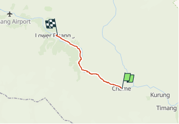
Tocht Stappen van 14,1 km beschikbaar op Onbekend, मनाङ, Chame. Deze tocht wordt voorgesteld door sandra_leb.

Hoogteprofiel

Plaatsbepaling

Land:
Nepal
Regio :
Onbekend
Departement/Provincie :
मनाङ
Gemeente :
Chame
Locatie:
Unknown
Vertrek:(UTM)
230232 ; 3161293 (45R) N.

Wandeltochten in de omgeving

Tocht Stappen Pasang - Trek Nepal J3 - Upper Pisang - Manang - Photo
Stappen
sandra_leb

Stappen

Zeer moeilijk
Pasang, Onbekend, मनाङ, Nepal
21 km | 32 km-effort
7h 12min
Neen


Sluiten
Mijn abonnementen