


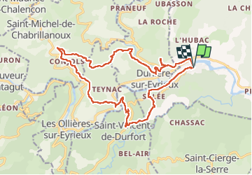

22 km | 33 km-effort


Gebruiker


Gratisgps-wandelapplicatie
 SityTrail
IGN / Geografische instituten
SityTrail World
De wereld gaat voor u open
Tocht Stappen van 20 km beschikbaar op Auvergne-Rhône-Alpes, Ardèche, Saint-Fortunat-sur-Eyrieux. Deze tocht wordt voorgesteld door Chamois30.
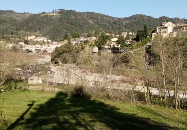
Boucle horaire au départ de St-Fortunuat qui passe par St Vincent-de-Durefort, Pimpie, Conjol, Dunière, et retour.
Stappen
Stappen
Wegfiets
Stappen
Stappen
Stappen
Stappen

Stappen

Stappen