![](/images/other/stat-length.png)
![Tocht Stappen La Ville-aux-Dames - Île de la Métairie à La Ville-aux-Dames - Photo](https://media.geolcdn.com/t/1900/400/86976435-9972-4a82-aa4d-1b9beb39a4d5.jpg&format=pjpeg&maxdim=2)
Île de la Métairie à La Ville-aux-Dames
guydu41
Gebruiker
![Lengte](/images/other/stat-length.png)
![Max. hoogte](https://static1.geolcdn.com/siteimages/upload/files/1508320355ic_sort_altitude_max_24dp.png)
![Positief hoogteverschil](https://static1.geolcdn.com/siteimages/upload/files/1508320355ic_sort_den_pos_24dp.png)
![Km-Effort](/images/other/stat-length.png)
![Min. hoogte](https://static1.geolcdn.com/siteimages/upload/files/1508320355ic_sort_altitude_min_24dp.png)
![Negatief hoogteverschil](https://static1.geolcdn.com/siteimages/upload/files/1508320355ic_sort_den_neg_24dp.png)
![Boucle](https://static1.geolcdn.com/siteimages/upload/files/16400158638029165_repeat_loop_refresh_sync_direction_icon.png)
![Stappen](https://static1.geolcdn.com/sitytour/trail-icons/101.png)
2h01
Moeilijkheid : Gemakkelijk
![Scan deze QR-code om de tocht te openen in de SityTrail-applicatie](https://capi.geolives.com/qq0zvz2zws4bq2lad0pu/sitytour/trails/3414884/qr.png?size=200)
Gratisgps-wandelapplicatie
Over ons
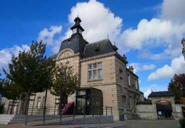
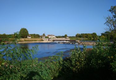
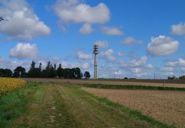
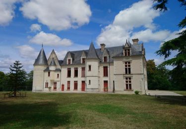
Tocht Stappen van 6 km beschikbaar op Centre-Val de Loire, Indre-et-Loire, La Ville-aux-Dames. Deze tocht wordt voorgesteld door guydu41.
Beschrijving
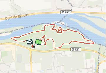
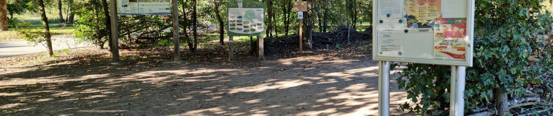
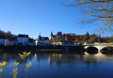
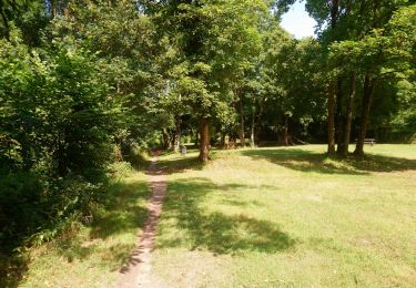
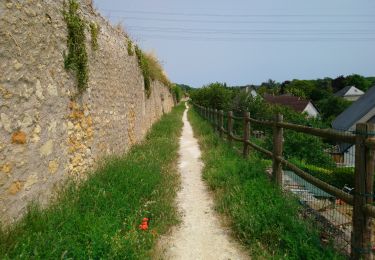
Ce petit circuit de 6 km sur l'Île de la Métairie permet de découvrir de nombreux parcs aménagés, des passerelles, des chemins en bord de Loire, d'admirer les coteaux avec ses grandes demeures de l'autre côté du fleuve, des sentiers tortueux à travers bois, etc.
Plaatsbepaling
Opmerkingen
Wandeltochten in de omgeving
![Tocht Stappen Tours (Indre-et-Loire) - Tours - Marmoutier GR3 GR655 Rochecorbon - 8.2km 105m 1h50 - 2021 10 09 - Photo](https://media.geolcdn.com/t/375/260/8eec29df-bf69-4696-8607-c35bff826c99.jpg&format=jpg&maxdim=2)
![Stappen Stappen](https://static1.geolcdn.com/sitytour/trail-icons/101.png)
Stappen
![](/images/other/stat-length.png)
![](https://static1.geolcdn.com/siteimages/upload/files/16400158638029165_repeat_loop_refresh_sync_direction_icon.png)
![Tocht Stappen Rochecorbon - Rochecorbon - Zig zag autour de Rochecorbon - 17km 295m 3h50 - 2024 03 13 - Photo](https://media.geolcdn.com/t/375/260/c0145acf-b15a-4f41-833a-811e7495297d.jpg&format=jpg&maxdim=2)
![Stappen Stappen](https://static1.geolcdn.com/sitytour/trail-icons/101.png)
Stappen
![](/images/other/stat-length.png)
![](https://static1.geolcdn.com/siteimages/upload/files/16400158638029165_repeat_loop_refresh_sync_direction_icon.png)
![Tocht Stappen Véretz - Véretz - PR Sentier de Bacchus - 14.9km 90m 3h00 - 2023 11 25 - Photo](https://media.geolcdn.com/t/375/260/ba6757e2-3664-4b27-83f8-18e13d10493f.jpg&format=jpg&maxdim=2)
![Stappen Stappen](https://static1.geolcdn.com/sitytour/trail-icons/101.png)
Stappen
![](/images/other/stat-length.png)
![](https://static1.geolcdn.com/siteimages/upload/files/16400158638029165_repeat_loop_refresh_sync_direction_icon.png)
![Tocht Stappen Saint-Pierre-des-Corps - Saint-Pierre-des-Corps - PR Sentier du bord de Loire avec variantes - 13.6km 75m 2h55 (30mn) - 2023 10 22 - Photo](https://media.geolcdn.com/t/375/260/6a165834-3cba-4860-930a-9c6f29b052c7.jpg&format=jpg&maxdim=2)
![Stappen Stappen](https://static1.geolcdn.com/sitytour/trail-icons/101.png)
Stappen
![](/images/other/stat-length.png)
![](https://static1.geolcdn.com/siteimages/upload/files/16400158638029165_repeat_loop_refresh_sync_direction_icon.png)
![Tocht Stappen Montlouis-sur-Loire - Montlouis-sur-Loire - gare GR41 Veretz Azay-sur-Cher - 13km 85m 2h45 - 2023 10 07 - Photo](https://media.geolcdn.com/t/375/260/0a795f12-7cb8-451f-a494-3acd28ec6c5f.jpg&format=jpg&maxdim=2)
![Stappen Stappen](https://static1.geolcdn.com/sitytour/trail-icons/101.png)
Stappen
![](/images/other/stat-length.png)
![](https://static1.geolcdn.com/siteimages/upload/files/16400158638029165_repeat_loop_refresh_sync_direction_icon.png)
![Tocht Stappen Parçay-Meslay - Parcay-Meslay - lieu-dit le Houdeau de Monnaie - 21.3km 190m 4h50 (50mn) - 2023 08 27 - Photo](https://media.geolcdn.com/t/375/260/12319d71-2676-4fa6-b6d8-bd3dc55c96dc.jpg&format=jpg&maxdim=2)
![Stappen Stappen](https://static1.geolcdn.com/sitytour/trail-icons/101.png)
Stappen
![](/images/other/stat-length.png)
![](https://static1.geolcdn.com/siteimages/upload/files/16400158638029165_repeat_loop_refresh_sync_direction_icon.png)
![Tocht Stappen Saint-Avertin - Saint-Avertin - PR Sentier du vieux Cher, Cangé - 9.3km 95m 2h05 (20mn) - 2023 07 12 - Photo](https://media.geolcdn.com/t/375/260/1c5742ed-1795-4a54-ac46-a850f2d399d9.jpg&format=jpg&maxdim=2)
![Stappen Stappen](https://static1.geolcdn.com/sitytour/trail-icons/101.png)
Stappen
![](/images/other/stat-length.png)
![](https://static1.geolcdn.com/siteimages/upload/files/16400158638029165_repeat_loop_refresh_sync_direction_icon.png)
![Tocht Stappen Montlouis-sur-Loire - Montlouis-sur-Loire - PR Sur les pas de Gabrielle d'Estrées - 9.5km 100m 2h20 - 2023 07 08 - Photo](https://media.geolcdn.com/t/375/260/b211a3c9-f8d2-42f6-bf4b-d2bf5553a450.jpg&format=jpg&maxdim=2)
![Stappen Stappen](https://static1.geolcdn.com/sitytour/trail-icons/101.png)
Stappen
![](/images/other/stat-length.png)
![](https://static1.geolcdn.com/siteimages/upload/files/16400158638029165_repeat_loop_refresh_sync_direction_icon.png)
![Tocht Stappen Vouvray - Vouvray - PR balisé en bleu - 15.1km 125m 3h30 - 2023 06 28 - Photo](https://media.geolcdn.com/t/375/260/60d19163-b23a-4217-bba8-93e697ea97cd.jpg&format=jpg&maxdim=2)
![Stappen Stappen](https://static1.geolcdn.com/sitytour/trail-icons/101.png)
Stappen
![](/images/other/stat-length.png)
![](https://static1.geolcdn.com/siteimages/upload/files/16400158638029165_repeat_loop_refresh_sync_direction_icon.png)