![](/images/other/stat-length.png)
![Tocht Stappen Bandol - Petit tour depuis Bandol vers port d'Alon - Photo](https://media.geolcdn.com/t/1900/400/20ff9578-70f9-4ad3-9f81-2dc42c903b57.jpg&format=pjpeg&maxdim=2)
Petit tour depuis Bandol vers port d'Alon
Robertplessier
Gebruiker
![Lengte](/images/other/stat-length.png)
Lengte
4,4 km
![Max. hoogte](https://static1.geolcdn.com/siteimages/upload/files/1508320355ic_sort_altitude_max_24dp.png)
Max. hoogte
82 m
![Positief hoogteverschil](https://static1.geolcdn.com/siteimages/upload/files/1508320355ic_sort_den_pos_24dp.png)
Positief hoogteverschil
110 m
![Km-Effort](/images/other/stat-length.png)
Km-Effort
5,9 km
![Min. hoogte](https://static1.geolcdn.com/siteimages/upload/files/1508320355ic_sort_altitude_min_24dp.png)
Min. hoogte
4 m
![Negatief hoogteverschil](https://static1.geolcdn.com/siteimages/upload/files/1508320355ic_sort_den_neg_24dp.png)
Negatief hoogteverschil
105 m
![Boucle](https://static1.geolcdn.com/siteimages/upload/files/16400158638029165_repeat_loop_refresh_sync_direction_icon.png)
Boucle
Neen
Datum van aanmaak :
2022-09-22 08:34:06.082
Laatste wijziging :
2022-11-08 10:11:37.399
![Stappen](https://static1.geolcdn.com/sitytour/trail-icons/101.png)
1h28
Moeilijkheid : Gemakkelijk
![Scan deze QR-code om de tocht te openen in de SityTrail-applicatie](https://capi.geolives.com/qq0zvz2zws4bq2lad0pu/sitytour/trails/3399880/qr.png?size=200)
Gratisgps-wandelapplicatie
Over ons
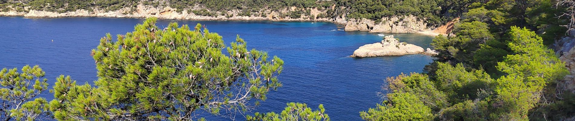
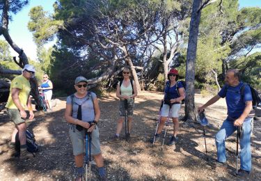
Tocht Stappen van 4,4 km beschikbaar op Provence-Alpes-Côte d'Azur, Var, Bandol. Deze tocht wordt voorgesteld door Robertplessier.
Beschrijving
Petite promenade à partir de Bandol jusqu'à Port d'Alon, très beau point de vue sur la mer et le bord de mer, facile et très joli.
Plaatsbepaling
Land:
France
Regio :
Provence-Alpes-Côte d'Azur
Departement/Provincie :
Var
Gemeente :
Bandol
Locatie:
Unknown
Vertrek:(Dec)
Vertrek:(UTM)
722792 ; 4779494 (31T) N.
Opmerkingen
Wandeltochten in de omgeving
![Tocht Stappen Bandol - SityTrail - fregate - Photo](https://media.geolcdn.com/t/375/260/2853a075-1e77-4b06-bf33-9c03418a8afd.jpg&format=jpg&maxdim=2)
![Stappen Stappen](https://static1.geolcdn.com/sitytour/trail-icons/101.png)
SityTrail - fregate
Stappen
Gemakkelijk
(1)
Bandol,
Provence-Alpes-Côte d'Azur,
Var,
France
![](/images/other/stat-length.png)
8,7 km | 11,4 km-effort
3h 15min
![](https://static1.geolcdn.com/siteimages/upload/files/16400158638029165_repeat_loop_refresh_sync_direction_icon.png)
Ja
![Tocht Stappen Bandol - SityTrail - Tour du golf de la Fregate (version longue ) - Photo](https://media.geolcdn.com/t/375/260/53cbdef8-8c49-42e8-bcb8-017960282ccb.jpg&format=jpg&maxdim=2)
![Stappen Stappen](https://static1.geolcdn.com/sitytour/trail-icons/101.png)
SityTrail - Tour du golf de la Fregate (version longue )
Stappen
Zeer moeilijk
(1)
Bandol,
Provence-Alpes-Côte d'Azur,
Var,
France
![](/images/other/stat-length.png)
13,5 km | 19 km-effort
4h 19min
![](https://static1.geolcdn.com/siteimages/upload/files/16400158638029165_repeat_loop_refresh_sync_direction_icon.png)
Ja
![Tocht Stappen Saint-Cyr-sur-Mer - Port d'Alon - Bandol - Port d'Alon - Photo](https://media.geolcdn.com/t/375/260/ext.jpg?maxdim=2&url=https%3A%2F%2Fservices.sitytrail.com%2FGeolivesWS%2FDownloadMedia.ashx%3FTrailID%3D103920%26Media%3D6771_1.jpg)
![Stappen Stappen](https://static1.geolcdn.com/sitytour/trail-icons/101.png)
Port d'Alon - Bandol - Port d'Alon
Stappen
Medium
(1)
Saint-Cyr-sur-Mer,
Provence-Alpes-Côte d'Azur,
Var,
France
![](/images/other/stat-length.png)
7,7 km | 9,9 km-effort
2h 0min
![](https://static1.geolcdn.com/siteimages/upload/files/16400158638029165_repeat_loop_refresh_sync_direction_icon.png)
Ja
![Tocht Stappen Saint-Cyr-sur-Mer - Le Port d'Alon - Photo](https://media.geolcdn.com/t/375/260/ext.jpg?maxdim=2&url=https%3A%2F%2Fservices.sitytrail.com%2FGeolivesWS%2FDownloadMedia.ashx%3FTrailID%3D103916%26Media%3D6764_1.jpg)
![Stappen Stappen](https://static1.geolcdn.com/sitytour/trail-icons/101.png)
Le Port d'Alon
Stappen
Medium
(2)
Saint-Cyr-sur-Mer,
Provence-Alpes-Côte d'Azur,
Var,
France
![](/images/other/stat-length.png)
9,4 km | 12,8 km-effort
3h 0min
![](https://static1.geolcdn.com/siteimages/upload/files/16400158638029165_repeat_loop_refresh_sync_direction_icon.png)
Ja
![Tocht Stappen Bandol - Rando Bandol - Port d'Alon - Bandol - Photo](https://media.geolcdn.com/t/375/260/ext.jpg?maxdim=2&url=https%3A%2F%2Fservices.sitytrail.com%2FGeolivesWS%2FDownloadMedia.ashx%3FTrailID%3D103781%26Media%3D6551_1.jpg)
![Stappen Stappen](https://static1.geolcdn.com/sitytour/trail-icons/101.png)
Rando Bandol - Port d'Alon - Bandol
Stappen
Moeilijk
(1)
Bandol,
Provence-Alpes-Côte d'Azur,
Var,
France
![](/images/other/stat-length.png)
7,2 km | 9,4 km-effort
2h 30min
![](https://static1.geolcdn.com/siteimages/upload/files/16400158638029165_repeat_loop_refresh_sync_direction_icon.png)
Ja
![Tocht Te voet Saint-Cyr-sur-Mer - Sentier du littoral (Saint-Cyr-sur-Mer) - Photo](https://media.geolcdn.com/t/375/260/92755a25-0a9e-442f-9ac8-e799adb59b27.jpeg&format=jpg&maxdim=2)
![Te voet Te voet](https://static1.geolcdn.com/sitytour/trail-icons/100.png)
Sentier du littoral (Saint-Cyr-sur-Mer)
Te voet
Gemakkelijk
Saint-Cyr-sur-Mer,
Provence-Alpes-Côte d'Azur,
Var,
France
![](/images/other/stat-length.png)
4,9 km | 6,5 km-effort
1h 27min
![](https://static1.geolcdn.com/siteimages/upload/files/16400158638029165_repeat_loop_refresh_sync_direction_icon.png)
Neen
![Tocht Stappen Bandol - SityTrail - Boucle Bandol - Port d'Alon - Dune de sable - La Madrague - Port d'Alon - Bandol - Photo](https://media.geolcdn.com/t/375/260/ext.jpg?maxdim=2&url=https%3A%2F%2Fstatic1.geolcdn.com%2Fsiteimages%2Fupload%2Ffiles%2F1553511878bg_sport_marche.png)
![Stappen Stappen](https://static1.geolcdn.com/sitytour/trail-icons/101.png)
SityTrail - Boucle Bandol - Port d'Alon - Dune de sable - La Madrague - Port ...
Stappen
Medium
(2)
Bandol,
Provence-Alpes-Côte d'Azur,
Var,
France
![](/images/other/stat-length.png)
14,1 km | 19,7 km-effort
6h 0min
![](https://static1.geolcdn.com/siteimages/upload/files/16400158638029165_repeat_loop_refresh_sync_direction_icon.png)
Ja
![Tocht Stappen Bandol - bandol baie des nations - Photo](https://media.geolcdn.com/t/375/260/5d08df52-a469-4cdd-a3c1-851cbb01cef5.jpg&format=jpg&maxdim=2)
![Stappen Stappen](https://static1.geolcdn.com/sitytour/trail-icons/101.png)
bandol baie des nations
Stappen
Heel gemakkelijk
(1)
Bandol,
Provence-Alpes-Côte d'Azur,
Var,
France
![](/images/other/stat-length.png)
13,2 km | 16,8 km-effort
5h 44min
![](https://static1.geolcdn.com/siteimages/upload/files/16400158638029165_repeat_loop_refresh_sync_direction_icon.png)
Ja
![Tocht Stappen Saint-Cyr-sur-Mer - le sentier littoral de la Madrague et la colline de sable - Photo](https://media.geolcdn.com/t/375/260/ext.jpg?maxdim=2&url=https%3A%2F%2Fservices.sitytrail.com%2FGeolivesWS%2FDownloadMedia.ashx%3FTrailID%3D485513%26Media%3D21ba94d9-fd64-486b-9460-9884fbc5235d.JPG)
![Stappen Stappen](https://static1.geolcdn.com/sitytour/trail-icons/101.png)
le sentier littoral de la Madrague et la colline de sable
Stappen
Gemakkelijk
(1)
Saint-Cyr-sur-Mer,
Provence-Alpes-Côte d'Azur,
Var,
France
![](/images/other/stat-length.png)
13 km | 18,7 km-effort
5h 20min
![](https://static1.geolcdn.com/siteimages/upload/files/16400158638029165_repeat_loop_refresh_sync_direction_icon.png)
Ja