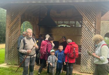
laouielle puylebon SityTrail > Tochten > Outdoor > France > Occitanië > Gers > Montesquiou SityTrail > Tochten > Outdoor > France > Occitanië > Gers > Montesquiou laouielle puylebon manginpascale Gebruiker 3D © OpenStreetMap contributors Lengte 9,6 km Max. hoogte 272 m Positief hoogteverschil 153 m Km-Effort 11,6 km Min. hoogte 164 m Negatief hoogteverschil 153 m Boucle Ja Datum van aanmaak : 2022-09-14 06:19:10.191 Laatste wijziging : 2022-09-14 07:47:49.344 (0 Bericht) Trail 1h27 Moeilijkheid : Heel gemakkelijk Gratisgps-wandelapplicatie SityTrail IGN / Geografische instituten SityTrail World De wereld gaat voor u open Over ons Tocht Trail van 9,6 km beschikbaar op Occitanië, Gers, Montesquiou. Deze tocht wordt voorgesteld door manginpascale. Legenden | Meer details (PDF) Hoogteprofiel Legenden > 15% 15% - 10% 10% - 5% vlak 5% - 10% 10% - 15% 15% - 30% > 30% Plaatsbepaling Land: France Regio : Occitanië Departement/Provincie : Gers Gemeente : Montesquiou Locatie: Unknown Vertrek:(Dec) 43.577775380891595 / 0.3061812600253563 Vertrek:(UTM) 282496 ; 4828505 (31T) N. Opmerkingen Gelieve in te loggen om een commentaar of een beoordeling achter te laten Wandeltochten in de omgeving papounet32 Transhumance castelnau d’angles Pouylebon Stappen Medium Castelnau-d'Anglès, Occitanië, Gers, France 8,4 km | 10,2 km-effort 2h 27min Neen GUIDE donda 06.05.17 Montesquiou Marciac Stappen Zeer moeilijk Montesquiou, Occitanië, Gers, France 24 km | 31 km-effort 6h 38min Neen Camsity Étape 4 Stappen Heel gemakkelijk Pouylebon, Occitanië, Gers, France 31 km | 40 km-effort 10h 7min Neen xenkod boucle de bassoues Fiets Heel gemakkelijk Bassoues, Occitanië, Gers, France 46 km | 55 km-effort 3h 9min Ja