![](/images/other/stat-length.png)
![Tocht Noords wandelen Prades-d'Aubrac - SityTrail - Sentier thématique de Brameloup - Photo](https://media.geolcdn.com/t/1900/400/be953f7f-fe28-41bf-bdc7-ec28c1ab1a87.png&format=pjpeg&maxdim=2)
SityTrail - Sentier thématique de Brameloup
mdauzat
Gebruiker
![Lengte](/images/other/stat-length.png)
![Max. hoogte](https://static1.geolcdn.com/siteimages/upload/files/1508320355ic_sort_altitude_max_24dp.png)
![Positief hoogteverschil](https://static1.geolcdn.com/siteimages/upload/files/1508320355ic_sort_den_pos_24dp.png)
![Km-Effort](/images/other/stat-length.png)
![Min. hoogte](https://static1.geolcdn.com/siteimages/upload/files/1508320355ic_sort_altitude_min_24dp.png)
![Negatief hoogteverschil](https://static1.geolcdn.com/siteimages/upload/files/1508320355ic_sort_den_neg_24dp.png)
![Boucle](https://static1.geolcdn.com/siteimages/upload/files/16400158638029165_repeat_loop_refresh_sync_direction_icon.png)
![Noords wandelen](https://static1.geolcdn.com/sitytour/trail-icons/102.png)
2h00
Moeilijkheid : Heel gemakkelijk
![Scan deze QR-code om de tocht te openen in de SityTrail-applicatie](https://capi.geolives.com/qq0zvz2zws4bq2lad0pu/sitytour/trails/3372017/qr.png?size=200)
Gratisgps-wandelapplicatie
Over ons
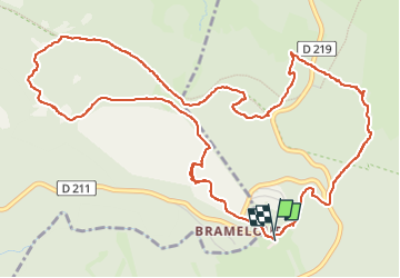
Tocht Noords wandelen van 7,8 km beschikbaar op Occitanië, Aveyron, Prades-d'Aubrac. Deze tocht wordt voorgesteld door mdauzat.
Beschrijving
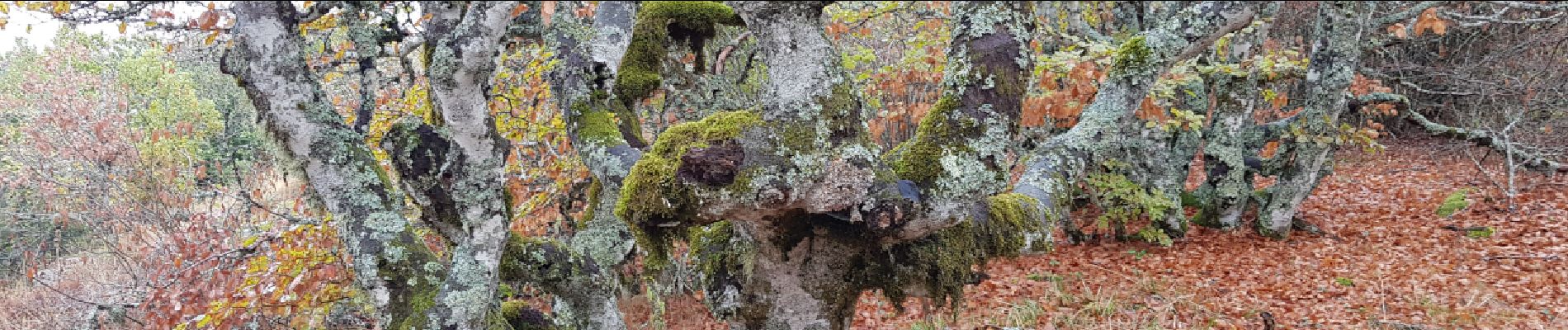
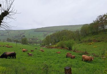
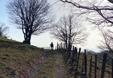
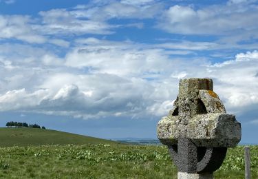
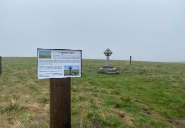
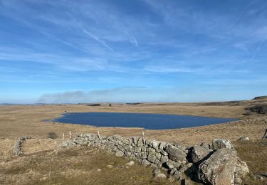
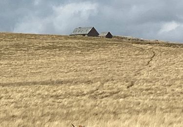
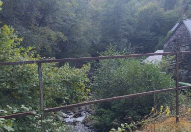
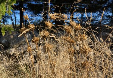
A partir de la station de ski de Brameloup, le Sentier Thématique s'élève résolument dans la forêt pour rejoindre le plateau et offrir une vue panoramique exceptionnelle sur les immenses prairies où les bovins à la belle robe brune passent nonchalamment la période estivale. Le sentier passe successivement sur des éminences rocheuses témoignant du passé volcanique, puis le long de vastes tourbières, et à travers quelques belles clairières, pour revenir régulièrement dans la forêt où les jeux d'ombres et de lumière sont un véritable enchantement. Les couleurs de l'automne commencent à apparaître, de même que quelques champignons encore timides... et la pluie, intermittente de ce splendide spectacle.
Tout au long du parcours, des panneaux illustrés renseignent le randonneur sur l'histoire, la géologie, la botanique... de cette merveilleuse région.
Plaatsbepaling
Opmerkingen
Wandeltochten in de omgeving
![Tocht Stappen Saint-Chély-d'Aubrac - Aubrac - St Côme d'Olt - Chemin de St-Jacques de Compostelle - Photo](https://media.geolcdn.com/t/375/260/ext.jpg?maxdim=2&url=https%3A%2F%2Fservices.sitytrail.com%2FGeolivesWS%2FDownloadMedia.ashx%3FTrailID%3D108743%26Media%3D1838_2.jpg)
![Stappen Stappen](https://static1.geolcdn.com/sitytour/trail-icons/101.png)
Stappen
![](/images/other/stat-length.png)
![](https://static1.geolcdn.com/siteimages/upload/files/16400158638029165_repeat_loop_refresh_sync_direction_icon.png)
![Tocht Stappen Saint-Chély-d'Aubrac - Mon chemin de St Guilhem étape 3 - Photo](https://media.geolcdn.com/t/375/260/decc6e0e-cc63-493a-98a1-a20926931e85.jpg&format=jpg&maxdim=2)
![Stappen Stappen](https://static1.geolcdn.com/sitytour/trail-icons/101.png)
Stappen
![](/images/other/stat-length.png)
![](https://static1.geolcdn.com/siteimages/upload/files/16400158638029165_repeat_loop_refresh_sync_direction_icon.png)
![Tocht Stappen Saint Geniez d'Olt et d'Aubrac - Les Vergnes Mailhebiau Tourbière - Photo](https://media.geolcdn.com/t/375/260/e78d9056-9093-4928-88b6-4bbf4637125b.jpg&format=jpg&maxdim=2)
![Stappen Stappen](https://static1.geolcdn.com/sitytour/trail-icons/101.png)
Stappen
![](/images/other/stat-length.png)
![](https://static1.geolcdn.com/siteimages/upload/files/16400158638029165_repeat_loop_refresh_sync_direction_icon.png)
![Tocht Stappen Saint Geniez d'Olt et d'Aubrac - Croix de Rodes Lac de Bonnecombe Signal de Mailhebiau - Photo](https://media.geolcdn.com/t/375/260/656d423b-e3b9-47a3-b781-744261c38bdb.jpg&format=jpg&maxdim=2)
![Stappen Stappen](https://static1.geolcdn.com/sitytour/trail-icons/101.png)
Stappen
![](/images/other/stat-length.png)
![](https://static1.geolcdn.com/siteimages/upload/files/16400158638029165_repeat_loop_refresh_sync_direction_icon.png)
![Tocht Stappen Saint-Chély-d'Aubrac - Étape 3 Saint Gilhem - Photo](https://media.geolcdn.com/t/375/260/2821279b-f5ae-4989-8e19-441e200f8ae5.jpg&format=jpg&maxdim=2)
![Stappen Stappen](https://static1.geolcdn.com/sitytour/trail-icons/101.png)
Stappen
![](/images/other/stat-length.png)
![](https://static1.geolcdn.com/siteimages/upload/files/16400158638029165_repeat_loop_refresh_sync_direction_icon.png)
![Tocht Stappen Nasbinals - Tour des lacs - Photo](https://media.geolcdn.com/t/375/260/57caf027-b102-4401-a021-6cc1214d2668.jpg&format=jpg&maxdim=2)
![Stappen Stappen](https://static1.geolcdn.com/sitytour/trail-icons/101.png)
Stappen
![](/images/other/stat-length.png)
![](https://static1.geolcdn.com/siteimages/upload/files/16400158638029165_repeat_loop_refresh_sync_direction_icon.png)
![Tocht Stappen Nasbinals - Montorzier Croix de Vaysse Croix de Rodes - Photo](https://media.geolcdn.com/t/375/260/a81222cc-0444-4bf5-96c1-4ce2500b22df.jpg&format=jpg&maxdim=2)
![Stappen Stappen](https://static1.geolcdn.com/sitytour/trail-icons/101.png)
Stappen
![](/images/other/stat-length.png)
![](https://static1.geolcdn.com/siteimages/upload/files/16400158638029165_repeat_loop_refresh_sync_direction_icon.png)
![Tocht Stappen Saint-Chély-d'Aubrac - Compostelle / Chemin du Puy : de Aubrac à Bonneval - Photo](https://media.geolcdn.com/t/375/260/dbc34bf8-a914-4f2b-98e8-658766b11ec6.jpg&format=jpg&maxdim=2)
![Stappen Stappen](https://static1.geolcdn.com/sitytour/trail-icons/101.png)
Stappen
![](/images/other/stat-length.png)
![](https://static1.geolcdn.com/siteimages/upload/files/16400158638029165_repeat_loop_refresh_sync_direction_icon.png)
![Tocht Stappen Nasbinals - Lac de Souveyrols Salles basses - Photo](https://media.geolcdn.com/t/375/260/cf11b175-8eba-4f9f-83b7-bb30ca8574d8.jpg&format=jpg&maxdim=2)
![Stappen Stappen](https://static1.geolcdn.com/sitytour/trail-icons/101.png)
Stappen
![](/images/other/stat-length.png)
![](https://static1.geolcdn.com/siteimages/upload/files/16400158638029165_repeat_loop_refresh_sync_direction_icon.png)