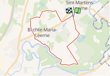
![](/images/other/stat-length.png)
![Tocht Stappen Deinze - Le château d’Ooidonk à Deinze - Photo](https://media.geolcdn.com/t/1900/400/d255fdad-ee32-44cd-b7de-2c94d8b7f7ee.jpeg&format=pjpeg&maxdim=2)
Le château d’Ooidonk à Deinze
Benjamin27
Gebruiker GUIDE
![Lengte](/images/other/stat-length.png)
![Max. hoogte](https://static1.geolcdn.com/siteimages/upload/files/1508320355ic_sort_altitude_max_24dp.png)
![Positief hoogteverschil](https://static1.geolcdn.com/siteimages/upload/files/1508320355ic_sort_den_pos_24dp.png)
![Km-Effort](/images/other/stat-length.png)
![Min. hoogte](https://static1.geolcdn.com/siteimages/upload/files/1508320355ic_sort_altitude_min_24dp.png)
![Negatief hoogteverschil](https://static1.geolcdn.com/siteimages/upload/files/1508320355ic_sort_den_neg_24dp.png)
![Boucle](https://static1.geolcdn.com/siteimages/upload/files/16400158638029165_repeat_loop_refresh_sync_direction_icon.png)
![Stappen](https://static1.geolcdn.com/sitytour/trail-icons/101.png)
1h52
Moeilijkheid : Medium
![Scan deze QR-code om de tocht te openen in de SityTrail-applicatie](https://capi.geolives.com/qq0zvz2zws4bq2lad0pu/sitytour/trails/3369594/qr.png?size=200)
Gratisgps-wandelapplicatie
Over ons
Tocht Stappen van 7,7 km beschikbaar op Vlaanderen, Oost-Vlaanderen, Deinze. Deze tocht wordt voorgesteld door Benjamin27.
Beschrijving
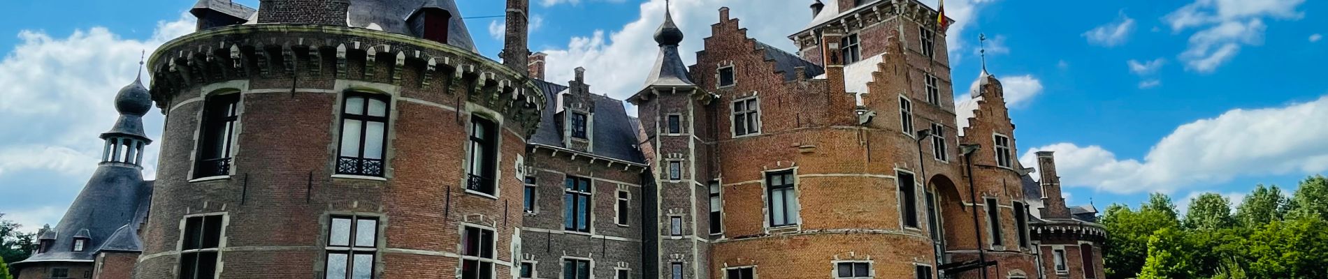
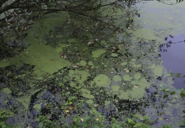
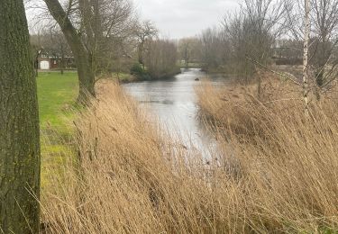
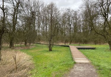
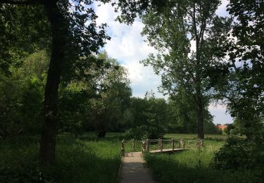
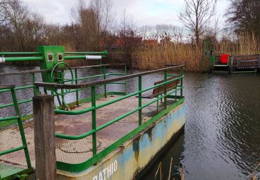
La région de la Lys flirte avec les frontières provinciales. Vous commencez la promenade dans la grande allée du majestueux château d’Ooidonk : visitez son parc, c’est une perle. Allez ensuite vous balader le long de la Lys avec de magnifiques paysages de cette région riche en surprises.
👣 Distance : 8km - balisage hexagone avec « Ooidonk wandelroute » écrit en vert.
📍Départ : parking prévu, ooidonkdreef 3 - 9800 Bachte-Maria-Leerne.
🚂🚍 Aller à la gare de Deinze, prendre le bus DE LIJN 14 jusqu’à l’arrêt « Barchte Maria Leerne - Mulderstraat » et marcher jusqu’au point de départ de la promenade.
⚠️ L’entrée dans le parc du château (et pour voir le château) est à 3euros à payer en liquide.
Plaatsbepaling
Opmerkingen
Wandeltochten in de omgeving
![Tocht Te voet Deinze - Ooidonkroute - Photo](https://media.geolcdn.com/t/375/260/a989dc90-b267-4c71-9207-1c5a32844e07.jpeg&format=jpg&maxdim=2)
![Te voet Te voet](https://static1.geolcdn.com/sitytour/trail-icons/100.png)
Te voet
![](/images/other/stat-length.png)
![](https://static1.geolcdn.com/siteimages/upload/files/16400158638029165_repeat_loop_refresh_sync_direction_icon.png)
![Tocht Te voet Sint-Martens-Latem - Albijn Van Den Abeele Route - Photo](https://media.geolcdn.com/t/375/260/bbfcb69d-666f-47bc-8c47-8c5c2ac7c6aa.jpeg&format=jpg&maxdim=2)
![Te voet Te voet](https://static1.geolcdn.com/sitytour/trail-icons/100.png)
Te voet
![](/images/other/stat-length.png)
![](https://static1.geolcdn.com/siteimages/upload/files/16400158638029165_repeat_loop_refresh_sync_direction_icon.png)
![Tocht Stappen Deinze - 19 km autour de Deinze et Machelen - Photo](https://media.geolcdn.com/t/375/260/f6f6d5b4-ad07-4d56-9b6b-e63ccbbcdac3.jpg&format=jpg&maxdim=2)
![Stappen Stappen](https://static1.geolcdn.com/sitytour/trail-icons/101.png)
Stappen
![](/images/other/stat-length.png)
![](https://static1.geolcdn.com/siteimages/upload/files/16400158638029165_repeat_loop_refresh_sync_direction_icon.png)
![Tocht Stappen Deinze - Filliers Deinze - Photo](https://media.geolcdn.com/t/375/260/e61df0b9-73c6-4e71-8315-6346762c2e63.jpg&format=jpg&maxdim=2)
![Stappen Stappen](https://static1.geolcdn.com/sitytour/trail-icons/101.png)
Stappen
![](/images/other/stat-length.png)
![](https://static1.geolcdn.com/siteimages/upload/files/16400158638029165_repeat_loop_refresh_sync_direction_icon.png)
![Tocht Stappen Sint-Martens-Latem - De Pinte près de Saint Maertens Laethem - Photo](https://media.geolcdn.com/t/375/260/3f289975-16ee-4ae9-be3b-e83cecdfdb62.jpg&format=jpg&maxdim=2)
![Stappen Stappen](https://static1.geolcdn.com/sitytour/trail-icons/101.png)
Stappen
![](/images/other/stat-length.png)
![](https://static1.geolcdn.com/siteimages/upload/files/16400158638029165_repeat_loop_refresh_sync_direction_icon.png)
![Tocht Te voet Gent - Rosdambeekroute - Photo](https://media.geolcdn.com/t/375/260/25a22a66-33f6-4767-91c4-e51d6f2970fd.jpeg&format=jpg&maxdim=2)
![Te voet Te voet](https://static1.geolcdn.com/sitytour/trail-icons/100.png)
Te voet
![](/images/other/stat-length.png)
![](https://static1.geolcdn.com/siteimages/upload/files/16400158638029165_repeat_loop_refresh_sync_direction_icon.png)
![Tocht Stappen Deinze - Randonnée des Filliers à Deinze - Photo](https://media.geolcdn.com/t/375/260/63489dac-74b1-4b82-bcac-292bc60f01cd.jpg&format=jpg&maxdim=2)
![Stappen Stappen](https://static1.geolcdn.com/sitytour/trail-icons/101.png)
Stappen
![](/images/other/stat-length.png)
![](https://static1.geolcdn.com/siteimages/upload/files/16400158638029165_repeat_loop_refresh_sync_direction_icon.png)
![Tocht Stappen Sint-Martens-Latem - albijn van den abeeleroute - Photo](https://media.geolcdn.com/t/375/260/ext.jpg?maxdim=2&url=https%3A%2F%2Fstatic1.geolcdn.com%2Fsiteimages%2Fupload%2Ffiles%2F1553511878bg_sport_marche.png)
![Stappen Stappen](https://static1.geolcdn.com/sitytour/trail-icons/101.png)
Stappen
![](/images/other/stat-length.png)
![](https://static1.geolcdn.com/siteimages/upload/files/16400158638029165_repeat_loop_refresh_sync_direction_icon.png)
![Tocht Te voet Sint-Martens-Latem - Gust De Smet wandelroute - Photo](https://media.geolcdn.com/t/375/260/ext.jpg?maxdim=2&url=https%3A%2F%2Fstatic1.geolcdn.com%2Fsiteimages%2Fupload%2Ffiles%2F1545311037marcheuse_200dpi.jpg)
![Te voet Te voet](https://static1.geolcdn.com/sitytour/trail-icons/100.png)
Te voet
![](/images/other/stat-length.png)
![](https://static1.geolcdn.com/siteimages/upload/files/16400158638029165_repeat_loop_refresh_sync_direction_icon.png)