Tocht Stappen Huldenberg - WK_route_kp214_Zuid-Dijleland_1570116223 - Photo

WK_route_kp214_Zuid-Dijleland_1570116223

 Benjamin27
Benjamin27

Gebruiker GUIDE

© OpenStreetMap contributors
Lengte
Lengte
4,7 km
Max. hoogte
Max. hoogte
50 m
Positief hoogteverschil
37 m
Km-Effort
Km-Effort  
5,2 km
Min. hoogte
Min. hoogte
23 m
Negatief hoogteverschil
37 m
Boucle
Boucle
Ja
Datum van aanmaak :
2022-08-27 11:53:39.166
Laatste wijziging :
2022-09-01 12:15:37.709

(0 Bericht)

Stappen
Stappen
1h10
Moeilijkheid : Gemakkelijk

Scan deze QR-code om de tocht te openen in de SityTrail-applicatie

Gratisgps-wandelapplicatie

Logo SityTrail SityTrail

IGN / Geografische instituten

SityTrail uit de App Store downloaden SityTrail uit Google Play downloaden

Logo SityTrail SityTrail World

De wereld gaat voor u open

SityTrail uit de App Store downloaden SityTrail uit Google Play downloaden SityTrail op Huawei AppGallery downloaden

Over ons

Tocht Stappen van 4,7 km beschikbaar op Vlaanderen, Vlaams-Brabant, Huldenberg. Deze tocht wordt voorgesteld door Benjamin27.

Beschrijving

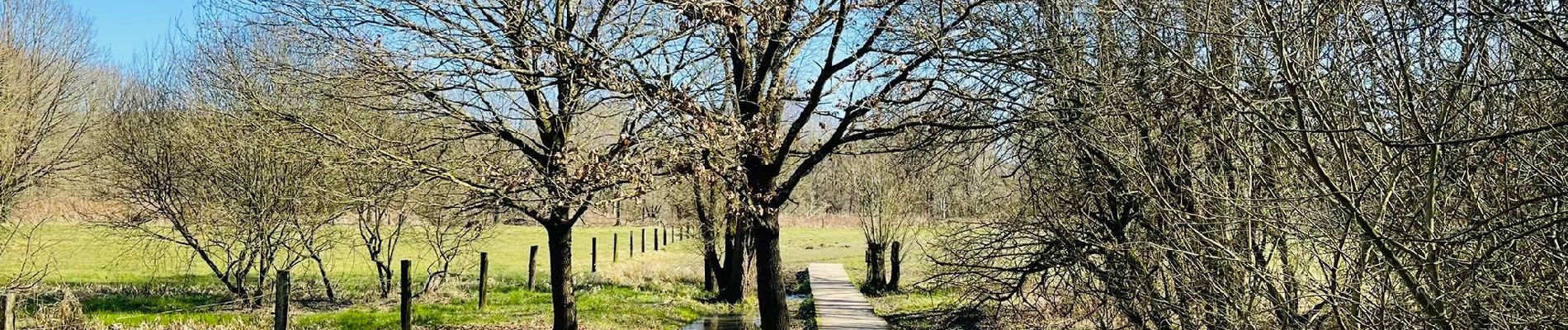
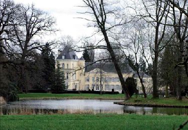
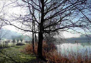
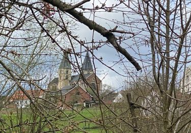
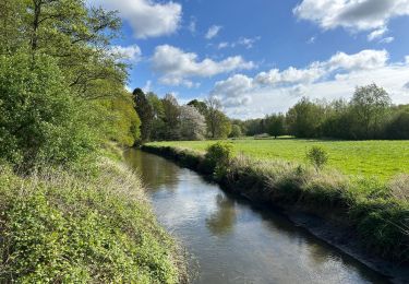
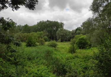
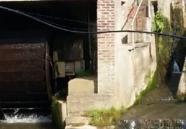
Dans cette réserve naturelle, on se promène le long de la Dyle en suivant ses méandres. C’est un tableau de champs, bosquets, prés, praires, étangs et canaux. C’est vraiment magnifique !

👣 Distance : 5,6km - balisage points noeuds (214-213-212-102-211-210-213-214)

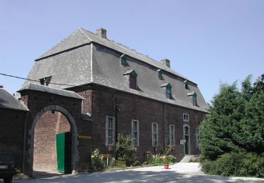
📍Départ : devant la brasserie « De Kroon » à Beekstraat 20 - 3040 Huldenberg.

🚂🚍 Aller à la gare de Louvain et prendre le bus DE LIJN 395 jusqu’à l’arrêt « Neerijse - Kerk ».

Hoogteprofiel

Foto's

POI's

POI Huldenberg - 214 - Photo
Benjamin27
HULDENBERG 
POI Huldenberg - 213 - Photo
Benjamin27
HULDENBERG 
POI Huldenberg - 210 - Photo
Benjamin27
HULDENBERG 
POI Huldenberg - 211 - Photo
Benjamin27
HULDENBERG 
POI Oud-Heverlee - 102 - Photo
Benjamin27
OUD-HEVERLEE 
POI Huldenberg - 212 - Photo
Benjamin27
HULDENBERG 
POI Huldenberg - 213 - Photo
Benjamin27
HULDENBERG 
POI Huldenberg - 214 - Photo
Benjamin27
HULDENBERG 

Plaatsbepaling

Land:
Belgium
Regio :
Vlaanderen
Departement/Provincie :
Vlaams-Brabant
Gemeente :
Huldenberg
Locatie:
Neerijse
Vertrek:(UTM)
614471 ; 5630475 (31U) N.

Wandeltochten in de omgeving

Tocht Stappen Graven - RB-BW-06-raccourci 2 - De rivières en collines, au nord de Wavre - Photo
Stappen
PRO

Stappen

Gemakkelijk
(5)
Graven, Wallonië, Waals-Brabant, Belgium
7 km | 8,4 km-effort
1h 49min
Ja
Tocht Stappen Graven - RB-BW-06-raccourci 1 - De rivières en collines, au nord de Wavre - Photo
Stappen
PRO

Stappen

Gemakkelijk
(10)
Graven, Wallonië, Waals-Brabant, Belgium
14,6 km | 17,1 km-effort
3h 52min
Ja
Tocht Stappen Graven - RB-BW-06 - De rivières en collines, au nord de Wavre - Photo
Stappen
PRO

Stappen

Gemakkelijk
(9)
Graven, Wallonië, Waals-Brabant, Belgium
24 km | 28 km-effort
5h 29min
Ja
Tocht Stappen Graven - GG2-Bw-21_Pécrot-Genval_2021-11-04 - Photo
Stappen
PRO

Stappen

Zeer moeilijk
(3)
Graven, Wallonië, Waals-Brabant, Belgium
26 km | 31 km-effort
7h 7min
Neen
Tocht Stappen Huldenberg - #230710 - Neerijse, Dyle et Doode Bemde - Photo
Stappen
Randos Ouvertes

Stappen

Medium
(1)
Huldenberg, Vlaanderen, Vlaams-Brabant, Belgium
5,9 km | 6,7 km-effort
1h 30min
Ja
Tocht Stappen Overijse - #230220 - Terlanen, Schaatbroekbos, GR579 - Photo
Stappen
Randos Ouvertes

Stappen

Medium
(1)
Overijse, Vlaanderen, Vlaams-Brabant, Belgium
7,2 km | 8,4 km-effort
1h 55min
Ja
Tocht Stappen Huldenberg - Neerijse - Photo
Stappen
liteanu

Stappen

Moeilijk
(1)
Huldenberg, Vlaanderen, Vlaams-Brabant, Belgium
19,7 km | 23 km-effort
6h 7min
Ja
Tocht Noords wandelen Graven - 2014-01-31 marche autour de Nethen - Photo
Noords wandelen
charlykersten

Noords wandelen

Gemakkelijk
(1)
Graven, Wallonië, Waals-Brabant, Belgium
12,4 km | 14,7 km-effort
2h 59min
Ja
Tocht Stappen Graven - Pecrot 11,5 km Nathalie Demain - Photo
Stappen
ThierryGABRIEL

Stappen

Gemakkelijk
(2)
Graven, Wallonië, Waals-Brabant, Belgium
13,7 km | 15,8 km-effort
5h 54min
Ja


Sluiten
Mijn abonnementen