![](/images/other/stat-length.png)
![Tocht Stappen Colonno - Greenway del lago - Colono---> Griante - Photo](https://media.geolcdn.com/t/1900/400/ext.pjpeg?maxdim=2&url=https%3A%2F%2Fmedia.geolcdn.com%2Ff%2F2f26dfd5-aad1-431b-97a3-8a0c562b43b6.jpg)
Greenway del lago - Colono---> Griante
chessyca
Gebruiker
![Lengte](/images/other/stat-length.png)
Lengte
14,3 km
![Max. hoogte](https://static1.geolcdn.com/siteimages/upload/files/1508320355ic_sort_altitude_max_24dp.png)
Max. hoogte
280 m
![Positief hoogteverschil](https://static1.geolcdn.com/siteimages/upload/files/1508320355ic_sort_den_pos_24dp.png)
Positief hoogteverschil
340 m
![Km-Effort](/images/other/stat-length.png)
Km-Effort
18,9 km
![Min. hoogte](https://static1.geolcdn.com/siteimages/upload/files/1508320355ic_sort_altitude_min_24dp.png)
Min. hoogte
198 m
![Negatief hoogteverschil](https://static1.geolcdn.com/siteimages/upload/files/1508320355ic_sort_den_neg_24dp.png)
Negatief hoogteverschil
347 m
![Boucle](https://static1.geolcdn.com/siteimages/upload/files/16400158638029165_repeat_loop_refresh_sync_direction_icon.png)
Boucle
Neen
Datum van aanmaak :
2022-08-17 07:59:56.106
Laatste wijziging :
2022-08-17 16:01:12.164
![Stappen](https://static1.geolcdn.com/sitytour/trail-icons/101.png)
3h37
Moeilijkheid : Heel gemakkelijk
![Scan deze QR-code om de tocht te openen in de SityTrail-applicatie](https://capi.geolives.com/qq0zvz2zws4bq2lad0pu/sitytour/trails/3357847/qr.png?size=200)
Gratisgps-wandelapplicatie
Over ons
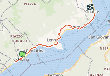
Tocht Stappen van 14,3 km beschikbaar op Lombardije, Como, Colonno. Deze tocht wordt voorgesteld door chessyca.
Beschrijving
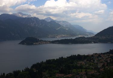
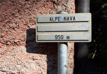
Colonno - Sala Comacina- Ossucio - Lenno - Mezzegra- Tremezzo - Griante
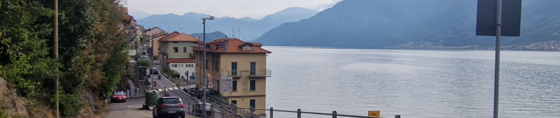
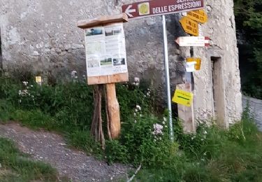
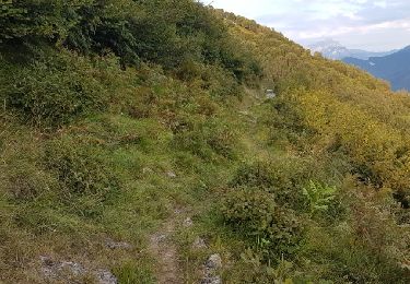
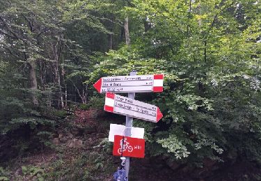
Aucune difficulté , balisage très visible et super balade très variée
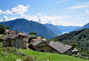
Il faut se perdre dans les ruelles des villages médiévaux
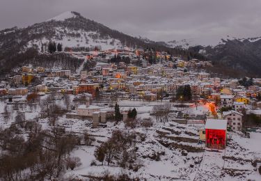
Plaatsbepaling
Land:
Italy
Regio :
Lombardije
Departement/Provincie :
Como
Gemeente :
Colonno
Locatie:
Unknown
Vertrek:(Dec)
Vertrek:(UTM)
511797 ; 5089233 (32T) N.
Opmerkingen
Wandeltochten in de omgeving
![Tocht Te voet Pigra - Circolare Piz Pasquela - Photo](https://media.geolcdn.com/t/375/260/ext.jpg?maxdim=2&url=https%3A%2F%2Fmedia.geolcdn.com%2Ff%2Fc244535b-8ba8-4eb7-9be7-093b33742875.jpeg)
![Te voet Te voet](https://static1.geolcdn.com/sitytour/trail-icons/100.png)
Circolare Piz Pasquela
Te voet
Gemakkelijk
Pigra,
Lombardije,
Como,
Italy
![](/images/other/stat-length.png)
7 km | 12,4 km-effort
2h 48min
![](https://static1.geolcdn.com/siteimages/upload/files/16400158638029165_repeat_loop_refresh_sync_direction_icon.png)
Neen
![Tocht Te voet Pigra - Corniga - Alpe di Colonno - Photo](https://media.geolcdn.com/t/375/260/ext.jpg?maxdim=2&url=https%3A%2F%2Fmedia.geolcdn.com%2Ff%2F7a5f1f4f-7cc4-44f9-9d71-2aec39b30793.jpeg)
![Te voet Te voet](https://static1.geolcdn.com/sitytour/trail-icons/100.png)
Corniga - Alpe di Colonno
Te voet
Gemakkelijk
Pigra,
Lombardije,
Como,
Italy
![](/images/other/stat-length.png)
6,1 km | 12,4 km-effort
2h 49min
![](https://static1.geolcdn.com/siteimages/upload/files/16400158638029165_repeat_loop_refresh_sync_direction_icon.png)
Neen
![Tocht Te voet Colonno - Greenway del Lago di Como - Photo](https://media.geolcdn.com/t/375/260/ext.jpg?maxdim=2&url=https%3A%2F%2Fmedia.geolcdn.com%2Ff%2F08911550-efb7-47c0-b491-03e3153ccc8c.jpeg)
![Te voet Te voet](https://static1.geolcdn.com/sitytour/trail-icons/100.png)
Greenway del Lago di Como
Te voet
Gemakkelijk
Colonno,
Lombardije,
Como,
Italy
![](/images/other/stat-length.png)
11,3 km | 14,4 km-effort
3h 16min
![](https://static1.geolcdn.com/siteimages/upload/files/16400158638029165_repeat_loop_refresh_sync_direction_icon.png)
Neen
![Tocht Te voet Brienno - Sentiero botanico di Brienno - Photo](https://media.geolcdn.com/t/375/260/ext.jpg?maxdim=2&url=https%3A%2F%2Fmedia.geolcdn.com%2Ff%2F58eecaa7-c8d4-483c-8ec3-c6a0249cb2fe.jpeg)
![Te voet Te voet](https://static1.geolcdn.com/sitytour/trail-icons/100.png)
Sentiero botanico di Brienno
Te voet
Gemakkelijk
Brienno,
Lombardije,
Como,
Italy
![](/images/other/stat-length.png)
4,2 km | 13,1 km-effort
2h 58min
![](https://static1.geolcdn.com/siteimages/upload/files/16400158638029165_repeat_loop_refresh_sync_direction_icon.png)
Neen
![Tocht Te voet Tremezzina - (SI D12N) Rifugio Boffalora - Grandola e Uniti (Frazione Cardano) - Photo](https://media.geolcdn.com/t/375/260/ext.jpg?maxdim=2&url=https%3A%2F%2Fmedia.geolcdn.com%2Ff%2Fa4392d28-93a8-41cb-90c1-9891283c7810.jpeg)
![Te voet Te voet](https://static1.geolcdn.com/sitytour/trail-icons/100.png)
(SI D12N) Rifugio Boffalora - Grandola e Uniti (Frazione Cardano)
Te voet
Medium
Tremezzina,
Lombardije,
Como,
Italy
![](/images/other/stat-length.png)
17,5 km | 28 km-effort
6h 22min
![](https://static1.geolcdn.com/siteimages/upload/files/16400158638029165_repeat_loop_refresh_sync_direction_icon.png)
Neen
![Tocht Te voet Colonno - Antica Via Regina - Photo](https://media.geolcdn.com/t/375/260/ext.jpg?maxdim=2&url=https%3A%2F%2Fmedia.geolcdn.com%2Ff%2F41daec48-51a0-4398-90eb-19c7e0b46924.jpeg)
![Te voet Te voet](https://static1.geolcdn.com/sitytour/trail-icons/100.png)
Antica Via Regina
Te voet
Moeilijk
Colonno,
Lombardije,
Como,
Italy
![](/images/other/stat-length.png)
23 km | 34 km-effort
7h 47min
![](https://static1.geolcdn.com/siteimages/upload/files/16400158638029165_repeat_loop_refresh_sync_direction_icon.png)
Neen
![Tocht Stappen Schignano - sentiero espressioni - Photo](https://media.geolcdn.com/t/375/260/ext.jpg?maxdim=2&url=https%3A%2F%2Fservices.sitytrail.com%2FGeolivesWS%2FDownloadMedia.ashx%3FTrailID%3D853798%26Media%3Dfix__20170806210244.jpg)
![Stappen Stappen](https://static1.geolcdn.com/sitytour/trail-icons/101.png)
sentiero espressioni
Stappen
Medium
Schignano,
Lombardije,
Como,
Italy
![](/images/other/stat-length.png)
17,6 km | 30 km-effort
6h 27min
![](https://static1.geolcdn.com/siteimages/upload/files/16400158638029165_repeat_loop_refresh_sync_direction_icon.png)
Ja
![Tocht Stappen Pigra - pigra - Photo](https://media.geolcdn.com/t/375/260/ext.jpg?maxdim=2&url=https%3A%2F%2Fservices.sitytrail.com%2FGeolivesWS%2FDownloadMedia.ashx%3FTrailID%3D853795%26Media%3Dfix__20170807193028.jpg)
![Stappen Stappen](https://static1.geolcdn.com/sitytour/trail-icons/101.png)
![Tocht Stappen Schignano - la concassées di schignano - Photo](https://media.geolcdn.com/t/375/260/ext.jpg?maxdim=2&url=https%3A%2F%2Fservices.sitytrail.com%2FGeolivesWS%2FDownloadMedia.ashx%3FTrailID%3D338021%26Media%3Dfix__20140822164834.jpg)
![Stappen Stappen](https://static1.geolcdn.com/sitytour/trail-icons/101.png)
la concassées di schignano
Stappen
Gemakkelijk
Schignano,
Lombardije,
Como,
Italy
![](/images/other/stat-length.png)
9,3 km | 17,1 km-effort
3h 28min
![](https://static1.geolcdn.com/siteimages/upload/files/16400158638029165_repeat_loop_refresh_sync_direction_icon.png)
Ja