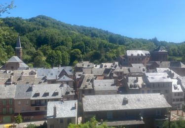
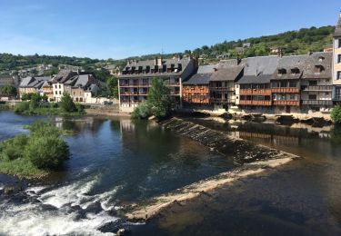
Tocht Stappen Villecomtal - La Chapelle de Servières - Photo

La Chapelle de Servières

 jpb83
jpb83

Gebruiker

© OpenStreetMap contributors
Lengte
Lengte
9,5 km
Max. hoogte
Max. hoogte
540 m
Positief hoogteverschil
316 m
Km-Effort
Km-Effort  
13,7 km
Min. hoogte
Min. hoogte
304 m
Negatief hoogteverschil
307 m
Boucle
Boucle
Ja
Datum van aanmaak :
2022-08-17 07:14:51.399
Laatste wijziging :
2022-08-17 07:16:30.723

(0 Bericht)

Stappen
Stappen
3h06
Moeilijkheid : Gemakkelijk

Scan deze QR-code om de tocht te openen in de SityTrail-applicatie

Gratisgps-wandelapplicatie

Logo SityTrail SityTrail

IGN / Geografische instituten

SityTrail uit de App Store downloaden SityTrail uit Google Play downloaden

Logo SityTrail SityTrail World

De wereld gaat voor u open

SityTrail uit de App Store downloaden SityTrail uit Google Play downloaden SityTrail op Huawei AppGallery downloaden

Over ons

Tocht Stappen van 9,5 km beschikbaar op Occitanië, Aveyron, Villecomtal. Deze tocht wordt voorgesteld door jpb83.

Hoogteprofiel

POI's

POI Mouret - Parking mairie - Photo
jpb83
POI Mouret - Le Mas Bas - Photo
jpb83
MOURET 
POI Villecomtal - Pabotiés - Photo
jpb83
VILLECOMTAL 
POI Villecomtal - Carrefou carral - Photo
jpb83
VILLECOMTAL 
POI Villecomtal - Chapelle de Servières - Photo
jpb83
POI Villecomtal - Carrefour avant le pont - Photo
jpb83
POI Villecomtal - Parking mairie. Proche du - Photo
jpb83

Plaatsbepaling

Land:
France
Regio :
Occitanië
Departement/Provincie :
Aveyron
Gemeente :
Villecomtal
Locatie:
Unknown
Vertrek:(UTM)
465340 ; 4931894 (31T) N.

Wandeltochten in de omgeving

Tocht Stappen Campuac - campuac - Photo
Stappen
yves12

Stappen

Medium
(1)
Campuac, Occitanië, Aveyron, France
22 km | 32 km-effort
5h 8min
Ja
Tocht Te voet Muret-le-Château - Terra Trail 9 - Photo
Te voet
GUIDE+

Te voet

Gemakkelijk
Muret-le-Château, Occitanië, Aveyron, France
11 km | 12,6 km-effort
2h 52min
Neen
Tocht Te voet Campuac - Le Plateau de Campuac - Photo
Te voet
GUIDE+

Te voet

Gemakkelijk
Campuac, Occitanië, Aveyron, France
7,6 km | 9 km-effort
2h 2min
Neen
Tocht Te voet Mouret - La Chapelle de Servières - Photo
Te voet
GUIDE+

Te voet

Gemakkelijk
Mouret, Occitanië, Aveyron, France
5,6 km | 7,2 km-effort
1h 38min
Neen
Tocht Te voet Muret-le-Château - Les Corniches des Douzes - Photo
Te voet
GUIDE+

Te voet

Gemakkelijk
Muret-le-Château, Occitanië, Aveyron, France
12 km | 15,5 km-effort
3h 31min
Ja
Tocht Elektrische fiets Muret-le-Château - Villecomtal dans le 12 - Photo
Elektrische fiets
papajp

Elektrische fiets

Muret-le-Château, Occitanië, Aveyron, France
5,7 km | 6,8 km-effort
21min
Neen
Tocht Andere activiteiten Campuac - Atlamed campuac - espalion - Photo
Andere activiteiten
jbtregouet

Andere activiteiten

Heel gemakkelijk
Campuac, Occitanië, Aveyron, France
26 km | 35 km-effort
6h 6min
Neen
Tocht Mountainbike Campuac - Site VTT FFC - Gorges Lot et Truyère - Circuit n°1 Les Deux Clochers - Photo
Mountainbike
tracegps

Mountainbike

Moeilijk
Campuac, Occitanië, Aveyron, France
25 km | 31 km-effort
1h 45min
Ja
Tocht Stappen Campuac - Campuac à Conques  - Photo
Stappen
bernardecarnot

Stappen

Moeilijk
Campuac, Occitanië, Aveyron, France
22 km | 30 km-effort
7h 5min
Neen


Sluiten
Mijn abonnementen