![](/images/other/stat-length.png)
![Tocht Stappen Diepenbeek - La vallée du Démer - Le ruisseau Dauten et les Dautewijers à Diepenbeek - Photo](https://media.geolcdn.com/t/1900/400/ff431e14-a2e4-4401-9193-e96799f79a9a.jpeg&format=pjpeg&maxdim=2)
La vallée du Démer - Le ruisseau Dauten et les Dautewijers à Diepenbeek
Benjamin27
Gebruiker GUIDE
![Lengte](/images/other/stat-length.png)
![Max. hoogte](https://static1.geolcdn.com/siteimages/upload/files/1508320355ic_sort_altitude_max_24dp.png)
![Positief hoogteverschil](https://static1.geolcdn.com/siteimages/upload/files/1508320355ic_sort_den_pos_24dp.png)
![Km-Effort](/images/other/stat-length.png)
![Min. hoogte](https://static1.geolcdn.com/siteimages/upload/files/1508320355ic_sort_altitude_min_24dp.png)
![Negatief hoogteverschil](https://static1.geolcdn.com/siteimages/upload/files/1508320355ic_sort_den_neg_24dp.png)
![Boucle](https://static1.geolcdn.com/siteimages/upload/files/16400158638029165_repeat_loop_refresh_sync_direction_icon.png)
![Stappen](https://static1.geolcdn.com/sitytour/trail-icons/101.png)
1h19
Moeilijkheid : Gemakkelijk
![Scan deze QR-code om de tocht te openen in de SityTrail-applicatie](https://capi.geolives.com/qq0zvz2zws4bq2lad0pu/sitytour/trails/3350294/qr.png?size=200)
Gratisgps-wandelapplicatie
Over ons
Tocht Stappen van 5,4 km beschikbaar op Vlaanderen, Limburg, Diepenbeek. Deze tocht wordt voorgesteld door Benjamin27.
Beschrijving
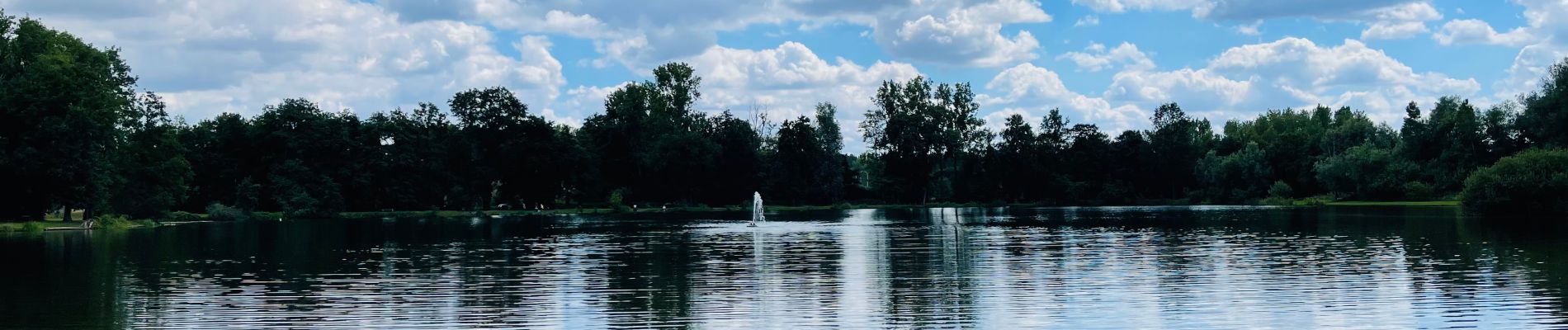
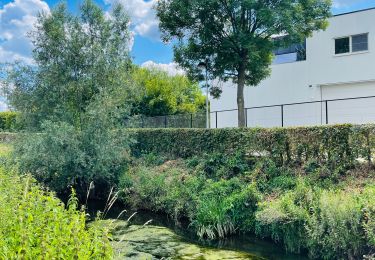
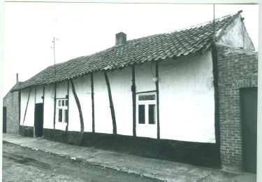
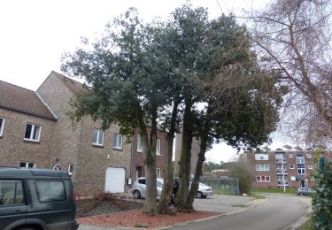
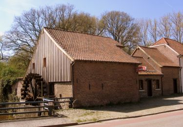
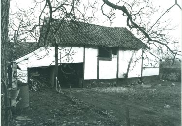
L’eau a une place centrale dans la région : rivière, ruisseau, étangs… la réserve naturelle des Dautewijers est le paysage fleuri idéal pour les animaux. La réserve naturelle est assez préservée que pour pouvoir observer des écureuils, des rainettes, divers oiseaux et même des chevaux.
👣 Distance : 5,3km - balisage losange bleu.
🗺️ Carte / Fichier GPX en bio.
📍Départ : parking Demerstrand, Stationsstraat 27 - 3590 Diepenbeek.
🚂 La promenade peut être démarrée à partir de la gare de Diepenbeek.
💡A combiner avec la promenade « La réserve naturelle Dorpsbeemden ».
Plaatsbepaling
Opmerkingen
Wandeltochten in de omgeving
![Tocht Stappen Diepenbeek - La vallée du Démer - La réserve naturelle Dorpsbemden à Diepenbeek - Photo](https://media.geolcdn.com/t/375/260/831c90b3-6b69-4442-bd2d-357552ece2e5.jpeg&format=jpg&maxdim=2)
![Stappen Stappen](https://static1.geolcdn.com/sitytour/trail-icons/101.png)
Stappen
![](/images/other/stat-length.png)
![](https://static1.geolcdn.com/siteimages/upload/files/16400158638029165_repeat_loop_refresh_sync_direction_icon.png)
![Tocht Te voet Diepenbeek - Lange afstandstocht - Photo](https://media.geolcdn.com/t/375/260/c0f28296-bcff-4fe2-9db4-902c2464ce24.jpeg&format=jpg&maxdim=2)
![Te voet Te voet](https://static1.geolcdn.com/sitytour/trail-icons/100.png)
Te voet
![](/images/other/stat-length.png)
![](https://static1.geolcdn.com/siteimages/upload/files/16400158638029165_repeat_loop_refresh_sync_direction_icon.png)
![Tocht Te voet Hasselt - Mombeekpad W700 geel - Photo](https://media.geolcdn.com/t/375/260/d91aeff8-4d52-4b35-a08b-6ff9055d6a9b.jpeg&format=jpg&maxdim=2)
![Te voet Te voet](https://static1.geolcdn.com/sitytour/trail-icons/100.png)
Te voet
![](/images/other/stat-length.png)
![](https://static1.geolcdn.com/siteimages/upload/files/16400158638029165_repeat_loop_refresh_sync_direction_icon.png)
![Tocht Te voet Diepenbeek - Dorpsbemden - Photo](https://media.geolcdn.com/t/375/260/3c4356e7-f857-471e-86d0-400db7034da1.jpeg&format=jpg&maxdim=2)
![Te voet Te voet](https://static1.geolcdn.com/sitytour/trail-icons/100.png)
Te voet
![](/images/other/stat-length.png)
![](https://static1.geolcdn.com/siteimages/upload/files/16400158638029165_repeat_loop_refresh_sync_direction_icon.png)
![Tocht Te voet Diepenbeek - Dauteweyers - Photo](https://media.geolcdn.com/t/375/260/c0f28296-bcff-4fe2-9db4-902c2464ce24.jpeg&format=jpg&maxdim=2)
![Te voet Te voet](https://static1.geolcdn.com/sitytour/trail-icons/100.png)
Te voet
![](/images/other/stat-length.png)
![](https://static1.geolcdn.com/siteimages/upload/files/16400158638029165_repeat_loop_refresh_sync_direction_icon.png)
![Tocht Te voet Diepenbeek - 12.500 stappen/oranje - Photo](https://media.geolcdn.com/t/375/260/c0f28296-bcff-4fe2-9db4-902c2464ce24.jpeg&format=jpg&maxdim=2)
![Te voet Te voet](https://static1.geolcdn.com/sitytour/trail-icons/100.png)
Te voet
![](/images/other/stat-length.png)
![](https://static1.geolcdn.com/siteimages/upload/files/16400158638029165_repeat_loop_refresh_sync_direction_icon.png)
![Tocht Te voet Genk - Melberg Rode driehoek wandeling - Photo](https://media.geolcdn.com/t/375/260/6925453e-2323-4e41-8380-50ced4fee93a.jpeg&format=jpg&maxdim=2)
![Te voet Te voet](https://static1.geolcdn.com/sitytour/trail-icons/100.png)
Te voet
![](/images/other/stat-length.png)
![](https://static1.geolcdn.com/siteimages/upload/files/16400158638029165_repeat_loop_refresh_sync_direction_icon.png)
![Tocht Te voet Diepenbeek - De Maten rood - Photo](https://media.geolcdn.com/t/375/260/9980fe5d-a221-412a-85ce-57156ea9267e.jpeg&format=jpg&maxdim=2)
![Te voet Te voet](https://static1.geolcdn.com/sitytour/trail-icons/100.png)
Te voet
![](/images/other/stat-length.png)
![](https://static1.geolcdn.com/siteimages/upload/files/16400158638029165_repeat_loop_refresh_sync_direction_icon.png)
![Tocht Te voet Diepenbeek - Nietelbroeken - Photo](https://media.geolcdn.com/t/375/260/7541b859-d97b-4d1a-892d-184d3aaca5b8.jpeg&format=jpg&maxdim=2)
![Te voet Te voet](https://static1.geolcdn.com/sitytour/trail-icons/100.png)
Te voet
![](/images/other/stat-length.png)
![](https://static1.geolcdn.com/siteimages/upload/files/16400158638029165_repeat_loop_refresh_sync_direction_icon.png)