![](/images/other/stat-length.png)
![Tocht Stappen Halen - La vallée du Zwarte Beek à Zelem - Photo](https://media.geolcdn.com/t/1900/400/7895c069-90e4-4755-97a2-49d8f75f00bb.jpg&format=pjpeg&maxdim=2)
La vallée du Zwarte Beek à Zelem
Benjamin27
Gebruiker GUIDE
![Lengte](/images/other/stat-length.png)
![Max. hoogte](https://static1.geolcdn.com/siteimages/upload/files/1508320355ic_sort_altitude_max_24dp.png)
![Positief hoogteverschil](https://static1.geolcdn.com/siteimages/upload/files/1508320355ic_sort_den_pos_24dp.png)
![Km-Effort](/images/other/stat-length.png)
![Min. hoogte](https://static1.geolcdn.com/siteimages/upload/files/1508320355ic_sort_altitude_min_24dp.png)
![Negatief hoogteverschil](https://static1.geolcdn.com/siteimages/upload/files/1508320355ic_sort_den_neg_24dp.png)
![Boucle](https://static1.geolcdn.com/siteimages/upload/files/16400158638029165_repeat_loop_refresh_sync_direction_icon.png)
![Stappen](https://static1.geolcdn.com/sitytour/trail-icons/101.png)
2h02
Moeilijkheid : Medium
![Scan deze QR-code om de tocht te openen in de SityTrail-applicatie](https://capi.geolives.com/qq0zvz2zws4bq2lad0pu/sitytour/trails/3350281/qr.png?size=200)
Gratisgps-wandelapplicatie
Over ons
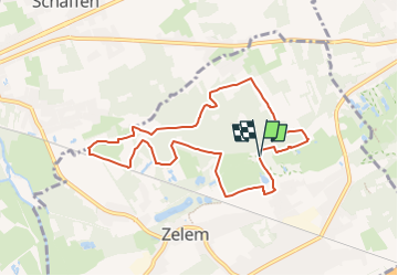
Tocht Stappen van 7,9 km beschikbaar op Vlaanderen, Limburg, Halen. Deze tocht wordt voorgesteld door Benjamin27.
Beschrijving
Photo de profil de lesbaladesdebenja
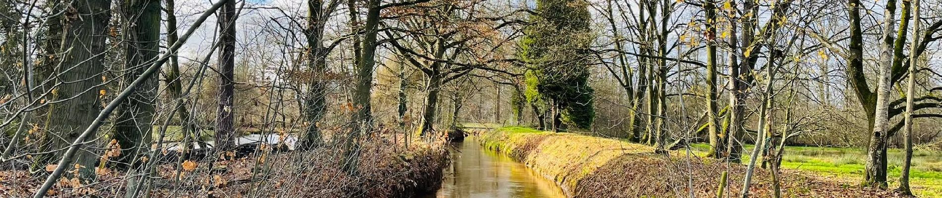
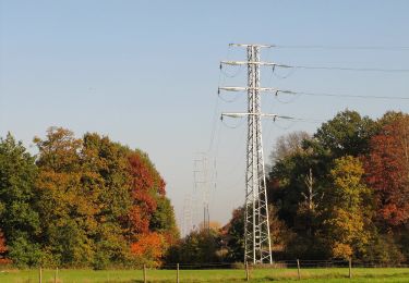
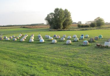
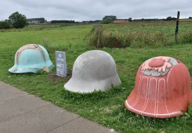
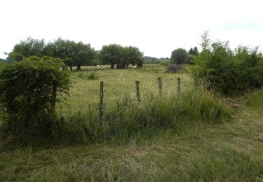
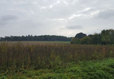
La vallée du Zwarte Beek à Zelem.
Le Zwarte Beek est un ruisseau qui tient son nom de sa couleur particulièrement foncée. Cette promenade vous emmènera dans une nature magnifique en bord de ruisseau, dans les bois et le magnifique paysage de la région.
👣 Distance : 8km - balisage triangle rouge.
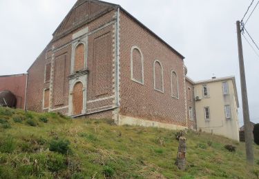
📍Départ : parking devant l’église, dorpsstraat 34 - 3545 Zelem (Halen).
🚂🚍 Aller à la gare de Diest, prendre le bus DE LIJN 92 jusqu’à l’arrêt « Zelem - Thibautstraat » et marcher 4 minutes jusqu’au point de départ.
Plaatsbepaling
Opmerkingen
Wandeltochten in de omgeving
![Tocht Te voet Lummen - Lummensbroek rode driehoek - Photo](https://media.geolcdn.com/t/375/260/da9a5d6a-8877-4c5a-bca2-fdd50203b419.jpeg&format=jpg&maxdim=2)
![Te voet Te voet](https://static1.geolcdn.com/sitytour/trail-icons/100.png)
Te voet
![](/images/other/stat-length.png)
![](https://static1.geolcdn.com/siteimages/upload/files/16400158638029165_repeat_loop_refresh_sync_direction_icon.png)
![Tocht Te voet Lummen - Lummense Parels Blauwe ruit - Photo](https://media.geolcdn.com/t/375/260/3f6dc320-e729-4d4d-9db7-571f5c09e396.jpeg&format=jpg&maxdim=2)
![Te voet Te voet](https://static1.geolcdn.com/sitytour/trail-icons/100.png)
Te voet
![](/images/other/stat-length.png)
![](https://static1.geolcdn.com/siteimages/upload/files/16400158638029165_repeat_loop_refresh_sync_direction_icon.png)
![Tocht Te voet Tessenderlo - Asdonk Blauwe ruit - Photo](https://media.geolcdn.com/t/375/260/c599fae6-000e-4f9b-be4f-f8004ced1ebf.jpeg&format=jpg&maxdim=2)
![Te voet Te voet](https://static1.geolcdn.com/sitytour/trail-icons/100.png)
Te voet
![](/images/other/stat-length.png)
![](https://static1.geolcdn.com/siteimages/upload/files/16400158638029165_repeat_loop_refresh_sync_direction_icon.png)
![Tocht Te voet Tessenderlo - Asdonk Rode driehoek - Photo](https://media.geolcdn.com/t/375/260/c599fae6-000e-4f9b-be4f-f8004ced1ebf.jpeg&format=jpg&maxdim=2)
![Te voet Te voet](https://static1.geolcdn.com/sitytour/trail-icons/100.png)
Te voet
![](/images/other/stat-length.png)
![](https://static1.geolcdn.com/siteimages/upload/files/16400158638029165_repeat_loop_refresh_sync_direction_icon.png)
![Tocht Te voet Halen - Zilveren Helmenwandeling - Photo](https://media.geolcdn.com/t/375/260/5671e5b0-70b4-4d41-9e57-848b60eb02ae.jpeg&format=jpg&maxdim=2)
![Te voet Te voet](https://static1.geolcdn.com/sitytour/trail-icons/100.png)
Te voet
![](/images/other/stat-length.png)
![](https://static1.geolcdn.com/siteimages/upload/files/16400158638029165_repeat_loop_refresh_sync_direction_icon.png)
![Tocht Te voet Halen - Slagveldwandeling blauw - Photo](https://media.geolcdn.com/t/375/260/ff6211c8-a080-4021-98ce-d80aa3de7615.jpeg&format=jpg&maxdim=2)
![Te voet Te voet](https://static1.geolcdn.com/sitytour/trail-icons/100.png)
Te voet
![](/images/other/stat-length.png)
![](https://static1.geolcdn.com/siteimages/upload/files/16400158638029165_repeat_loop_refresh_sync_direction_icon.png)
![Tocht Te voet Halen - Loksbergen Blauwe ruit - Photo](https://media.geolcdn.com/t/375/260/ae9d2e43-fc91-4f02-9abd-cee686703602.jpeg&format=jpg&maxdim=2)
![Te voet Te voet](https://static1.geolcdn.com/sitytour/trail-icons/100.png)
Te voet
![](/images/other/stat-length.png)
![](https://static1.geolcdn.com/siteimages/upload/files/16400158638029165_repeat_loop_refresh_sync_direction_icon.png)
![Tocht Te voet Halen - Zelk Oranje bol - Photo](https://media.geolcdn.com/t/375/260/54f67bfb-93a4-4273-8a07-b47b83b202cf.jpeg&format=jpg&maxdim=2)
![Te voet Te voet](https://static1.geolcdn.com/sitytour/trail-icons/100.png)
Te voet
![](/images/other/stat-length.png)
![](https://static1.geolcdn.com/siteimages/upload/files/16400158638029165_repeat_loop_refresh_sync_direction_icon.png)
![Tocht Te voet Halen - Kartuizerspatiamentum Oranje bol - Photo](https://media.geolcdn.com/t/375/260/9bcbcf4b-6db4-4abd-8824-a8ed4639b90d.jpeg&format=jpg&maxdim=2)
![Te voet Te voet](https://static1.geolcdn.com/sitytour/trail-icons/100.png)
Te voet
![](/images/other/stat-length.png)
![](https://static1.geolcdn.com/siteimages/upload/files/16400158638029165_repeat_loop_refresh_sync_direction_icon.png)