Tocht Stappen Ustou - 2022 TRANSPYRÉNÉEN - St Lizier -d’Ustou -Aulus les Bains - Photo

2022 TRANSPYRÉNÉEN - St Lizier -d’Ustou -Aulus les Bains

 LEGUE
LEGUE

Gebruiker

© OpenStreetMap contributors
Lengte
Lengte
17,5 km
Max. hoogte
Max. hoogte
1748 m
Positief hoogteverschil
1142 m
Km-Effort
Km-Effort  
33 km
Min. hoogte
Min. hoogte
731 m
Negatief hoogteverschil
1131 m
Boucle
Boucle
Neen
Datum van aanmaak :
2022-08-10 06:30:21.0
Laatste wijziging :
2022-08-10 14:09:43.435

(0 Bericht)

Stappen
Stappen
4h40
Moeilijkheid : Zeer moeilijk

Scan deze QR-code om de tocht te openen in de SityTrail-applicatie

Gratisgps-wandelapplicatie

Logo SityTrail SityTrail

IGN / Geografische instituten

SityTrail uit de App Store downloaden SityTrail uit Google Play downloaden

Logo SityTrail SityTrail World

De wereld gaat voor u open

SityTrail uit de App Store downloaden SityTrail uit Google Play downloaden SityTrail op Huawei AppGallery downloaden

Over ons

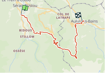
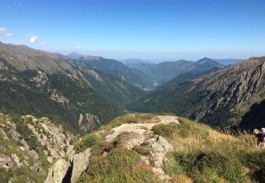
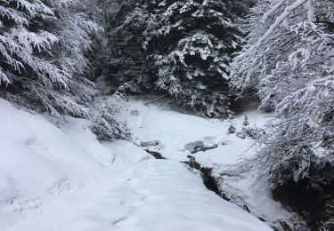
Tocht Stappen van 17,5 km beschikbaar op Occitanië, Ariège, Ustou. Deze tocht wordt voorgesteld door LEGUE.

Beschrijving

17 Km
1200 positifs et 1200 Négatifs

Hoogteprofiel

Foto's

Plaatsbepaling

Land:
France
Regio :
Occitanië
Departement/Provincie :
Ariège
Gemeente :
Ustou
Locatie:
Unknown
Vertrek:(Dec)
Vertrek:(UTM)
358093 ; 4739673 (31T) N.

Wandeltochten in de omgeving

Tocht Stappen Ustou - Col de serre - Photo
Stappen
georghinio

Stappen

(1)
Ustou, Occitanië, Ariège, France
6,3 km | 13,6 km-effort
1h 56min
Ja
Tocht Stappen Ustou - Le tour de la cabane d'Ardio - Photo
Stappen
tracegps

Stappen

Medium
(1)
Ustou, Occitanië, Ariège, France
4,4 km | 7,1 km-effort
1h 30min
Ja
Tocht Stappen Ustou - Les Cascades du chemin d'Espagne - Photo
Stappen
tracegps

Stappen

Medium
(1)
Ustou, Occitanië, Ariège, France
8,1 km | 13,1 km-effort
2h 30min
Ja
Tocht Stappen Ustou - Alet lacarde - Photo
Stappen
georghinio

Stappen

Zeer moeilijk
Ustou, Occitanië, Ariège, France
13,3 km | 30 km-effort
6h 22min
Ja
Tocht Te voet Ustou - Le cirque de Cagateille - Photo
Te voet
PRO

Te voet

Medium
Ustou, Occitanië, Ariège, France
11,1 km | 26 km-effort
5h 49min
Ja
Tocht Te voet Ustou - Pic de Couillac par le cirque de Cagateille - Photo
Te voet
PRO

Te voet

Moeilijk
Ustou, Occitanië, Ariège, France
16,3 km | 39 km-effort
8h 52min
Ja
Tocht Stappen Ustou - Cagateille - Certascan - Photo
Stappen
ARVIEU

Stappen

Zeer moeilijk
Ustou, Occitanië, Ariège, France
10,4 km | 29 km-effort
8h 0min
Neen
Tocht Noords wandelen Ustou - Combes de criespie - Photo
Noords wandelen
georghinio

Noords wandelen

Gemakkelijk
Ustou, Occitanië, Ariège, France
4,6 km | 8 km-effort
2h 18min
Ja
Tocht Stappen Ustou - Ossése - port de Marterat A/R - Photo
Stappen
countryjack

Stappen

Medium
Ustou, Occitanië, Ariège, France
15 km | 34 km-effort
5h 45min
Ja


Sluiten
Mijn abonnementen