![](/images/other/stat-length.png)
![Tocht Stappen Tréhorenteuc - Broceliande - Photo](https://media.geolcdn.com/t/1900/400/81018fdd-76b5-4b1a-8652-c9a532731623.jpg&format=pjpeg&maxdim=2)
Broceliande
Raymond DAVID
Gebruiker
![Lengte](/images/other/stat-length.png)
Lengte
72 km
![Max. hoogte](https://static1.geolcdn.com/siteimages/upload/files/1508320355ic_sort_altitude_max_24dp.png)
Max. hoogte
189 m
![Positief hoogteverschil](https://static1.geolcdn.com/siteimages/upload/files/1508320355ic_sort_den_pos_24dp.png)
Positief hoogteverschil
965 m
![Km-Effort](/images/other/stat-length.png)
Km-Effort
85 km
![Min. hoogte](https://static1.geolcdn.com/siteimages/upload/files/1508320355ic_sort_altitude_min_24dp.png)
Min. hoogte
30 m
![Negatief hoogteverschil](https://static1.geolcdn.com/siteimages/upload/files/1508320355ic_sort_den_neg_24dp.png)
Negatief hoogteverschil
944 m
![Boucle](https://static1.geolcdn.com/siteimages/upload/files/16400158638029165_repeat_loop_refresh_sync_direction_icon.png)
Boucle
Neen
Datum van aanmaak :
2022-08-06 08:05:48.72
Laatste wijziging :
2022-08-07 13:18:21.832
![Stappen](https://static1.geolcdn.com/sitytour/trail-icons/101.png)
4h45
Moeilijkheid : Medium
![Scan deze QR-code om de tocht te openen in de SityTrail-applicatie](https://capi.geolives.com/qq0zvz2zws4bq2lad0pu/sitytour/trails/3345948/qr.png?size=200)
Gratisgps-wandelapplicatie
Over ons
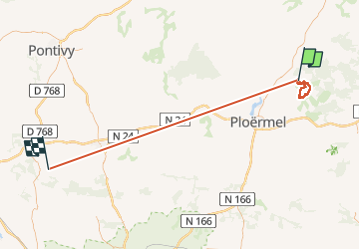
Tocht Stappen van 72 km beschikbaar op Bretagne, Morbihan, Tréhorenteuc. Deze tocht wordt voorgesteld door Raymond DAVID .
Beschrijving
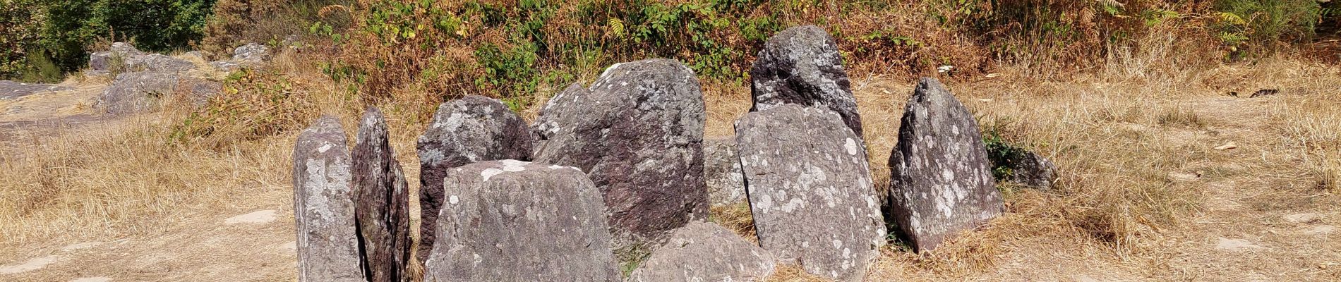
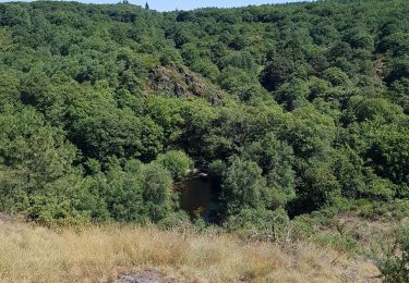
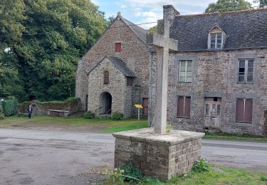
Découverte du Val sans retour, de la chapelle St Jean (de loin, privée), du magnifique Château de Trècesson et de son pigeonnier. Faire le détour pour voir le Hotie ou maison de Viviane. Rando de 15,5 km (et non de 17, 7 car erreur de parcours) dénivelée de 200 m environ
Plaatsbepaling
Land:
France
Regio :
Bretagne
Departement/Provincie :
Morbihan
Gemeente :
Tréhorenteuc
Locatie:
Unknown
Vertrek:(Dec)
Vertrek:(UTM)
553212 ; 5317406 (30U) N.
Opmerkingen
Wandeltochten in de omgeving
![Tocht Paardrijden Néant-sur-Yvel - Broceliande - Photo](https://media.geolcdn.com/t/375/260/203abf06-19c3-4c8f-9ce2-990712cb0787.jpg&format=jpg&maxdim=2)
![Paardrijden Paardrijden](https://static1.geolcdn.com/sitytour/trail-icons/301.png)
Broceliande
Paardrijden
Medium
(1)
Néant-sur-Yvel,
Bretagne,
Morbihan,
France
![](/images/other/stat-length.png)
22 km | 26 km-effort
4h 46min
![](https://static1.geolcdn.com/siteimages/upload/files/16400158638029165_repeat_loop_refresh_sync_direction_icon.png)
Ja
![Tocht Stappen Campénéac - Château de TRECESSON - Tombeau du Géant - L'Hotié de la Fée Viviane - (8/2019) - Photo](https://media.geolcdn.com/t/375/260/6dc55585-1341-4962-8006-32206bea207b.jpg&format=jpg&maxdim=2)
![Stappen Stappen](https://static1.geolcdn.com/sitytour/trail-icons/101.png)
Château de TRECESSON - Tombeau du Géant - L'Hotié de la Fée Viviane - (8/2019)
Stappen
Medium
(1)
Campénéac,
Bretagne,
Morbihan,
France
![](/images/other/stat-length.png)
11 km | 13,4 km-effort
2h 43min
![](https://static1.geolcdn.com/siteimages/upload/files/16400158638029165_repeat_loop_refresh_sync_direction_icon.png)
Ja
![Tocht Stappen Tréhorenteuc - les landes de Gurwant et le Val sans retour - Photo](https://media.geolcdn.com/t/375/260/8ebdb65c-0df1-4e76-a908-0321b1ff5945.jpg&format=jpg&maxdim=2)
![Stappen Stappen](https://static1.geolcdn.com/sitytour/trail-icons/101.png)
les landes de Gurwant et le Val sans retour
Stappen
Gemakkelijk
Tréhorenteuc,
Bretagne,
Morbihan,
France
![](/images/other/stat-length.png)
14,9 km | 18,2 km-effort
4h 46min
![](https://static1.geolcdn.com/siteimages/upload/files/16400158638029165_repeat_loop_refresh_sync_direction_icon.png)
Ja
![Tocht Stappen Tréhorenteuc - Tréhorenteuc - Photo](https://media.geolcdn.com/t/375/260/d78e64c2-e4c4-446d-80e9-2d94e7737353.jpg&format=jpg&maxdim=2)
![Stappen Stappen](https://static1.geolcdn.com/sitytour/trail-icons/101.png)
![Tocht Stappen Mauron - GR_37_CF_40_Mauron_Taupont_20220925 - Photo](https://media.geolcdn.com/t/375/260/5934c0c6-bee8-44fc-9fe2-148a0c004337.jpg&format=jpg&maxdim=2)
![Stappen Stappen](https://static1.geolcdn.com/sitytour/trail-icons/101.png)
GR_37_CF_40_Mauron_Taupont_20220925
Stappen
Heel gemakkelijk
Mauron,
Bretagne,
Morbihan,
France
![](/images/other/stat-length.png)
22 km | 25 km-effort
4h 47min
![](https://static1.geolcdn.com/siteimages/upload/files/16400158638029165_repeat_loop_refresh_sync_direction_icon.png)
Neen
![Tocht Stappen Paimpont - GR_37_CE_39_Paimpont_Mauron_20220924 - Photo](https://media.geolcdn.com/t/375/260/d0e9fad4-0af6-4e10-b643-661a6c1313a8.jpg&format=jpg&maxdim=2)
![Stappen Stappen](https://static1.geolcdn.com/sitytour/trail-icons/101.png)
GR_37_CE_39_Paimpont_Mauron_20220924
Stappen
Zeer moeilijk
Paimpont,
Bretagne,
Ille-et-Vilaine,
France
![](/images/other/stat-length.png)
20 km | 25 km-effort
5h 17min
![](https://static1.geolcdn.com/siteimages/upload/files/16400158638029165_repeat_loop_refresh_sync_direction_icon.png)
Neen
![Tocht Te voet Campénéac - Les Landes de Gurwan - Photo](https://media.geolcdn.com/t/375/260/b737382d-2b17-4f2d-90a4-5777864a81d4.jpeg&format=jpg&maxdim=2)
![Te voet Te voet](https://static1.geolcdn.com/sitytour/trail-icons/100.png)
Les Landes de Gurwan
Te voet
Gemakkelijk
Campénéac,
Bretagne,
Morbihan,
France
![](/images/other/stat-length.png)
11,4 km | 13,7 km-effort
3h 6min
![](https://static1.geolcdn.com/siteimages/upload/files/16400158638029165_repeat_loop_refresh_sync_direction_icon.png)
Ja
![Tocht Stappen Néant-sur-Yvel - TUMULUS DU JARDIN AUX MOINES (9/20) - Photo](https://media.geolcdn.com/t/375/260/7bb9903b-d90a-4ad2-bb6c-2c00df8bd974.jpg&format=jpg&maxdim=2)
![Stappen Stappen](https://static1.geolcdn.com/sitytour/trail-icons/101.png)
TUMULUS DU JARDIN AUX MOINES (9/20)
Stappen
Medium
Néant-sur-Yvel,
Bretagne,
Morbihan,
France
![](/images/other/stat-length.png)
11,7 km | 14,2 km-effort
3h 30min
![](https://static1.geolcdn.com/siteimages/upload/files/16400158638029165_repeat_loop_refresh_sync_direction_icon.png)
Ja
![Tocht Stappen Néant-sur-Yvel - Autour des étangs à partir du gîte de tante Phonsine - Photo](https://media.geolcdn.com/t/375/260/c9087903-e076-4035-95d3-8fbe645b66c6.jpg&format=jpg&maxdim=2)
![Stappen Stappen](https://static1.geolcdn.com/sitytour/trail-icons/101.png)
Autour des étangs à partir du gîte de tante Phonsine
Stappen
Medium
Néant-sur-Yvel,
Bretagne,
Morbihan,
France
![](/images/other/stat-length.png)
4 km | 4,9 km-effort
1h 0min
![](https://static1.geolcdn.com/siteimages/upload/files/16400158638029165_repeat_loop_refresh_sync_direction_icon.png)
Ja
Dommage que la trace enregistrée fasse 72kms. Ce serait sympa de corriger