![](/images/other/stat-length.png)
![Tocht Stappen Py - PIC DE TRES ESTELLES - Photo](https://media.geolcdn.com/t/1900/400/ext.pjpeg?maxdim=2&url=https%3A%2F%2Fservices.sitytrail.com%2FGeolivesWS%2FDownloadMedia.ashx%3FTrailID%3D333302%26Media%3Dfix__20140806111504.jpg)
PIC DE TRES ESTELLES
PVERTICAL
Gebruiker
![Lengte](/images/other/stat-length.png)
Lengte
8,1 km
![Max. hoogte](https://static1.geolcdn.com/siteimages/upload/files/1508320355ic_sort_altitude_max_24dp.png)
Max. hoogte
2124 m
![Positief hoogteverschil](https://static1.geolcdn.com/siteimages/upload/files/1508320355ic_sort_den_pos_24dp.png)
Positief hoogteverschil
457 m
![Km-Effort](/images/other/stat-length.png)
Km-Effort
14,2 km
![Min. hoogte](https://static1.geolcdn.com/siteimages/upload/files/1508320355ic_sort_altitude_min_24dp.png)
Min. hoogte
1759 m
![Negatief hoogteverschil](https://static1.geolcdn.com/siteimages/upload/files/1508320355ic_sort_den_neg_24dp.png)
Negatief hoogteverschil
454 m
![Boucle](https://static1.geolcdn.com/siteimages/upload/files/16400158638029165_repeat_loop_refresh_sync_direction_icon.png)
Boucle
Ja
Datum van aanmaak :
2014-12-10 00:00:00.0
Laatste wijziging :
2014-12-10 00:00:00.0
![Stappen](https://static1.geolcdn.com/sitytour/trail-icons/101.png)
3h05
Moeilijkheid : Gemakkelijk
![Scan deze QR-code om de tocht te openen in de SityTrail-applicatie](https://capi.geolives.com/qq0zvz2zws4bq2lad0pu/sitytour/trails/333302/qr.png?size=200)
Gratisgps-wandelapplicatie
Over ons
Tocht Stappen van 8,1 km beschikbaar op Occitanië, Pyrénées-Orientales, Py. Deze tocht wordt voorgesteld door PVERTICAL.
Beschrijving
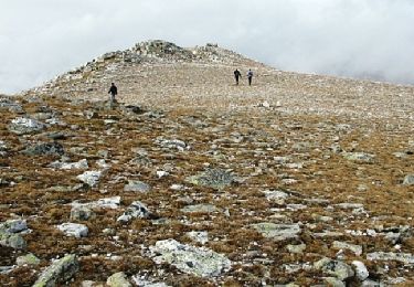
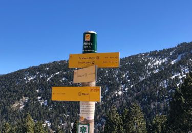
depuis col de Mantet - retour proposé par une partie des crêtes et les trois pics formant le massif (2099,2114 et 2135) - privilégié le retour par même sentier avec enfants ou débutants
Plaatsbepaling
Land:
France
Regio :
Occitanië
Departement/Provincie :
Pyrénées-Orientales
Gemeente :
Py
Locatie:
Unknown
Vertrek:(Dec)
Vertrek:(UTM)
443626 ; 4703444 (31T) N.
Opmerkingen
Wandeltochten in de omgeving
![Tocht Stappen Py - Roc Colom - Photo](https://media.geolcdn.com/t/375/260/ext.jpg?maxdim=2&url=https%3A%2F%2Fservices.sitytrail.com%2FGeolivesWS%2FDownloadMedia.ashx%3FTrailID%3D109700%26Media%3D4391_1.jpg)
![Stappen Stappen](https://static1.geolcdn.com/sitytour/trail-icons/101.png)
Roc Colom
Stappen
Moeilijk
(1)
Py,
Occitanië,
Pyrénées-Orientales,
France
![](/images/other/stat-length.png)
19,4 km | 34 km-effort
4h 30min
![](https://static1.geolcdn.com/siteimages/upload/files/16400158638029165_repeat_loop_refresh_sync_direction_icon.png)
Neen
![Tocht Sneeuwschoenen Mantet - Cime de Pomarole - Photo](https://media.geolcdn.com/t/375/260/ext.jpg?maxdim=2&url=https%3A%2F%2Fservices.sitytrail.com%2FGeolivesWS%2FDownloadMedia.ashx%3FTrailID%3D388205%26Media%3Dfix__20150220123221.jpg)
![Sneeuwschoenen Sneeuwschoenen](https://static1.geolcdn.com/sitytour/trail-icons/504.png)
Cime de Pomarole
Sneeuwschoenen
Medium
(1)
Mantet,
Occitanië,
Pyrénées-Orientales,
France
![](/images/other/stat-length.png)
8,6 km | 16,2 km-effort
3h 21min
![](https://static1.geolcdn.com/siteimages/upload/files/16400158638029165_repeat_loop_refresh_sync_direction_icon.png)
Ja
![Tocht Stappen Py - 2022 TRANSPYRÉNÉENNE : refuge de Py- refuge des wmarialles - Photo](https://media.geolcdn.com/t/375/260/82751e70-487b-487b-a0f9-3c15620b4a06.jpg&format=jpg&maxdim=2)
![Stappen Stappen](https://static1.geolcdn.com/sitytour/trail-icons/101.png)
2022 TRANSPYRÉNÉENNE : refuge de Py- refuge des wmarialles
Stappen
Heel gemakkelijk
Py,
Occitanië,
Pyrénées-Orientales,
France
![](/images/other/stat-length.png)
9,7 km | 18,3 km-effort
2h 30min
![](https://static1.geolcdn.com/siteimages/upload/files/16400158638029165_repeat_loop_refresh_sync_direction_icon.png)
Neen
![Tocht Stappen Py - 20220528 Col de Mantet - Photo](https://media.geolcdn.com/t/375/260/54979b33-8888-45b0-896b-8bb77210f9dc.jpg&format=jpg&maxdim=2)
![Stappen Stappen](https://static1.geolcdn.com/sitytour/trail-icons/101.png)
20220528 Col de Mantet
Stappen
Moeilijk
Py,
Occitanië,
Pyrénées-Orientales,
France
![](/images/other/stat-length.png)
19,5 km | 36 km-effort
6h 40min
![](https://static1.geolcdn.com/siteimages/upload/files/16400158638029165_repeat_loop_refresh_sync_direction_icon.png)
Ja
![Tocht Stappen Mantet - Montet à caranza - Photo](https://media.geolcdn.com/t/375/260/2b4fe8d2-3127-4309-8c56-28dd2c2c30a0.jpg&format=jpg&maxdim=2)
![Stappen Stappen](https://static1.geolcdn.com/sitytour/trail-icons/101.png)
Montet à caranza
Stappen
Moeilijk
Mantet,
Occitanië,
Pyrénées-Orientales,
France
![](/images/other/stat-length.png)
12,5 km | 24 km-effort
6h 37min
![](https://static1.geolcdn.com/siteimages/upload/files/16400158638029165_repeat_loop_refresh_sync_direction_icon.png)
Neen
![Tocht Stappen Py - 20210508 randonnée autour de Py - Photo](https://media.geolcdn.com/t/375/260/7ba4f0cc-5abd-4d61-aa1a-3ee82582c0f1.jpg&format=jpg&maxdim=2)
![Stappen Stappen](https://static1.geolcdn.com/sitytour/trail-icons/101.png)
20210508 randonnée autour de Py
Stappen
Medium
Py,
Occitanië,
Pyrénées-Orientales,
France
![](/images/other/stat-length.png)
14,9 km | 27 km-effort
5h 11min
![](https://static1.geolcdn.com/siteimages/upload/files/16400158638029165_repeat_loop_refresh_sync_direction_icon.png)
Ja
![Tocht Stappen Py - 20210301 boucle Pu - Photo](https://media.geolcdn.com/t/375/260/dd923a89-d8e4-4d39-9719-5f5666ee17fe.jpg&format=jpg&maxdim=2)
![Stappen Stappen](https://static1.geolcdn.com/sitytour/trail-icons/101.png)
20210301 boucle Pu
Stappen
Medium
Py,
Occitanië,
Pyrénées-Orientales,
France
![](/images/other/stat-length.png)
13,1 km | 22 km-effort
4h 7min
![](https://static1.geolcdn.com/siteimages/upload/files/16400158638029165_repeat_loop_refresh_sync_direction_icon.png)
Ja
![Tocht Stappen Mantet - 24/02/2021 MANTET au Refuge des Allemany - Photo](https://media.geolcdn.com/t/375/260/c721ef70-5c10-48a3-a83e-528144673962.jpg&format=jpg&maxdim=2)
![Stappen Stappen](https://static1.geolcdn.com/sitytour/trail-icons/101.png)
24/02/2021 MANTET au Refuge des Allemany
Stappen
Moeilijk
Mantet,
Occitanië,
Pyrénées-Orientales,
France
![](/images/other/stat-length.png)
8,9 km | 16,8 km-effort
3h 27min
![](https://static1.geolcdn.com/siteimages/upload/files/16400158638029165_repeat_loop_refresh_sync_direction_icon.png)
Ja
![Tocht Stappen Mantet - 20200826 Mantet-Allemany-.. - Photo](https://media.geolcdn.com/t/375/260/4312e231-a581-4df2-855c-1b66ad4ef2d6.jpg&format=jpg&maxdim=2)
![Stappen Stappen](https://static1.geolcdn.com/sitytour/trail-icons/101.png)
20200826 Mantet-Allemany-..
Stappen
Medium
Mantet,
Occitanië,
Pyrénées-Orientales,
France
![](/images/other/stat-length.png)
12,4 km | 22 km-effort
4h 9min
![](https://static1.geolcdn.com/siteimages/upload/files/16400158638029165_repeat_loop_refresh_sync_direction_icon.png)
Ja