![](/images/other/stat-length.png)
![Tocht Fietstoerisme Audierne - Activity - Photo](https://media.geolcdn.com/t/1900/400/ext.pjpeg?maxdim=2&url=https%3A%2F%2Fstatic1.geolcdn.com%2Fsiteimages%2Fupload%2Ffiles%2F1524743154velo.jpg)
Activity
Sarah92130
Gebruiker
![Lengte](/images/other/stat-length.png)
![Max. hoogte](https://static1.geolcdn.com/siteimages/upload/files/1508320355ic_sort_altitude_max_24dp.png)
![Positief hoogteverschil](https://static1.geolcdn.com/siteimages/upload/files/1508320355ic_sort_den_pos_24dp.png)
![Km-Effort](/images/other/stat-length.png)
![Min. hoogte](https://static1.geolcdn.com/siteimages/upload/files/1508320355ic_sort_altitude_min_24dp.png)
![Negatief hoogteverschil](https://static1.geolcdn.com/siteimages/upload/files/1508320355ic_sort_den_neg_24dp.png)
![Boucle](https://static1.geolcdn.com/siteimages/upload/files/16400158638029165_repeat_loop_refresh_sync_direction_icon.png)
![Fietstoerisme](https://static1.geolcdn.com/sitytour/trail-icons/204.png)
0m
Moeilijkheid : Heel gemakkelijk
![Scan deze QR-code om de tocht te openen in de SityTrail-applicatie](https://capi.geolives.com/qq0zvz2zws4bq2lad0pu/sitytour/trails/3326271/qr.png?size=200)
Gratisgps-wandelapplicatie
Over ons
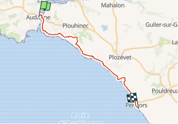
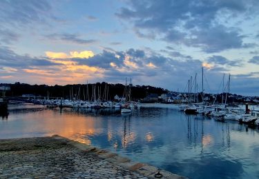
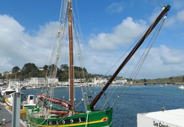
Tocht Fietstoerisme van 17,8 km beschikbaar op Bretagne, Finistère, Audierne. Deze tocht wordt voorgesteld door Sarah92130.
Beschrijving
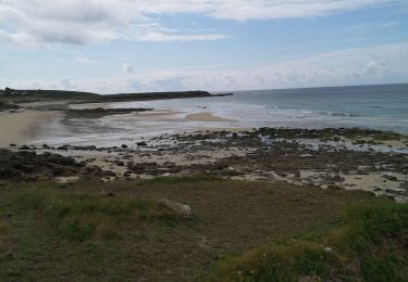
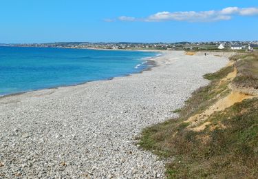
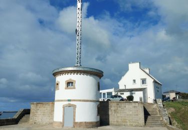
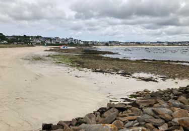
France Vélo Tourisme : Nature sauvage et paysages à couper le souffle sont au programme de cette étape de la véloroute littorale. Depuis Audierne, dans l'estuaire du Goyen, le parcours vélo s'éloigne légèrement de la côte sur les premiers kilomètres avant de s'en rapprocher à nouveau au niveau de la commune de Plouhinec où elle longe le site préhistorique de Menez Drégan, une ancienne grotte marine effondrée. Vous contournez la crique de Pors Poulhan, qui marque la fin du Cap Sizun et le début du Pays Bigouden. L'étape se termine devant la grande plage de Penhors, prisée des surfeurs.
Plaatsbepaling
Opmerkingen
Wandeltochten in de omgeving
![Tocht Stappen Audierne - TREK RCY GR34 2022 J5 Audierne - Du gite à l'embarcadère - Photo](https://media.geolcdn.com/t/375/260/c8ceb096-71a9-4fb0-a364-a75aaaad50cc.jpg&format=jpg&maxdim=2)
![Stappen Stappen](https://static1.geolcdn.com/sitytour/trail-icons/101.png)
Stappen
![](/images/other/stat-length.png)
![](https://static1.geolcdn.com/siteimages/upload/files/16400158638029165_repeat_loop_refresh_sync_direction_icon.png)
![Tocht Stappen Plouhinec - TREK RCY GR34 2022 Audierne sortie du soir - Photo](https://media.geolcdn.com/t/375/260/9c4fe132-0a7a-4a88-96fa-7615fd476d7b.jpg&format=jpg&maxdim=2)
![Stappen Stappen](https://static1.geolcdn.com/sitytour/trail-icons/101.png)
Stappen
![](/images/other/stat-length.png)
![](https://static1.geolcdn.com/siteimages/upload/files/16400158638029165_repeat_loop_refresh_sync_direction_icon.png)
![Tocht Stappen Plouhinec - GR34 Audierne -- Hôtel Breiz Armor (Penhors) - Photo](https://media.geolcdn.com/t/375/260/ff6b2cca-7803-413b-a829-456b8afa9c53.jpg&format=jpg&maxdim=2)
![Stappen Stappen](https://static1.geolcdn.com/sitytour/trail-icons/101.png)
Stappen
![](/images/other/stat-length.png)
![](https://static1.geolcdn.com/siteimages/upload/files/16400158638029165_repeat_loop_refresh_sync_direction_icon.png)
![Tocht Stappen Audierne - Audierne , Pointe du Raz - Photo](https://media.geolcdn.com/t/375/260/b1cf5526-8dea-48df-b3da-3e2322cb85ca.jpg&format=jpg&maxdim=2)
![Stappen Stappen](https://static1.geolcdn.com/sitytour/trail-icons/101.png)
Stappen
![](/images/other/stat-length.png)
![](https://static1.geolcdn.com/siteimages/upload/files/16400158638029165_repeat_loop_refresh_sync_direction_icon.png)
![Tocht Stappen Audierne - Audierne , Pont Croix,Audierne - Photo](https://media.geolcdn.com/t/375/260/7971b1fa-6d8e-431f-b3a1-18ec437e51ea.jpg&format=jpg&maxdim=2)
![Stappen Stappen](https://static1.geolcdn.com/sitytour/trail-icons/101.png)
Stappen
![](/images/other/stat-length.png)
![](https://static1.geolcdn.com/siteimages/upload/files/16400158638029165_repeat_loop_refresh_sync_direction_icon.png)
![Tocht Stappen Goulien - GOULIEN - Photo](https://media.geolcdn.com/t/375/260/7d93338c-6c83-49ac-83d8-859cc48046aa.jpg&format=jpg&maxdim=2)
![Stappen Stappen](https://static1.geolcdn.com/sitytour/trail-icons/101.png)
![Tocht Stappen Audierne - Audierne - Esquibien - Photo](https://media.geolcdn.com/t/375/260/436a95d4-8c2c-418c-a40b-e8085addf12b.jpg&format=jpg&maxdim=2)
![Stappen Stappen](https://static1.geolcdn.com/sitytour/trail-icons/101.png)
Stappen
![](/images/other/stat-length.png)
![](https://static1.geolcdn.com/siteimages/upload/files/16400158638029165_repeat_loop_refresh_sync_direction_icon.png)
![Tocht Stappen Audierne - custrein - Photo](https://media.geolcdn.com/t/375/260/d7985a5c-7fde-4541-afcb-b2d94a714eb9.jpg&format=jpg&maxdim=2)
![Stappen Stappen](https://static1.geolcdn.com/sitytour/trail-icons/101.png)
![Tocht Stappen Plouhinec - PLOUHINEC - Photo](https://media.geolcdn.com/t/375/260/a337ed1a-2a6d-44e3-ba47-36df95ef4161.jpg&format=jpg&maxdim=2)
![Stappen Stappen](https://static1.geolcdn.com/sitytour/trail-icons/101.png)