Tocht Stappen Pagny-sur-Moselle - Pagny-sur-Moselle - Photo
 DanielROLLET
DanielROLLET

Gebruiker

© OpenStreetMap contributors
Lengte
Lengte
16,3 km
Max. hoogte
Max. hoogte
349 m
Positief hoogteverschil
320 m
Km-Effort
Km-Effort  
21 km
Min. hoogte
Min. hoogte
168 m
Negatief hoogteverschil
322 m
Boucle
Boucle
Ja
Datum van aanmaak :
2014-12-10 00:00:00.0
Laatste wijziging :
2014-12-10 00:00:00.0

(0 Bericht)

Stappen
Stappen
4h31
Moeilijkheid : Medium

Scan deze QR-code om de tocht te openen in de SityTrail-applicatie

Gratisgps-wandelapplicatie

Logo SityTrail SityTrail

IGN / Geografische instituten

SityTrail uit de App Store downloaden SityTrail uit Google Play downloaden

Logo SityTrail SityTrail World

De wereld gaat voor u open

SityTrail uit de App Store downloaden SityTrail uit Google Play downloaden SityTrail op Huawei AppGallery downloaden

Over ons

Tocht Stappen van 16,3 km beschikbaar op Grand Est, Meurthe-et-Moselle, Pagny-sur-Moselle. Deze tocht wordt voorgesteld door DanielROLLET.

Beschrijving

8 août 2014. Reco avec Marie
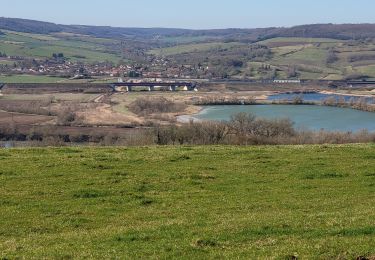
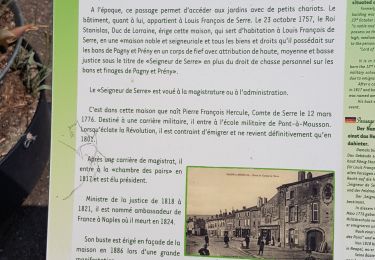
Départ et retour à la gare de Pagny. Montée vers Prény par les rues de Pagny puis par le GR5. A voir chpateau de Prény avec un point d'eau. Puis continuer sur le GR5, passer au-dessus de la LGV (vue sur le racc L12 et les opuvrages) poursuivre sur le GR5 et le quitter pour redescendre sur Vandières (1 bar et 1 auberge) Franchir le passage à niveau puis le canal et cheminer entre gravières et la Moselle. Puis repasser le canal et franchir le passage à niveau de Pagny et arrivée à la gare.
Attention pas d'abri en route.

Hoogteprofiel

POI's

POI Vandières - bar le coyottePoint 1 - Photo
DanielROLLET

Plaatsbepaling

Land:
France
Regio :
Grand Est
Departement/Provincie :
Meurthe-et-Moselle
Gemeente :
Pagny-sur-Moselle
Locatie:
Unknown
Vertrek:(Dec)
Vertrek:(UTM)
282352 ; 5430066 (32U) N.

Wandeltochten in de omgeving

Tocht Te voet Arry - Circuit d'Arry Nord - Photo
Te voet
GUIDE+

Te voet

Gemakkelijk
Arry, Grand Est, Moselle, France
3,4 km | 4,2 km-effort
57min
Neen
Tocht Stappen Pagny-sur-Moselle - Pagny sur Moselle - Photo
Stappen
joelclaudel

Stappen

Heel gemakkelijk
(1)
Pagny-sur-Moselle, Grand Est, Meurthe-et-Moselle, France
18,1 km | 23 km-effort
4h 55min
Ja
Tocht Stappen Arry - Arry - côte Saint Pierre - Vezon - Marieulles - Lorry Mardigny - Arry  - Photo
Stappen
jean-marie.parachini

Stappen

Medium
Arry, Grand Est, Moselle, France
13,9 km | 18 km-effort
24h 12min
Ja
Tocht Stappen Champey-sur-Moselle - CHAMPEY - LA FRONTIERE - Photo
Stappen
jean-marie.parachini

Stappen

Gemakkelijk
Champey-sur-Moselle, Grand Est, Meurthe-et-Moselle, France
10,7 km | 14,5 km-effort
3h 31min
Ja
Tocht Stappen Arnaville - ARNAVILLE - LES AÏTRES MEDIEVAUX - Photo
Stappen
jean-marie.parachini

Stappen

Gemakkelijk
Arnaville, Grand Est, Meurthe-et-Moselle, France
12,7 km | 15,6 km-effort
3h 51min
Ja
Tocht Stappen Arnaville - ARNAVILLE - LA VALLEE DU RUPT DE MAD - Photo
Stappen
jean-marie.parachini

Stappen

Gemakkelijk
Arnaville, Grand Est, Meurthe-et-Moselle, France
9,9 km | 13,5 km-effort
3h 55min
Ja
Tocht Stappen Pagny-sur-Moselle - PAGNY SUR MOSELLE - VAL ET PLATEAU - Photo
Stappen
jean-marie.parachini

Stappen

Medium
Pagny-sur-Moselle, Grand Est, Meurthe-et-Moselle, France
18,1 km | 23 km-effort
6h 46min
Ja
Tocht Stappen Prény - Forêt de Preny dévastée quelle dommage - Photo
Stappen
bitiba

Stappen

Medium
Prény, Grand Est, Meurthe-et-Moselle, France
7,4 km | 9,7 km-effort
1h 14min
Neen
Tocht Stappen Prény - Marche Prény 2017 - Photo
Stappen
pgydbt

Stappen

Medium
(1)
Prény, Grand Est, Meurthe-et-Moselle, France
9,5 km | 13 km-effort
2h 41min
Ja


Sluiten
Mijn abonnementen