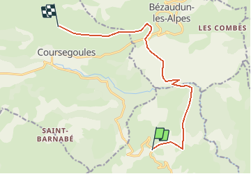
![](/images/other/stat-length.png)
![Tocht Stappen Vence - Rando Riou Cheiron - Photo](https://media.geolcdn.com/t/1900/400/ext.pjpeg?maxdim=2&url=https%3A%2F%2Fstatic1.geolcdn.com%2Fsiteimages%2Fupload%2Ffiles%2F1553511878bg_sport_marche.png)
Rando Riou Cheiron
olivier.loevenbruck
Gebruiker
![Lengte](/images/other/stat-length.png)
![Max. hoogte](https://static1.geolcdn.com/siteimages/upload/files/1508320355ic_sort_altitude_max_24dp.png)
![Positief hoogteverschil](https://static1.geolcdn.com/siteimages/upload/files/1508320355ic_sort_den_pos_24dp.png)
![Km-Effort](/images/other/stat-length.png)
![Min. hoogte](https://static1.geolcdn.com/siteimages/upload/files/1508320355ic_sort_altitude_min_24dp.png)
![Negatief hoogteverschil](https://static1.geolcdn.com/siteimages/upload/files/1508320355ic_sort_den_neg_24dp.png)
![Boucle](https://static1.geolcdn.com/siteimages/upload/files/16400158638029165_repeat_loop_refresh_sync_direction_icon.png)
![Stappen](https://static1.geolcdn.com/sitytour/trail-icons/101.png)
4h48
Moeilijkheid : Medium
![Scan deze QR-code om de tocht te openen in de SityTrail-applicatie](https://capi.geolives.com/qq0zvz2zws4bq2lad0pu/sitytour/trails/330421/qr.png?size=200)
Gratisgps-wandelapplicatie
Over ons
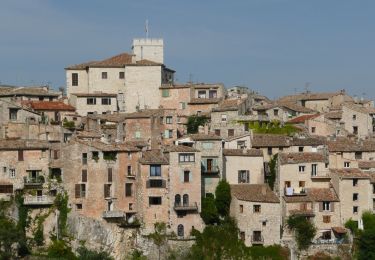
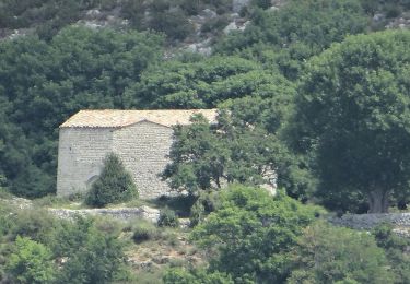
Tocht Stappen van 12 km beschikbaar op Provence-Alpes-Côte d'Azur, Alpes-Maritimes, Vence. Deze tocht wordt voorgesteld door olivier.loevenbruck.
Beschrijving
Départ Parking Plan des Noves
(on pose une voiture au col de Vence, au cas où)
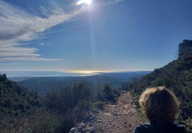
Pause déjeuner dans les vasques naturelles du Riou
Sieste ^^
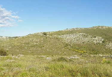
Bivouac dans les dollines sur la crête du Cheiron
Plusieurs options pour le chemin retour, à discuter plus tard.
Plaatsbepaling
Opmerkingen
Wandeltochten in de omgeving
![Tocht Stappen Saint-Jeannet - Baou de Saint-Jeannet - Photo](https://media.geolcdn.com/t/375/260/d4c22365-bd73-4ba1-a46d-47812961244f.jpg&format=jpg&maxdim=2)
![Stappen Stappen](https://static1.geolcdn.com/sitytour/trail-icons/101.png)
Stappen
![](/images/other/stat-length.png)
![](https://static1.geolcdn.com/siteimages/upload/files/16400158638029165_repeat_loop_refresh_sync_direction_icon.png)
![Tocht Stappen Tourrettes-sur-Loup - Le Puy de Naouri 1024 m, depuis Tourrettes-sur-Loup - Photo](https://media.geolcdn.com/t/375/260/ext.jpg?maxdim=2&url=https%3A%2F%2Fservices.sitytrail.com%2FGeolivesWS%2FDownloadMedia.ashx%3FTrailID%3D214858%26Media%3D15396_1.jpg)
![Stappen Stappen](https://static1.geolcdn.com/sitytour/trail-icons/101.png)
Stappen
![](/images/other/stat-length.png)
![](https://static1.geolcdn.com/siteimages/upload/files/16400158638029165_repeat_loop_refresh_sync_direction_icon.png)
![Tocht Stappen Tourrettes-sur-Loup - Tourettes-sur loup Pic Courmettes Puys Tourettes et Naouri Trace réélle - Photo](https://media.geolcdn.com/t/375/260/f748dbe0-f767-4ec6-adb2-ccba5818c44e.jpg&format=jpg&maxdim=2)
![Stappen Stappen](https://static1.geolcdn.com/sitytour/trail-icons/101.png)
Stappen
![](/images/other/stat-length.png)
![](https://static1.geolcdn.com/siteimages/upload/files/16400158638029165_repeat_loop_refresh_sync_direction_icon.png)
![Tocht Te voet Vence - Circuit des Blaquières - Photo](https://media.geolcdn.com/t/375/260/46014005-cf89-423b-a650-f449be44d3f6.jpeg&format=jpg&maxdim=2)
![Te voet Te voet](https://static1.geolcdn.com/sitytour/trail-icons/100.png)
Te voet
![](/images/other/stat-length.png)
![](https://static1.geolcdn.com/siteimages/upload/files/16400158638029165_repeat_loop_refresh_sync_direction_icon.png)
![Tocht Te voet Tourrettes-sur-Loup - Circuit de Pié Martin - Photo](https://media.geolcdn.com/t/375/260/6e40e7c0-6b09-4a1a-a532-91e02b70ea94.jpeg&format=jpg&maxdim=2)
![Te voet Te voet](https://static1.geolcdn.com/sitytour/trail-icons/100.png)
Te voet
![](/images/other/stat-length.png)
![](https://static1.geolcdn.com/siteimages/upload/files/16400158638029165_repeat_loop_refresh_sync_direction_icon.png)
![Tocht Te voet Coursegoules - Circuit du Viériou - Photo](https://media.geolcdn.com/t/375/260/033e2b9d-7778-4f86-857e-14601d59043a.jpeg&format=jpg&maxdim=2)
![Te voet Te voet](https://static1.geolcdn.com/sitytour/trail-icons/100.png)
Te voet
![](/images/other/stat-length.png)
![](https://static1.geolcdn.com/siteimages/upload/files/16400158638029165_repeat_loop_refresh_sync_direction_icon.png)
![Tocht Te voet Vence - Circuit du Malvan - Photo](https://media.geolcdn.com/t/375/260/a11b075b-d314-4d7d-9ea3-2c9f013025ba.jpeg&format=jpg&maxdim=2)
![Te voet Te voet](https://static1.geolcdn.com/sitytour/trail-icons/100.png)
Te voet
![](/images/other/stat-length.png)
![](https://static1.geolcdn.com/siteimages/upload/files/16400158638029165_repeat_loop_refresh_sync_direction_icon.png)
![Tocht Te voet Vence - Plan des Noves - Photo](https://media.geolcdn.com/t/375/260/5bdbad17-ece4-4950-8e82-290491f5430d.jpeg&format=jpg&maxdim=2)
![Te voet Te voet](https://static1.geolcdn.com/sitytour/trail-icons/100.png)
Te voet
![](/images/other/stat-length.png)
![](https://static1.geolcdn.com/siteimages/upload/files/16400158638029165_repeat_loop_refresh_sync_direction_icon.png)
![Tocht Te voet Tourrettes-sur-Loup - Puy de Naouri - Photo](https://media.geolcdn.com/t/375/260/a11b075b-d314-4d7d-9ea3-2c9f013025ba.jpeg&format=jpg&maxdim=2)
![Te voet Te voet](https://static1.geolcdn.com/sitytour/trail-icons/100.png)
Te voet
![](/images/other/stat-length.png)
![](https://static1.geolcdn.com/siteimages/upload/files/16400158638029165_repeat_loop_refresh_sync_direction_icon.png)