![](/images/other/stat-length.png)
![Tocht Stappen Saint-Hubert - SityTrail - St Hubert - La Borne - Photo](https://media.geolcdn.com/t/1900/400/ext.pjpeg?maxdim=2&url=https%3A%2F%2Fstatic1.geolcdn.com%2Fsiteimages%2Fupload%2Ffiles%2F1553511878bg_sport_marche.png)
SityTrail - St Hubert - La Borne
nico_be
Gebruiker
![Lengte](/images/other/stat-length.png)
Lengte
13,5 km
![Max. hoogte](https://static1.geolcdn.com/siteimages/upload/files/1508320355ic_sort_altitude_max_24dp.png)
Max. hoogte
591 m
![Positief hoogteverschil](https://static1.geolcdn.com/siteimages/upload/files/1508320355ic_sort_den_pos_24dp.png)
Positief hoogteverschil
293 m
![Km-Effort](/images/other/stat-length.png)
Km-Effort
17,4 km
![Min. hoogte](https://static1.geolcdn.com/siteimages/upload/files/1508320355ic_sort_altitude_min_24dp.png)
Min. hoogte
421 m
![Negatief hoogteverschil](https://static1.geolcdn.com/siteimages/upload/files/1508320355ic_sort_den_neg_24dp.png)
Negatief hoogteverschil
288 m
![Boucle](https://static1.geolcdn.com/siteimages/upload/files/16400158638029165_repeat_loop_refresh_sync_direction_icon.png)
Boucle
Ja
Datum van aanmaak :
2022-06-21 12:56:14.45
Laatste wijziging :
2022-06-21 13:03:42.572
![Stappen](https://static1.geolcdn.com/sitytour/trail-icons/101.png)
3h57
Moeilijkheid : Moeilijk
![Scan deze QR-code om de tocht te openen in de SityTrail-applicatie](https://capi.geolives.com/qq0zvz2zws4bq2lad0pu/sitytour/trails/3289938/qr.png?size=200)
Gratisgps-wandelapplicatie
Over ons
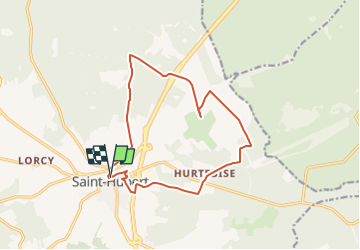
Tocht Stappen van 13,5 km beschikbaar op Wallonië, Luxemburg, Saint-Hubert. Deze tocht wordt voorgesteld door nico_be.
Beschrijving
Tracé modifié de la promenade initiale de l'office du tourisme afin d'éviter de passer par le zoning et d'éviter la nationale..
Plaatsbepaling
Land:
Belgium
Regio :
Wallonië
Departement/Provincie :
Luxemburg
Gemeente :
Saint-Hubert
Locatie:
Unknown
Vertrek:(Dec)
Vertrek:(UTM)
670040 ; 5544232 (31U) N.
Opmerkingen
Wandeltochten in de omgeving
![Tocht Stappen Saint-Hubert - Saint-Hubert - La Borne (SH07) - Photo](https://media.geolcdn.com/t/375/260/ext.jpg?maxdim=2&url=https%3A%2F%2Fservices.sitytrail.com%2FGeolivesWS%2FDownloadMedia.ashx%3FTrailID%3D334588%26Media%3D91d6a6a6-ea9a-437b-8504-44eab9898f8f.JPG)
![Stappen Stappen](https://static1.geolcdn.com/sitytour/trail-icons/101.png)
Saint-Hubert - La Borne (SH07)
Stappen
Moeilijk
(8)
Saint-Hubert,
Wallonië,
Luxemburg,
Belgium
![](/images/other/stat-length.png)
13,9 km | 17,6 km-effort
3h 47min
![](https://static1.geolcdn.com/siteimages/upload/files/16400158638029165_repeat_loop_refresh_sync_direction_icon.png)
Ja
![Tocht Stappen Saint-Hubert - Hatrival - Banalbois (SH13) - Photo](https://media.geolcdn.com/t/375/260/ext.jpg?maxdim=2&url=https%3A%2F%2Fservices.sitytrail.com%2FGeolivesWS%2FDownloadMedia.ashx%3FTrailID%3D334467%26Media%3D16828998-416a-43a0-960f-95ce479e5d6d.jpg)
![Stappen Stappen](https://static1.geolcdn.com/sitytour/trail-icons/101.png)
Hatrival - Banalbois (SH13)
Stappen
Medium
(6)
Saint-Hubert,
Wallonië,
Luxemburg,
Belgium
![](/images/other/stat-length.png)
7,5 km | 9,5 km-effort
2h 2min
![](https://static1.geolcdn.com/siteimages/upload/files/16400158638029165_repeat_loop_refresh_sync_direction_icon.png)
Ja
![Tocht Stappen Saint-Hubert - RB-Lu-26_Saint-Hubert_via-racc-1-et-2 - Photo](https://media.geolcdn.com/t/375/260/ext.jpg?maxdim=2&url=https%3A%2F%2Fmedia.geolcdn.com%2Ff%2F3adeabe9-024e-4cb2-b47c-99bcb2679a1f.JPG)
![Stappen Stappen](https://static1.geolcdn.com/sitytour/trail-icons/101.png)
RB-Lu-26_Saint-Hubert_via-racc-1-et-2
Stappen
Heel gemakkelijk
(6)
Saint-Hubert,
Wallonië,
Luxemburg,
Belgium
![](/images/other/stat-length.png)
14,6 km | 19,5 km-effort
4h 15min
![](https://static1.geolcdn.com/siteimages/upload/files/16400158638029165_repeat_loop_refresh_sync_direction_icon.png)
Ja
![Tocht Stappen Saint-Hubert - Vesqueville - Vesqueville (SH09) - Photo](https://media.geolcdn.com/t/375/260/ext.jpg?maxdim=2&url=https%3A%2F%2Fservices.sitytrail.com%2FGeolivesWS%2FDownloadMedia.ashx%3FTrailID%3D334610%26Media%3D79c980a9-bd48-4f1e-9150-6b805f1400ff.jpg)
![Stappen Stappen](https://static1.geolcdn.com/sitytour/trail-icons/101.png)
Vesqueville - Vesqueville (SH09)
Stappen
Moeilijk
(6)
Saint-Hubert,
Wallonië,
Luxemburg,
Belgium
![](/images/other/stat-length.png)
15,6 km | 19,4 km-effort
4h 9min
![](https://static1.geolcdn.com/siteimages/upload/files/16400158638029165_repeat_loop_refresh_sync_direction_icon.png)
Ja
![Tocht Stappen Saint-Hubert - Saint-Hubert - Les Abanages (SH03) - Photo](https://media.geolcdn.com/t/375/260/ext.jpg?maxdim=2&url=https%3A%2F%2Fservices.sitytrail.com%2FGeolivesWS%2FDownloadMedia.ashx%3FTrailID%3D334550%26Media%3D8af2823f-59d0-452e-b66b-4a477ca4facd.JPG)
![Stappen Stappen](https://static1.geolcdn.com/sitytour/trail-icons/101.png)
Saint-Hubert - Les Abanages (SH03)
Stappen
Moeilijk
(11)
Saint-Hubert,
Wallonië,
Luxemburg,
Belgium
![](/images/other/stat-length.png)
9,8 km | 13,1 km-effort
2h 49min
![](https://static1.geolcdn.com/siteimages/upload/files/16400158638029165_repeat_loop_refresh_sync_direction_icon.png)
Ja
![Tocht Stappen Saint-Hubert - Saint-Hubert - Les Gottes (SH02) - Photo](https://media.geolcdn.com/t/375/260/ext.jpg?maxdim=2&url=https%3A%2F%2Fservices.sitytrail.com%2FGeolivesWS%2FDownloadMedia.ashx%3FTrailID%3D334532%26Media%3D483dd5de-c3cc-4d3d-acb4-87fceee0aac0.JPG)
![Stappen Stappen](https://static1.geolcdn.com/sitytour/trail-icons/101.png)
Saint-Hubert - Les Gottes (SH02)
Stappen
Medium
(14)
Saint-Hubert,
Wallonië,
Luxemburg,
Belgium
![](/images/other/stat-length.png)
6,9 km | 8,6 km-effort
1h 52min
![](https://static1.geolcdn.com/siteimages/upload/files/16400158638029165_repeat_loop_refresh_sync_direction_icon.png)
Ja
![Tocht Stappen Saint-Hubert - RB-Lu-26_Saint-Hubert - Photo](https://media.geolcdn.com/t/375/260/ext.jpg?maxdim=2&url=https%3A%2F%2Fmedia.geolcdn.com%2Ff%2Fcab71100-c9f1-4a92-8f85-5fbf4b5f6f75.JPG)
![Stappen Stappen](https://static1.geolcdn.com/sitytour/trail-icons/101.png)
RB-Lu-26_Saint-Hubert
Stappen
Heel gemakkelijk
(4)
Saint-Hubert,
Wallonië,
Luxemburg,
Belgium
![](/images/other/stat-length.png)
25 km | 33 km-effort
7h 2min
![](https://static1.geolcdn.com/siteimages/upload/files/16400158638029165_repeat_loop_refresh_sync_direction_icon.png)
Ja
![Tocht Stappen Saint-Hubert - RB-Lu-26_Saint-Hubert_via-racc-2 - Photo](https://media.geolcdn.com/t/375/260/ext.jpg?maxdim=2&url=https%3A%2F%2Fmedia.geolcdn.com%2Ff%2F10064532-ed32-42ee-b744-4a6372b67792.JPG)
![Stappen Stappen](https://static1.geolcdn.com/sitytour/trail-icons/101.png)
RB-Lu-26_Saint-Hubert_via-racc-2
Stappen
Heel gemakkelijk
(2)
Saint-Hubert,
Wallonië,
Luxemburg,
Belgium
![](/images/other/stat-length.png)
23 km | 30 km-effort
6h 19min
![](https://static1.geolcdn.com/siteimages/upload/files/16400158638029165_repeat_loop_refresh_sync_direction_icon.png)
Ja
![Tocht Stappen Saint-Hubert - Saint-Hubert - Circuit Natura 2000, des sites qui valent le détour - Lx16 - Photo](https://media.geolcdn.com/t/375/260/ext.jpg?maxdim=2&url=https%3A%2F%2Fservices.sitytrail.com%2FGeolivesWS%2FDownloadMedia.ashx%3FTrailID%3D192420%26Media%3D160ebb9e-bb02-48c8-9060-fbc3e077c7c3.JPG)
![Stappen Stappen](https://static1.geolcdn.com/sitytour/trail-icons/101.png)
Saint-Hubert - Circuit Natura 2000, des sites qui valent le détour - Lx16
Stappen
Medium
(3)
Saint-Hubert,
Wallonië,
Luxemburg,
Belgium
![](/images/other/stat-length.png)
9,8 km | 13 km-effort
1h 11min
![](https://static1.geolcdn.com/siteimages/upload/files/16400158638029165_repeat_loop_refresh_sync_direction_icon.png)
Ja