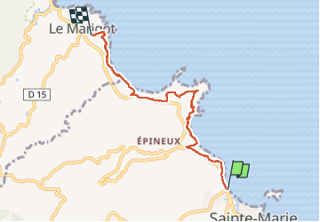
![](/images/other/stat-length.png)
![Tocht Stappen Sainte-Marie - Ste Marie vers Marigot - Photo](https://media.geolcdn.com/t/1900/400/2b09671f-5a24-4799-aa61-8da40f2e65c1.jpg&format=pjpeg&maxdim=2)
Ste Marie vers Marigot
GabyG
Gebruiker GUIDE
![Lengte](/images/other/stat-length.png)
![Max. hoogte](https://static1.geolcdn.com/siteimages/upload/files/1508320355ic_sort_altitude_max_24dp.png)
![Positief hoogteverschil](https://static1.geolcdn.com/siteimages/upload/files/1508320355ic_sort_den_pos_24dp.png)
![Km-Effort](/images/other/stat-length.png)
![Min. hoogte](https://static1.geolcdn.com/siteimages/upload/files/1508320355ic_sort_altitude_min_24dp.png)
![Negatief hoogteverschil](https://static1.geolcdn.com/siteimages/upload/files/1508320355ic_sort_den_neg_24dp.png)
![Boucle](https://static1.geolcdn.com/siteimages/upload/files/16400158638029165_repeat_loop_refresh_sync_direction_icon.png)
![Stappen](https://static1.geolcdn.com/sitytour/trail-icons/101.png)
3h15
Moeilijkheid : Medium
![Scan deze QR-code om de tocht te openen in de SityTrail-applicatie](https://capi.geolives.com/qq0zvz2zws4bq2lad0pu/sitytour/trails/3287982/qr.png?size=200)
Gratisgps-wandelapplicatie
Over ons
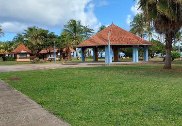
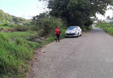
Tocht Stappen van 7,6 km beschikbaar op Martinique, Onbekend, Sainte-Marie. Deze tocht wordt voorgesteld door GabyG.
Beschrijving
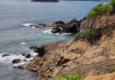
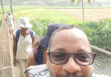
Tronçon du GR, de Ste Marie vers le Marigot. Randonnée très paisible au début, qui donne l'impression d'une balade en forêt ! Puis atteint son niveau de difficulté tout en vous offrant de beaux points de vue. Belle randonnée sportive à faire en groupe en prévoyant des moments de repos... prévoir des voitures sur la fin, car c'est un circuit ouvert.
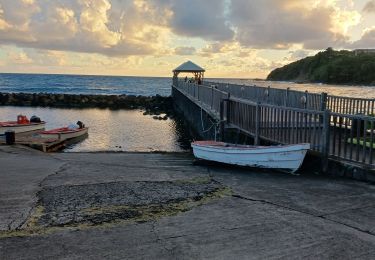
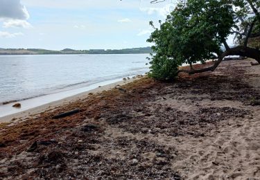
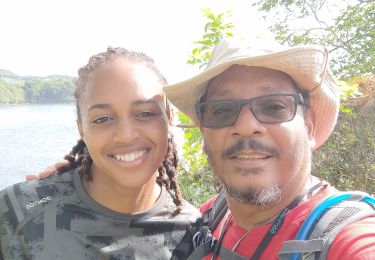
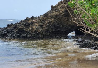
Plaatsbepaling
Opmerkingen
Wandeltochten in de omgeving
![Tocht Stappen Le Marigot - Boucle Le Mariigot - Charpentier - SLNA. - Photo](https://media.geolcdn.com/t/375/260/b4acbe47-87c5-4bec-aa83-83441bd5fc60.jpg&format=jpg&maxdim=2)
![Stappen Stappen](https://static1.geolcdn.com/sitytour/trail-icons/101.png)
Stappen
![](/images/other/stat-length.png)
![](https://static1.geolcdn.com/siteimages/upload/files/16400158638029165_repeat_loop_refresh_sync_direction_icon.png)
![Tocht Stappen La Trinité - Cosmy circuit seniors 1 - Photo](https://media.geolcdn.com/t/375/260/d178e028-b847-4bb5-84e1-5a70741f5418.jpg&format=jpg&maxdim=2)
![Stappen Stappen](https://static1.geolcdn.com/sitytour/trail-icons/101.png)
Stappen
![](/images/other/stat-length.png)
![](https://static1.geolcdn.com/siteimages/upload/files/16400158638029165_repeat_loop_refresh_sync_direction_icon.png)
![Tocht Stappen Sainte-Marie - Azérot morne bataillon, pointe Martineau, pointe Lahoussaye et Cité étoile. - Photo](https://media.geolcdn.com/t/375/260/835e2d34-f364-4740-a423-bd63a399b993.jpg&format=jpg&maxdim=2)
![Stappen Stappen](https://static1.geolcdn.com/sitytour/trail-icons/101.png)
Stappen
![](/images/other/stat-length.png)
![](https://static1.geolcdn.com/siteimages/upload/files/16400158638029165_repeat_loop_refresh_sync_direction_icon.png)
![Tocht Stappen Sainte-Marie - Anse Azerot vers pointe Lahoussaye - Photo](https://media.geolcdn.com/t/375/260/a58e4989-fde6-4c10-a5d8-e0b7a822737a.jpg&format=jpg&maxdim=2)
![Stappen Stappen](https://static1.geolcdn.com/sitytour/trail-icons/101.png)
Stappen
![](/images/other/stat-length.png)
![](https://static1.geolcdn.com/siteimages/upload/files/16400158638029165_repeat_loop_refresh_sync_direction_icon.png)
![Tocht Stappen Sainte-Marie - Anse Azérot, morne Bataillon et la Pte Martineau. - Photo](https://media.geolcdn.com/t/375/260/7557c863-6e2e-420b-b523-9232a44b4d8e.jpg&format=jpg&maxdim=2)
![Stappen Stappen](https://static1.geolcdn.com/sitytour/trail-icons/101.png)
Stappen
![](/images/other/stat-length.png)
![](https://static1.geolcdn.com/siteimages/upload/files/16400158638029165_repeat_loop_refresh_sync_direction_icon.png)
![Tocht Stappen Le Marigot - Marigot vers le Lorrain - Photo](https://media.geolcdn.com/t/375/260/6a93875e-8aed-454e-924f-79cf5824df2f.jpg&format=jpg&maxdim=2)
![Stappen Stappen](https://static1.geolcdn.com/sitytour/trail-icons/101.png)
Stappen
![](/images/other/stat-length.png)
![](https://static1.geolcdn.com/siteimages/upload/files/16400158638029165_repeat_loop_refresh_sync_direction_icon.png)
![Tocht Stappen Sainte-Marie - Boucle Forêt de Reculée - Photo](https://media.geolcdn.com/t/375/260/75dddc71-d3e1-4bc1-9d56-791d6ffe8ae4.jpg&format=jpg&maxdim=2)
![Stappen Stappen](https://static1.geolcdn.com/sitytour/trail-icons/101.png)
Stappen
![](/images/other/stat-length.png)
![](https://static1.geolcdn.com/siteimages/upload/files/16400158638029165_repeat_loop_refresh_sync_direction_icon.png)
![Tocht Stappen Sainte-Marie - Boucle Place Clarissa JP via Musée de la Banane - Photo](https://media.geolcdn.com/t/375/260/bc80034b-5433-411a-ab7b-87d02096c2c6.jpg&format=jpg&maxdim=2)
![Stappen Stappen](https://static1.geolcdn.com/sitytour/trail-icons/101.png)
Stappen
![](/images/other/stat-length.png)
![](https://static1.geolcdn.com/siteimages/upload/files/16400158638029165_repeat_loop_refresh_sync_direction_icon.png)
![Tocht Stappen Le Marigot - Boucle Lagrange via Papin - Le Marigot - Photo](https://media.geolcdn.com/t/375/260/14a228c6-1043-4aef-9d70-357e68ede85a.jpg&format=jpg&maxdim=2)
![Stappen Stappen](https://static1.geolcdn.com/sitytour/trail-icons/101.png)
Stappen
![](/images/other/stat-length.png)
![](https://static1.geolcdn.com/siteimages/upload/files/16400158638029165_repeat_loop_refresh_sync_direction_icon.png)