![](/images/other/stat-length.png)
![Tocht Stappen Caubios-Loos - 2022-06-13_21h45m40_SityTrail - 3181291 - caubios-loosxg4-xboucle--par-le-sanctuaire-de-sainte-quitteriex - Photo](https://media.geolcdn.com/t/1900/400/ext.pjpeg?maxdim=2&url=https%3A%2F%2Fstatic1.geolcdn.com%2Fsiteimages%2Fupload%2Ffiles%2F1553511878bg_sport_marche.png)
2022-06-13_21h45m40_SityTrail - 3181291 - caubios-loosxg4-xboucle--par-le-sanctuaire-de-sainte-quitteriex
mitch1952
Gebruiker
![Lengte](/images/other/stat-length.png)
![Max. hoogte](https://static1.geolcdn.com/siteimages/upload/files/1508320355ic_sort_altitude_max_24dp.png)
![Positief hoogteverschil](https://static1.geolcdn.com/siteimages/upload/files/1508320355ic_sort_den_pos_24dp.png)
![Km-Effort](/images/other/stat-length.png)
![Min. hoogte](https://static1.geolcdn.com/siteimages/upload/files/1508320355ic_sort_altitude_min_24dp.png)
![Negatief hoogteverschil](https://static1.geolcdn.com/siteimages/upload/files/1508320355ic_sort_den_neg_24dp.png)
![Boucle](https://static1.geolcdn.com/siteimages/upload/files/16400158638029165_repeat_loop_refresh_sync_direction_icon.png)
![Stappen](https://static1.geolcdn.com/sitytour/trail-icons/101.png)
3h00
Moeilijkheid : Medium
![Scan deze QR-code om de tocht te openen in de SityTrail-applicatie](https://capi.geolives.com/qq0zvz2zws4bq2lad0pu/sitytour/trails/3281235/qr.png?size=200)
Gratisgps-wandelapplicatie
Over ons
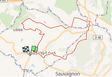
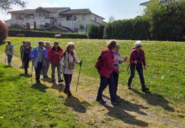
Tocht Stappen van 11 km beschikbaar op Nieuw-Aquitanië, Pyrénées-Atlantiques, Caubios-Loos. Deze tocht wordt voorgesteld door mitch1952.
Beschrijving
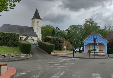
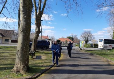
Départ rando de la Maison pour tous vers 9h45/10h00. Grand parking ombragé.
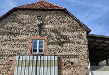
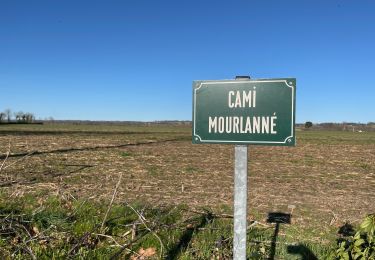
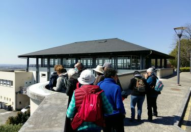
Du bitume les premiers km puis de très jolie chemin ombragé ensuite.
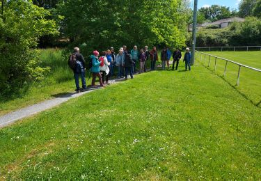
Picnic pris à la Chapelle Ste Quitterie au km 6.5 , très ombragée.
Durée rando (Picnic et pause comprise) = 4 h 30
Plaatsbepaling
Opmerkingen
Wandeltochten in de omgeving
![Tocht Stappen Momas - MOMAS chemin de l aubiosse G4](https://media.geolcdn.com/t/375/260/3e4b4ff7-0a1a-4751-95b9-c17b371f2fcc.jpg&format=jpg&maxdim=2)
![Stappen Stappen](https://static1.geolcdn.com/sitytour/trail-icons/101.png)
Stappen
![](/images/other/stat-length.png)
![](https://static1.geolcdn.com/siteimages/upload/files/16400158638029165_repeat_loop_refresh_sync_direction_icon.png)
![Tocht Noords wandelen Momas - MOMAS Reco chemin de l aubiosse](https://media.geolcdn.com/t/375/260/3ecdef62-d1df-41ae-bc07-42ed5d4fa76d.jpg&format=jpg&maxdim=2)
![Noords wandelen Noords wandelen](https://static1.geolcdn.com/sitytour/trail-icons/102.png)
Noords wandelen
![](/images/other/stat-length.png)
![](https://static1.geolcdn.com/siteimages/upload/files/16400158638029165_repeat_loop_refresh_sync_direction_icon.png)
![Tocht Stappen Uzein - Fait - Photo](https://media.geolcdn.com/t/375/260/107ef946-edb5-448b-81c7-b04150234edf.jpg&format=jpg&maxdim=2)
![Stappen Stappen](https://static1.geolcdn.com/sitytour/trail-icons/101.png)
Stappen
![](/images/other/stat-length.png)
![](https://static1.geolcdn.com/siteimages/upload/files/16400158638029165_repeat_loop_refresh_sync_direction_icon.png)
![Tocht Stappen Uzein - RS Uzein](https://media.geolcdn.com/t/375/260/da0305da-d09c-49d9-8b52-f3d770fc1b4d.jpg&format=jpg&maxdim=2)
![Stappen Stappen](https://static1.geolcdn.com/sitytour/trail-icons/101.png)
Stappen
![](/images/other/stat-length.png)
![](https://static1.geolcdn.com/siteimages/upload/files/16400158638029165_repeat_loop_refresh_sync_direction_icon.png)
![Tocht Stappen Serres-Castet - SERRES CASTET RS autour du lac - Photo](https://media.geolcdn.com/t/375/260/0287ff47-814b-4979-9fae-639cc528956d.jpg&format=jpg&maxdim=2)
![Stappen Stappen](https://static1.geolcdn.com/sitytour/trail-icons/101.png)
Stappen
![](/images/other/stat-length.png)
![](https://static1.geolcdn.com/siteimages/upload/files/16400158638029165_repeat_loop_refresh_sync_direction_icon.png)
![Tocht Stappen Momas - G4 Momas - Photo](https://media.geolcdn.com/t/375/260/5ca2fca5-7d5c-4c16-ad38-3d61058d7252.jpg&format=jpg&maxdim=2)
![Stappen Stappen](https://static1.geolcdn.com/sitytour/trail-icons/101.png)
Stappen
![](/images/other/stat-length.png)
![](https://static1.geolcdn.com/siteimages/upload/files/16400158638029165_repeat_loop_refresh_sync_direction_icon.png)
![Tocht Stappen Serres-Castet - Rs serrés castet 2024 - Photo](https://media.geolcdn.com/t/375/260/b1fe0341-67b4-4330-a058-ff164ab8dc9d.jpg&format=jpg&maxdim=2)
![Stappen Stappen](https://static1.geolcdn.com/sitytour/trail-icons/101.png)
Stappen
![](/images/other/stat-length.png)
![](https://static1.geolcdn.com/siteimages/upload/files/16400158638029165_repeat_loop_refresh_sync_direction_icon.png)
![Tocht Stappen Serres-Castet - serrescastet RSFait - Photo](https://media.geolcdn.com/t/375/260/13292052-8a0a-4f58-af18-0d36afaca4d0.jpg&format=jpg&maxdim=2)
![Stappen Stappen](https://static1.geolcdn.com/sitytour/trail-icons/101.png)
Stappen
![](/images/other/stat-length.png)
![](https://static1.geolcdn.com/siteimages/upload/files/16400158638029165_repeat_loop_refresh_sync_direction_icon.png)
![Tocht Stappen Serres-Castet - serres castet RS le lac 2023 - Photo](https://media.geolcdn.com/t/375/260/ext.jpg?maxdim=2&url=https%3A%2F%2Fstatic1.geolcdn.com%2Fsiteimages%2Fupload%2Ffiles%2F1553511878bg_sport_marche.png)
![Stappen Stappen](https://static1.geolcdn.com/sitytour/trail-icons/101.png)
Stappen
![](/images/other/stat-length.png)
![](https://static1.geolcdn.com/siteimages/upload/files/16400158638029165_repeat_loop_refresh_sync_direction_icon.png)