![](/images/other/stat-length.png)
![Tocht Stappen Chenailler-Mascheix - Gorges de la Ménoire - Photo](https://media.geolcdn.com/t/1900/400/ext.pjpeg?maxdim=2&url=https%3A%2F%2Fservices.sitytrail.com%2FGeolivesWS%2FDownloadMedia.ashx%3FTrailID%3D326293%26Media%3Dfix__20140618182131.jpg)
Gorges de la Ménoire
sdroneau
Gebruiker
![Lengte](/images/other/stat-length.png)
Lengte
9,3 km
![Max. hoogte](https://static1.geolcdn.com/siteimages/upload/files/1508320355ic_sort_altitude_max_24dp.png)
Max. hoogte
521 m
![Positief hoogteverschil](https://static1.geolcdn.com/siteimages/upload/files/1508320355ic_sort_den_pos_24dp.png)
Positief hoogteverschil
290 m
![Km-Effort](/images/other/stat-length.png)
Km-Effort
13,1 km
![Min. hoogte](https://static1.geolcdn.com/siteimages/upload/files/1508320355ic_sort_altitude_min_24dp.png)
Min. hoogte
321 m
![Negatief hoogteverschil](https://static1.geolcdn.com/siteimages/upload/files/1508320355ic_sort_den_neg_24dp.png)
Negatief hoogteverschil
286 m
![Boucle](https://static1.geolcdn.com/siteimages/upload/files/16400158638029165_repeat_loop_refresh_sync_direction_icon.png)
Boucle
Ja
Datum van aanmaak :
2014-12-10 00:00:00.0
Laatste wijziging :
2014-12-10 00:00:00.0
![Stappen](https://static1.geolcdn.com/sitytour/trail-icons/101.png)
2h45
Moeilijkheid : Medium
![Scan deze QR-code om de tocht te openen in de SityTrail-applicatie](https://capi.geolives.com/qq0zvz2zws4bq2lad0pu/sitytour/trails/326293/qr.png?size=200)
Gratisgps-wandelapplicatie
Over ons
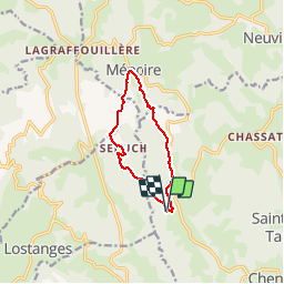
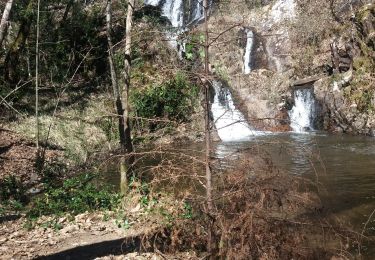
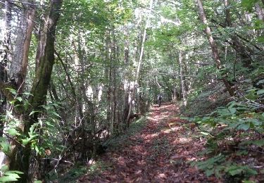
Tocht Stappen van 9,3 km beschikbaar op Nieuw-Aquitanië, Corrèze, Chenailler-Mascheix. Deze tocht wordt voorgesteld door sdroneau.
Beschrijving
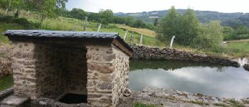
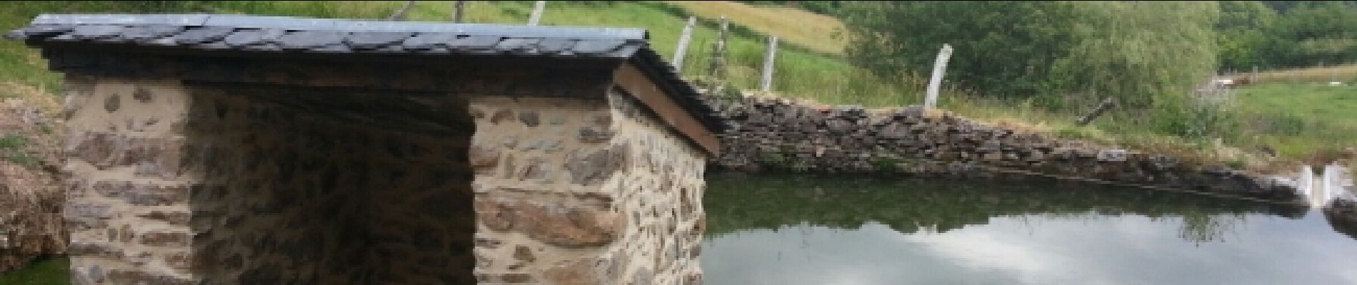
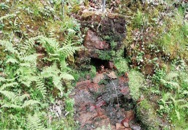
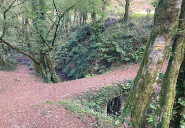
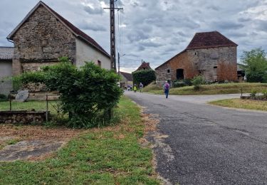
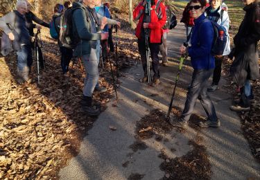
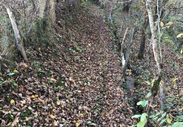
Balade au départ de l’église de Mascheix. Après la descente vers la Ménoire, une montée assez difficile d'1.5 km vous attend. Le reste du parcours est assez facile.
Plaatsbepaling
Land:
France
Regio :
Nieuw-Aquitanië
Departement/Provincie :
Corrèze
Gemeente :
Chenailler-Mascheix
Locatie:
Unknown
Vertrek:(Dec)
Vertrek:(UTM)
405863 ; 4991362 (31T) N.
Opmerkingen
Wandeltochten in de omgeving
![Tocht Stappen Beaulieu-sur-Dordogne - Fred BC Brivezac - Photo](https://media.geolcdn.com/t/375/260/9c977315-9e18-4282-9a28-77b8b1aa27d9.jpg&format=jpg&maxdim=2)
![Stappen Stappen](https://static1.geolcdn.com/sitytour/trail-icons/101.png)
Fred BC Brivezac
Stappen
Moeilijk
Beaulieu-sur-Dordogne,
Nieuw-Aquitanië,
Corrèze,
France
![](/images/other/stat-length.png)
9,7 km | 14,8 km-effort
3h 47min
![](https://static1.geolcdn.com/siteimages/upload/files/16400158638029165_repeat_loop_refresh_sync_direction_icon.png)
Ja
![Tocht Mountainbike Lostanges - SityTrail - 2034969 - monts-et-vallees-de-lostanges-variante - Photo](https://media.geolcdn.com/t/375/260/ext.jpg?maxdim=2&url=https%3A%2F%2Fstatic1.geolcdn.com%2Fsiteimages%2Fupload%2Ffiles%2F1524743154velo.jpg)
![Mountainbike Mountainbike](https://static1.geolcdn.com/sitytour/trail-icons/202.png)
SityTrail - 2034969 - monts-et-vallees-de-lostanges-variante
Mountainbike
Moeilijk
(1)
Lostanges,
Nieuw-Aquitanië,
Corrèze,
France
![](/images/other/stat-length.png)
23 km | 34 km-effort
2h 22min
![](https://static1.geolcdn.com/siteimages/upload/files/16400158638029165_repeat_loop_refresh_sync_direction_icon.png)
Ja
![Tocht Mountainbike Chenailler-Mascheix - Roche de Vic depuis Mascheix - Photo](https://media.geolcdn.com/t/375/260/ext.jpg?maxdim=2&url=https%3A%2F%2Fstatic1.geolcdn.com%2Fsiteimages%2Fupload%2Ffiles%2F1524743154velo.jpg)
![Mountainbike Mountainbike](https://static1.geolcdn.com/sitytour/trail-icons/202.png)
Roche de Vic depuis Mascheix
Mountainbike
Gemakkelijk
(1)
Chenailler-Mascheix,
Nieuw-Aquitanië,
Corrèze,
France
![](/images/other/stat-length.png)
13,2 km | 17,5 km-effort
1h 8min
![](https://static1.geolcdn.com/siteimages/upload/files/16400158638029165_repeat_loop_refresh_sync_direction_icon.png)
Ja
![Tocht Stappen Lostanges - Lostanges - Photo](https://media.geolcdn.com/t/375/260/5b875a5f-59f0-429c-b2e1-4616cf8385da.jpg&format=jpg&maxdim=2)
![Stappen Stappen](https://static1.geolcdn.com/sitytour/trail-icons/101.png)
Lostanges
Stappen
Medium
Lostanges,
Nieuw-Aquitanië,
Corrèze,
France
![](/images/other/stat-length.png)
13,9 km | 21 km-effort
4h 8min
![](https://static1.geolcdn.com/siteimages/upload/files/16400158638029165_repeat_loop_refresh_sync_direction_icon.png)
Ja
![Tocht Stappen Puy-d'Arnac - puy d'arnac - Photo](https://media.geolcdn.com/t/375/260/5f40bf7e-14f9-4940-8b51-cac111d153b6.jpg&format=jpg&maxdim=2)
![Stappen Stappen](https://static1.geolcdn.com/sitytour/trail-icons/101.png)
puy d'arnac
Stappen
Moeilijk
Puy-d'Arnac,
Nieuw-Aquitanië,
Corrèze,
France
![](/images/other/stat-length.png)
10,3 km | 14,1 km-effort
3h 12min
![](https://static1.geolcdn.com/siteimages/upload/files/16400158638029165_repeat_loop_refresh_sync_direction_icon.png)
Neen
![Tocht Stappen Ménoire - menoir 2 - Photo](https://media.geolcdn.com/t/375/260/3eec4932-8ad6-49f8-89d5-a2c1696554cb.jpg&format=jpg&maxdim=2)
![Stappen Stappen](https://static1.geolcdn.com/sitytour/trail-icons/101.png)
menoir 2
Stappen
Moeilijk
Ménoire,
Nieuw-Aquitanië,
Corrèze,
France
![](/images/other/stat-length.png)
11,3 km | 14,8 km-effort
3h 18min
![](https://static1.geolcdn.com/siteimages/upload/files/16400158638029165_repeat_loop_refresh_sync_direction_icon.png)
Ja
![Tocht Stappen Chenailler-Mascheix - Circuit Des Serpentines à Chenailler-Mascheix - Photo](https://media.geolcdn.com/t/375/260/16e86fa7-9726-47dd-8406-401ff5d08439.jpg&format=jpg&maxdim=2)
![Stappen Stappen](https://static1.geolcdn.com/sitytour/trail-icons/101.png)
Circuit Des Serpentines à Chenailler-Mascheix
Stappen
Medium
Chenailler-Mascheix,
Nieuw-Aquitanië,
Corrèze,
France
![](/images/other/stat-length.png)
10,2 km | 14,6 km-effort
2h 6min
![](https://static1.geolcdn.com/siteimages/upload/files/16400158638029165_repeat_loop_refresh_sync_direction_icon.png)
Ja
![Tocht Stappen Chenailler-Mascheix - gorges de mémoire et cascade gourlastine - Photo](https://media.geolcdn.com/t/375/260/a8056284-18ef-43b8-8329-b3cae7264059.jpg&format=jpg&maxdim=2)
![Stappen Stappen](https://static1.geolcdn.com/sitytour/trail-icons/101.png)
gorges de mémoire et cascade gourlastine
Stappen
Moeilijk
Chenailler-Mascheix,
Nieuw-Aquitanië,
Corrèze,
France
![](/images/other/stat-length.png)
10,6 km | 15 km-effort
4h 0min
![](https://static1.geolcdn.com/siteimages/upload/files/16400158638029165_repeat_loop_refresh_sync_direction_icon.png)
Neen
![Tocht Mountainbike Lostanges - Monts et vallées de Lostanges2 - Photo](https://media.geolcdn.com/t/375/260/ext.jpg?maxdim=2&url=https%3A%2F%2Fservices.sitytrail.com%2FGeolivesWS%2FDownloadMedia.ashx%3FTrailID%3D1010208%26Media%3Dfix__20131006115732.jpg)
![Mountainbike Mountainbike](https://static1.geolcdn.com/sitytour/trail-icons/202.png)
Monts et vallées de Lostanges2
Mountainbike
Moeilijk
Lostanges,
Nieuw-Aquitanië,
Corrèze,
France
![](/images/other/stat-length.png)
14,1 km | 21 km-effort
4h 0min
![](https://static1.geolcdn.com/siteimages/upload/files/16400158638029165_repeat_loop_refresh_sync_direction_icon.png)
Ja