![](/images/other/stat-length.png)
![Tocht Stappen Saint-Bauzille-de-Montmel - Mai 2022 - Tour du Pic Saint Loup - 7 étapes - Photo](https://media.geolcdn.com/t/1900/400/ext.pjpeg?maxdim=2&url=https%3A%2F%2Fstatic1.geolcdn.com%2Fsiteimages%2Fupload%2Ffiles%2F1553511878bg_sport_marche.png)
Mai 2022 - Tour du Pic Saint Loup - 7 étapes
Aux croisées des GR
Faites confiance au hasard des rencontres
![Lengte](/images/other/stat-length.png)
![Max. hoogte](https://static1.geolcdn.com/siteimages/upload/files/1508320355ic_sort_altitude_max_24dp.png)
![Positief hoogteverschil](https://static1.geolcdn.com/siteimages/upload/files/1508320355ic_sort_den_pos_24dp.png)
![Km-Effort](/images/other/stat-length.png)
![Min. hoogte](https://static1.geolcdn.com/siteimages/upload/files/1508320355ic_sort_altitude_min_24dp.png)
![Negatief hoogteverschil](https://static1.geolcdn.com/siteimages/upload/files/1508320355ic_sort_den_neg_24dp.png)
![Boucle](https://static1.geolcdn.com/siteimages/upload/files/16400158638029165_repeat_loop_refresh_sync_direction_icon.png)
![Stappen](https://static1.geolcdn.com/sitytour/trail-icons/101.png)
44h52
Moeilijkheid : Zeer moeilijk
![Scan deze QR-code om de tocht te openen in de SityTrail-applicatie](https://capi.geolives.com/qq0zvz2zws4bq2lad0pu/sitytour/trails/3258884/qr.png?size=200)
Gratisgps-wandelapplicatie
Over ons
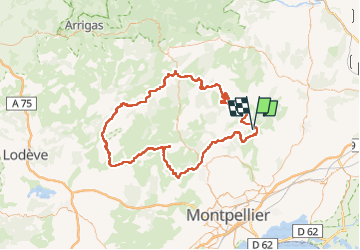
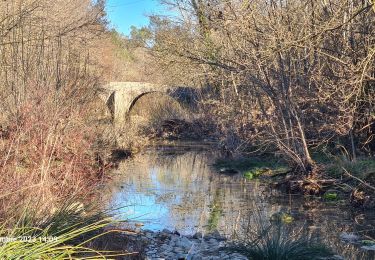
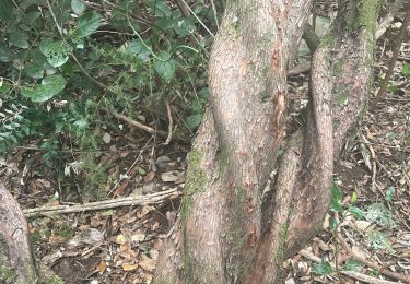
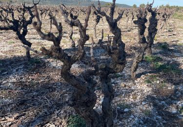
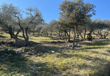
Tocht Stappen van 152 km beschikbaar op Occitanië, Hérault, Saint-Bauzille-de-Montmel. Deze tocht wordt voorgesteld door Aux croisées des GR.
Beschrijving
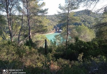
Ravitaillement possible sans détour à Saint Bauzille de Putois, Saint Jean de bouège, Saint Guilhem du Désert, Viol le Fort et Les Matelles.
Boulangerie le matin à Saint Bauzille de Montmel et épicerie.
Plaatsbepaling
Opmerkingen
Wandeltochten in de omgeving
![Tocht Stappen Sainte-Croix-de-Quintillargues - Ste Croix de Quintillargues - Photo](https://media.geolcdn.com/t/375/260/ext.jpg?maxdim=2&url=https%3A%2F%2Fstatic1.geolcdn.com%2Fsiteimages%2Fupload%2Ffiles%2F1553511878bg_sport_marche.png)
![Stappen Stappen](https://static1.geolcdn.com/sitytour/trail-icons/101.png)
Stappen
![](/images/other/stat-length.png)
![](https://static1.geolcdn.com/siteimages/upload/files/16400158638029165_repeat_loop_refresh_sync_direction_icon.png)
![Tocht sport Fontanès - Fontanes - Photo](https://media.geolcdn.com/t/375/260/1d9c4f50-de68-4de6-a46d-3eba75c7d0ac.jpg&format=jpg&maxdim=2)
sport
![](/images/other/stat-length.png)
![](https://static1.geolcdn.com/siteimages/upload/files/16400158638029165_repeat_loop_refresh_sync_direction_icon.png)
![Tocht Stappen Saint-Bauzille-de-Montmel - Puech des Mourgues - Photo](https://media.geolcdn.com/t/375/260/778d0258-477b-444e-94ad-029be09d1018.jpg&format=jpg&maxdim=2)
![Stappen Stappen](https://static1.geolcdn.com/sitytour/trail-icons/101.png)
Stappen
![](/images/other/stat-length.png)
![](https://static1.geolcdn.com/siteimages/upload/files/16400158638029165_repeat_loop_refresh_sync_direction_icon.png)
![Tocht Stappen Vacquières - chapelle D'Aleyrac vers vacquieres parc du duc - Photo](https://media.geolcdn.com/t/375/260/1016cbc1-84d7-4082-b269-d91c1919b57d.jpg&format=jpg&maxdim=2)
![Stappen Stappen](https://static1.geolcdn.com/sitytour/trail-icons/101.png)
Stappen
![](/images/other/stat-length.png)
![](https://static1.geolcdn.com/siteimages/upload/files/16400158638029165_repeat_loop_refresh_sync_direction_icon.png)
![Tocht Stappen Garrigues - Le bois de Paris - Photo](https://media.geolcdn.com/t/375/260/8deae6f9-09fb-4d62-a1cb-2b84c26d3682.jpg&format=jpg&maxdim=2)
![Stappen Stappen](https://static1.geolcdn.com/sitytour/trail-icons/101.png)
Stappen
![](/images/other/stat-length.png)
![](https://static1.geolcdn.com/siteimages/upload/files/16400158638029165_repeat_loop_refresh_sync_direction_icon.png)
![Tocht Stappen Sainte-Croix-de-Quintillargues - St croix de quintillargues Mas du Greffier M’ont la Suque - Photo](https://media.geolcdn.com/t/375/260/2f227888-4e40-44ad-b59b-0e71e99ca2dc.jpg&format=jpg&maxdim=2)
![Stappen Stappen](https://static1.geolcdn.com/sitytour/trail-icons/101.png)
Stappen
![](/images/other/stat-length.png)
![](https://static1.geolcdn.com/siteimages/upload/files/16400158638029165_repeat_loop_refresh_sync_direction_icon.png)
![Tocht Stappen Valflaunès - Lancyre en Liberté - Photo](https://media.geolcdn.com/t/375/260/2bc24bf9-7978-483e-952c-4da54ff91812.jpg&format=jpg&maxdim=2)
![Stappen Stappen](https://static1.geolcdn.com/sitytour/trail-icons/101.png)
Stappen
![](/images/other/stat-length.png)
![](https://static1.geolcdn.com/siteimages/upload/files/16400158638029165_repeat_loop_refresh_sync_direction_icon.png)
![Tocht Stappen Sainte-Croix-de-Quintillargues - 34 lac de ceceles par la suque26 01 2023 - Photo](https://media.geolcdn.com/t/375/260/62d02f8e-4b6c-4448-983c-345b9727b6c2.jpg&format=jpg&maxdim=2)
![Stappen Stappen](https://static1.geolcdn.com/sitytour/trail-icons/101.png)
Stappen
![](/images/other/stat-length.png)
![](https://static1.geolcdn.com/siteimages/upload/files/16400158638029165_repeat_loop_refresh_sync_direction_icon.png)
![Tocht Stappen Saint-Bauzille-de-Montmel - Le puech des Mourgues - Photo](https://media.geolcdn.com/t/375/260/ba8498e5-37b7-400d-b727-112a8855b4e1.jpg&format=jpg&maxdim=2)
![Stappen Stappen](https://static1.geolcdn.com/sitytour/trail-icons/101.png)
Stappen
![](/images/other/stat-length.png)
![](https://static1.geolcdn.com/siteimages/upload/files/16400158638029165_repeat_loop_refresh_sync_direction_icon.png)