![](/images/other/stat-length.png)
![Tocht Stappen Albiès - GR10 2022 - J5 - équipe marche - Photo](https://media.geolcdn.com/t/1900/400/ext.pjpeg?maxdim=2&url=https%3A%2F%2Fstatic1.geolcdn.com%2Fsiteimages%2Fupload%2Ffiles%2F1553511878bg_sport_marche.png)
GR10 2022 - J5 - équipe marche
JM Heine
Gebruiker
![Lengte](/images/other/stat-length.png)
Lengte
14 km
![Max. hoogte](https://static1.geolcdn.com/siteimages/upload/files/1508320355ic_sort_altitude_max_24dp.png)
Max. hoogte
2366 m
![Positief hoogteverschil](https://static1.geolcdn.com/siteimages/upload/files/1508320355ic_sort_den_pos_24dp.png)
Positief hoogteverschil
843 m
![Km-Effort](/images/other/stat-length.png)
Km-Effort
24 km
![Min. hoogte](https://static1.geolcdn.com/siteimages/upload/files/1508320355ic_sort_altitude_min_24dp.png)
Min. hoogte
1784 m
![Negatief hoogteverschil](https://static1.geolcdn.com/siteimages/upload/files/1508320355ic_sort_den_neg_24dp.png)
Negatief hoogteverschil
436 m
![Boucle](https://static1.geolcdn.com/siteimages/upload/files/16400158638029165_repeat_loop_refresh_sync_direction_icon.png)
Boucle
Neen
Datum van aanmaak :
2022-05-26 08:56:23.354
Laatste wijziging :
2022-05-26 09:00:04.773
![Stappen](https://static1.geolcdn.com/sitytour/trail-icons/101.png)
5h25
Moeilijkheid : Zeer moeilijk
![Scan deze QR-code om de tocht te openen in de SityTrail-applicatie](https://capi.geolives.com/qq0zvz2zws4bq2lad0pu/sitytour/trails/3257201/qr.png?size=200)
Gratisgps-wandelapplicatie
Over ons
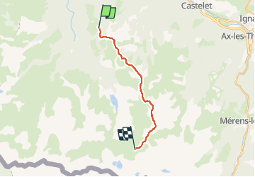
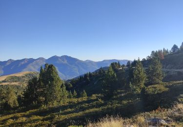
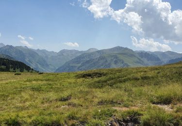
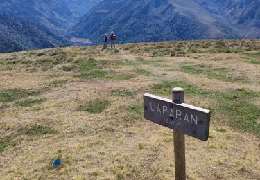
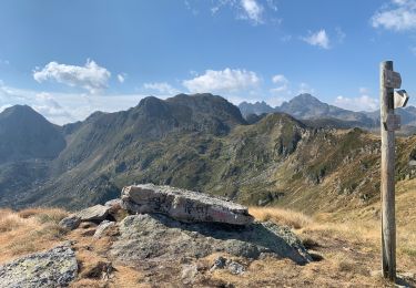
Tocht Stappen van 14 km beschikbaar op Occitanië, Ariège, Albiès. Deze tocht wordt voorgesteld door JM Heine.
Beschrijving
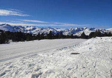
Départ parking du plateau de Beille
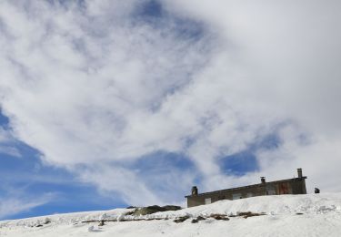
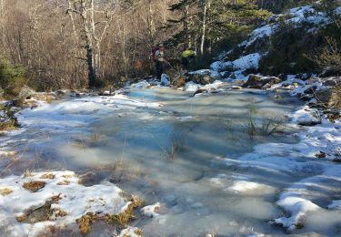
Nuit au refuge du Rhule : 1/2 pension pique-nique 05 61 65 65 01 ou 06 74 24 50 71
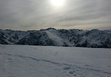
Plaatsbepaling
Land:
France
Regio :
Occitanië
Departement/Provincie :
Ariège
Gemeente :
Albiès
Locatie:
Unknown
Vertrek:(Dec)
Vertrek:(UTM)
392771 ; 4731159 (31T) N.
Opmerkingen
Wandeltochten in de omgeving
![Tocht Noords wandelen Albiès - Plateau de Beille - L'ours - Photo](https://media.geolcdn.com/t/375/260/ext.jpg?maxdim=2&url=https%3A%2F%2Fservices.sitytrail.com%2FGeolivesWS%2FDownloadMedia.ashx%3FTrailID%3D239827%26Media%3Dfix__20140101140841.jpg)
![Noords wandelen Noords wandelen](https://static1.geolcdn.com/sitytour/trail-icons/102.png)
Plateau de Beille - L'ours
Noords wandelen
Medium
(1)
Albiès,
Occitanië,
Ariège,
France
![](/images/other/stat-length.png)
11,5 km | 17 km-effort
3h 29min
![](https://static1.geolcdn.com/siteimages/upload/files/16400158638029165_repeat_loop_refresh_sync_direction_icon.png)
Ja
![Sneeuwschoenen Sneeuwschoenen](https://static1.geolcdn.com/sitytour/trail-icons/504.png)
Plateau de Beille
Sneeuwschoenen
Gemakkelijk
Albiès,
Occitanië,
Ariège,
France
![](/images/other/stat-length.png)
7,2 km | 10,1 km-effort
2h 33min
![](https://static1.geolcdn.com/siteimages/upload/files/16400158638029165_repeat_loop_refresh_sync_direction_icon.png)
Ja
![Tocht Sneeuwschoenen Albiès - Plateau de beille - Photo](https://media.geolcdn.com/t/375/260/da6a2572-4c1b-41ed-9590-3cd2a4cf46bb.jpg&format=jpg&maxdim=2)
![Sneeuwschoenen Sneeuwschoenen](https://static1.geolcdn.com/sitytour/trail-icons/504.png)
Plateau de beille
Sneeuwschoenen
Gemakkelijk
Albiès,
Occitanië,
Ariège,
France
![](/images/other/stat-length.png)
9,6 km | 12,8 km-effort
2h 46min
![](https://static1.geolcdn.com/siteimages/upload/files/16400158638029165_repeat_loop_refresh_sync_direction_icon.png)
Neen
![Tocht Stappen Albiès - Plateau de beille 2023 - Photo](https://media.geolcdn.com/t/375/260/fa1b8e61-ee1a-4848-b664-b8a72612b215.jpg&format=jpg&maxdim=2)
![Stappen Stappen](https://static1.geolcdn.com/sitytour/trail-icons/101.png)
Plateau de beille 2023
Stappen
Gemakkelijk
Albiès,
Occitanië,
Ariège,
France
![](/images/other/stat-length.png)
7,4 km | 9,9 km-effort
4h 1min
![](https://static1.geolcdn.com/siteimages/upload/files/16400158638029165_repeat_loop_refresh_sync_direction_icon.png)
Ja
![Tocht Stappen Albiès - Plateau de Beille et Crête des Gènibres - Photo](https://media.geolcdn.com/t/375/260/cf66f9fb-ea7d-4bb9-8906-e5d9cb1e9304.jpg&format=jpg&maxdim=2)
![Stappen Stappen](https://static1.geolcdn.com/sitytour/trail-icons/101.png)
Plateau de Beille et Crête des Gènibres
Stappen
Medium
Albiès,
Occitanië,
Ariège,
France
![](/images/other/stat-length.png)
16,8 km | 25 km-effort
5h 40min
![](https://static1.geolcdn.com/siteimages/upload/files/16400158638029165_repeat_loop_refresh_sync_direction_icon.png)
Ja
![Tocht Stappen Albiès - plateau Beille - Photo](https://media.geolcdn.com/t/375/260/f3b2cab8-bd62-4c33-9981-852ae48441a8.jpg&format=jpg&maxdim=2)
![Stappen Stappen](https://static1.geolcdn.com/sitytour/trail-icons/101.png)
![Tocht Stappen Albiès - Beille 2022 - Photo](https://media.geolcdn.com/t/375/260/10123c6e-4d4a-40ba-9f46-828c7d62ad25.jpg&format=jpg&maxdim=2)
![Stappen Stappen](https://static1.geolcdn.com/sitytour/trail-icons/101.png)
![Tocht Stappen Albiès - 2022 TRANSPYRÉNÉ - Plateau de Bielle (Angaka) - refuge de Ruhle - Photo](https://media.geolcdn.com/t/375/260/fd2d908d-d73f-431b-aa74-1af01944cbee.jpg&format=jpg&maxdim=2)
![Stappen Stappen](https://static1.geolcdn.com/sitytour/trail-icons/101.png)
2022 TRANSPYRÉNÉ - Plateau de Bielle (Angaka) - refuge de Ruhle
Stappen
Moeilijk
Albiès,
Occitanië,
Ariège,
France
![](/images/other/stat-length.png)
15,4 km | 25 km-effort
4h 23min
![](https://static1.geolcdn.com/siteimages/upload/files/16400158638029165_repeat_loop_refresh_sync_direction_icon.png)
Neen
![Tocht Stappen Aston - Massayres janvier 2020 - Photo](https://media.geolcdn.com/t/375/260/bb411948-71b3-4a92-a42a-79e20006fb67.jpg&format=jpg&maxdim=2)
![Stappen Stappen](https://static1.geolcdn.com/sitytour/trail-icons/101.png)
Massayres janvier 2020
Stappen
Moeilijk
Aston,
Occitanië,
Ariège,
France
![](/images/other/stat-length.png)
9,7 km | 21 km-effort
5h 42min
![](https://static1.geolcdn.com/siteimages/upload/files/16400158638029165_repeat_loop_refresh_sync_direction_icon.png)
Ja