![](/images/other/stat-length.png)
![Tocht Stappen Err - Pigmal - Photo](https://media.geolcdn.com/t/1900/400/ext.pjpeg?maxdim=2&url=https%3A%2F%2Fservices.sitytrail.com%2FGeolivesWS%2FDownloadMedia.ashx%3FTrailID%3D324708%26Media%3Dfix__20140715155646.jpg)
Pigmal
ip45
Gebruiker
![Lengte](/images/other/stat-length.png)
Lengte
13,2 km
![Max. hoogte](https://static1.geolcdn.com/siteimages/upload/files/1508320355ic_sort_altitude_max_24dp.png)
Max. hoogte
2904 m
![Positief hoogteverschil](https://static1.geolcdn.com/siteimages/upload/files/1508320355ic_sort_den_pos_24dp.png)
Positief hoogteverschil
994 m
![Km-Effort](/images/other/stat-length.png)
Km-Effort
27 km
![Min. hoogte](https://static1.geolcdn.com/siteimages/upload/files/1508320355ic_sort_altitude_min_24dp.png)
Min. hoogte
1980 m
![Negatief hoogteverschil](https://static1.geolcdn.com/siteimages/upload/files/1508320355ic_sort_den_neg_24dp.png)
Negatief hoogteverschil
1004 m
![Boucle](https://static1.geolcdn.com/siteimages/upload/files/16400158638029165_repeat_loop_refresh_sync_direction_icon.png)
Boucle
Ja
Datum van aanmaak :
2014-12-10 00:00:00.0
Laatste wijziging :
2014-12-10 00:00:00.0
![Stappen](https://static1.geolcdn.com/sitytour/trail-icons/101.png)
7h08
Moeilijkheid : Zeer moeilijk
![Scan deze QR-code om de tocht te openen in de SityTrail-applicatie](https://capi.geolives.com/qq0zvz2zws4bq2lad0pu/sitytour/trails/324708/qr.png?size=200)
Gratisgps-wandelapplicatie
Over ons
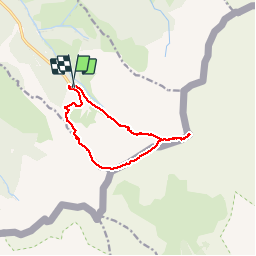
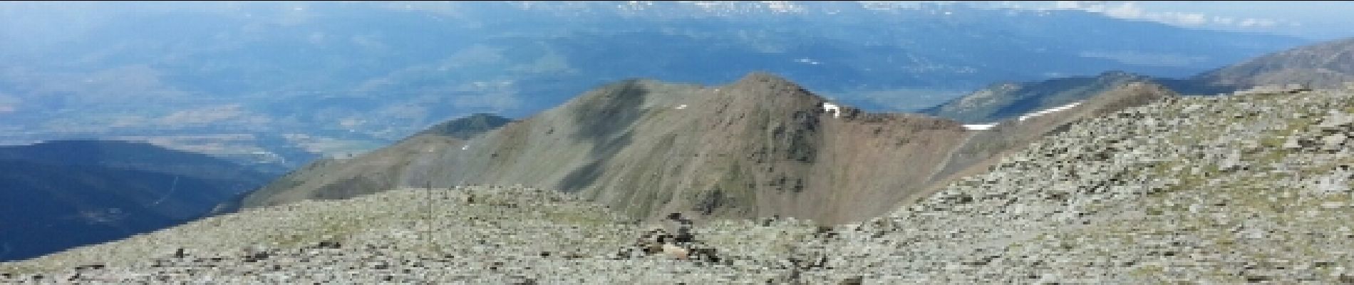
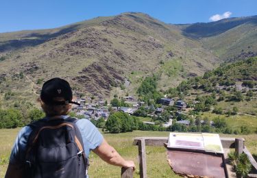
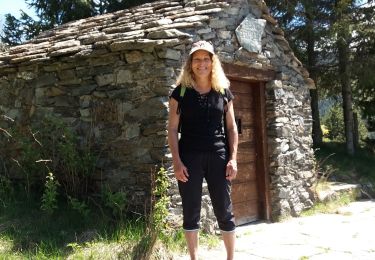
Tocht Stappen van 13,2 km beschikbaar op Occitanië, Pyrénées-Orientales, Err. Deze tocht wordt voorgesteld door ip45.
Beschrijving
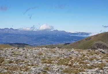
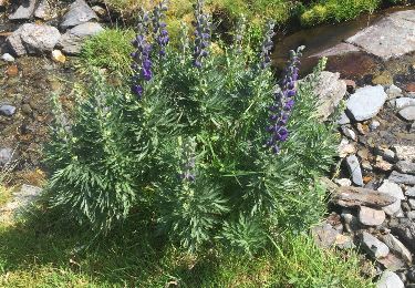
randonnée très difficile avec un gros dénivelé. Passage très dur dans les cailloux avoir un pied montagnard.Temps changeant prévoir et équipement chaud avec coupe vent. Mais reste un e belle randonnée qui se mérite.
Plaatsbepaling
Land:
France
Regio :
Occitanië
Departement/Provincie :
Pyrénées-Orientales
Gemeente :
Err
Locatie:
Unknown
Vertrek:(Dec)
Vertrek:(UTM)
424007 ; 4694099 (31T) N.
Opmerkingen
Wandeltochten in de omgeving
![Tocht Stappen Valcebollère - Chapelle San Bernabéu - Photo](https://media.geolcdn.com/t/375/260/9aec05f5-c983-4353-80fa-609f342769b3.jpg&format=jpg&maxdim=2)
![Stappen Stappen](https://static1.geolcdn.com/sitytour/trail-icons/101.png)
Chapelle San Bernabéu
Stappen
Gemakkelijk
Valcebollère,
Occitanië,
Pyrénées-Orientales,
France
![](/images/other/stat-length.png)
5,4 km | 8,6 km-effort
1h 50min
![](https://static1.geolcdn.com/siteimages/upload/files/16400158638029165_repeat_loop_refresh_sync_direction_icon.png)
Neen
![Tocht Stappen Valcebollère - la cami de sant bertheleu - Photo](https://media.geolcdn.com/t/375/260/bc57d595-92e3-4ec5-83cc-2b8866de7a20.jpg&format=jpg&maxdim=2)
![Stappen Stappen](https://static1.geolcdn.com/sitytour/trail-icons/101.png)
la cami de sant bertheleu
Stappen
Heel gemakkelijk
Valcebollère,
Occitanië,
Pyrénées-Orientales,
France
![](/images/other/stat-length.png)
6,2 km | 9,7 km-effort
2h 25min
![](https://static1.geolcdn.com/siteimages/upload/files/16400158638029165_repeat_loop_refresh_sync_direction_icon.png)
Ja
![Tocht Stappen Err - d'Err à Bolquère - Photo](https://media.geolcdn.com/t/375/260/ext.jpg?maxdim=2&url=https%3A%2F%2Fservices.sitytrail.com%2FGeolivesWS%2FDownloadMedia.ashx%3FTrailID%3D463856%26Media%3Dcd69e17a-c2ca-4f73-a13d-f94eeec431c1.JPG)
![Stappen Stappen](https://static1.geolcdn.com/sitytour/trail-icons/101.png)
d'Err à Bolquère
Stappen
Gemakkelijk
Err,
Occitanië,
Pyrénées-Orientales,
France
![](/images/other/stat-length.png)
12,9 km | 18,5 km-effort
4h 10min
![](https://static1.geolcdn.com/siteimages/upload/files/16400158638029165_repeat_loop_refresh_sync_direction_icon.png)
Neen
![Tocht Sneeuwschoenen Err - Pas de Lladres - Err - Photo](https://media.geolcdn.com/t/375/260/ext.jpg?maxdim=2&url=https%3A%2F%2Fservices.sitytrail.com%2FGeolivesWS%2FDownloadMedia.ashx%3FTrailID%3D173001%26Media%3D14500_5.jpg)
![Sneeuwschoenen Sneeuwschoenen](https://static1.geolcdn.com/sitytour/trail-icons/504.png)
Pas de Lladres - Err
Sneeuwschoenen
Moeilijk
Err,
Occitanië,
Pyrénées-Orientales,
France
![](/images/other/stat-length.png)
15,1 km | 28 km-effort
5h 0min
![](https://static1.geolcdn.com/siteimages/upload/files/16400158638029165_repeat_loop_refresh_sync_direction_icon.png)
Ja
![Tocht Stappen Err - Puig Puigmal d'err - Photo](https://media.geolcdn.com/t/375/260/1d9ddde0-fa85-4c3d-b5b9-c9f964431b8f.jpg&format=jpg&maxdim=2)
![Stappen Stappen](https://static1.geolcdn.com/sitytour/trail-icons/101.png)
Puig Puigmal d'err
Stappen
Medium
Err,
Occitanië,
Pyrénées-Orientales,
France
![](/images/other/stat-length.png)
10,4 km | 23 km-effort
3h 12min
![](https://static1.geolcdn.com/siteimages/upload/files/16400158638029165_repeat_loop_refresh_sync_direction_icon.png)
Ja
![Tocht Stappen Valcebollère - balade frontalière - Photo](https://media.geolcdn.com/t/375/260/ext.jpg?maxdim=2&url=https%3A%2F%2Fservices.sitytrail.com%2FGeolivesWS%2FDownloadMedia.ashx%3FTrailID%3D1021750%26Media%3Dfix__20180814133008.jpg)
![Stappen Stappen](https://static1.geolcdn.com/sitytour/trail-icons/101.png)
balade frontalière
Stappen
Gemakkelijk
Valcebollère,
Occitanië,
Pyrénées-Orientales,
France
![](/images/other/stat-length.png)
11,4 km | 17,6 km-effort
3h 9min
![](https://static1.geolcdn.com/siteimages/upload/files/16400158638029165_repeat_loop_refresh_sync_direction_icon.png)
Ja
![Tocht Stappen Err - parking les Planes au Puigmal d'Err - Photo](https://media.geolcdn.com/t/375/260/ext.jpg?maxdim=2&url=https%3A%2F%2Fservices.sitytrail.com%2FGeolivesWS%2FDownloadMedia.ashx%3FTrailID%3D606025%26Media%3D20160730122138.jpg)
![Stappen Stappen](https://static1.geolcdn.com/sitytour/trail-icons/101.png)
parking les Planes au Puigmal d'Err
Stappen
Moeilijk
Err,
Occitanië,
Pyrénées-Orientales,
France
![](/images/other/stat-length.png)
11,5 km | 24 km-effort
5h 0min
![](https://static1.geolcdn.com/siteimages/upload/files/16400158638029165_repeat_loop_refresh_sync_direction_icon.png)
Ja
![Tocht Sneeuwschoenen Valcebollère - La Capella de Sant Barnabeu - Valcebollère - Photo](https://media.geolcdn.com/t/375/260/ext.jpg?maxdim=2&url=https%3A%2F%2Fservices.sitytrail.com%2FGeolivesWS%2FDownloadMedia.ashx%3FTrailID%3D111510%26Media%3D7501_2.jpg)
![Sneeuwschoenen Sneeuwschoenen](https://static1.geolcdn.com/sitytour/trail-icons/504.png)
La Capella de Sant Barnabeu - Valcebollère
Sneeuwschoenen
Moeilijk
Valcebollère,
Occitanië,
Pyrénées-Orientales,
France
![](/images/other/stat-length.png)
9,9 km | 14,7 km-effort
4h 49min
![](https://static1.geolcdn.com/siteimages/upload/files/16400158638029165_repeat_loop_refresh_sync_direction_icon.png)
Ja
![Tocht Sneeuwschoenen Sainte-Léocadie - Le Puig d'Estaques en raquettes - Photo](https://media.geolcdn.com/t/375/260/ext.jpg?maxdim=2&url=https%3A%2F%2Fservices.sitytrail.com%2FGeolivesWS%2FDownloadMedia.ashx%3FTrailID%3D111482%26Media%3D7438_1.jpg)
![Sneeuwschoenen Sneeuwschoenen](https://static1.geolcdn.com/sitytour/trail-icons/504.png)
Le Puig d'Estaques en raquettes
Sneeuwschoenen
Moeilijk
Sainte-Léocadie,
Occitanië,
Pyrénées-Orientales,
France
![](/images/other/stat-length.png)
9,3 km | 15,4 km-effort
5h 15min
![](https://static1.geolcdn.com/siteimages/upload/files/16400158638029165_repeat_loop_refresh_sync_direction_icon.png)
Ja