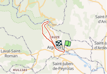
![](/images/other/stat-length.png)
![Tocht Stappen Saint-Martin-d'Ardèche - aiguèze - Photo](https://media.geolcdn.com/t/1900/400/ext.pjpeg?maxdim=2&url=https%3A%2F%2Fstatic1.geolcdn.com%2Fsiteimages%2Fupload%2Ffiles%2F1553511878bg_sport_marche.png)
aiguèze
jeanjacquescavet
Gebruiker
![Lengte](/images/other/stat-length.png)
![Max. hoogte](https://static1.geolcdn.com/siteimages/upload/files/1508320355ic_sort_altitude_max_24dp.png)
![Positief hoogteverschil](https://static1.geolcdn.com/siteimages/upload/files/1508320355ic_sort_den_pos_24dp.png)
![Km-Effort](/images/other/stat-length.png)
![Min. hoogte](https://static1.geolcdn.com/siteimages/upload/files/1508320355ic_sort_altitude_min_24dp.png)
![Negatief hoogteverschil](https://static1.geolcdn.com/siteimages/upload/files/1508320355ic_sort_den_neg_24dp.png)
![Boucle](https://static1.geolcdn.com/siteimages/upload/files/16400158638029165_repeat_loop_refresh_sync_direction_icon.png)
![Stappen](https://static1.geolcdn.com/sitytour/trail-icons/101.png)
3h12
Moeilijkheid : Moeilijk
![Scan deze QR-code om de tocht te openen in de SityTrail-applicatie](https://capi.geolives.com/qq0zvz2zws4bq2lad0pu/sitytour/trails/3228232/qr.png?size=200)
Gratisgps-wandelapplicatie
Over ons
Tocht Stappen van 9,5 km beschikbaar op Auvergne-Rhône-Alpes, Ardèche, Saint-Martin-d'Ardèche. Deze tocht wordt voorgesteld door jeanjacquescavet.
Beschrijving
boucle à partir de Saint Martin d'Ardèche
Passer le pont suspendu
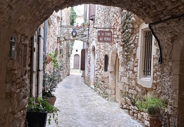
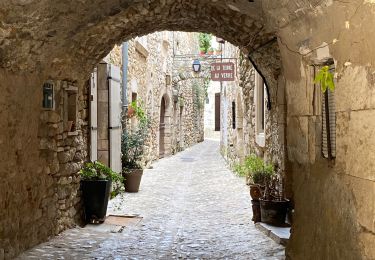
remonter jusqu'à Ai guèze
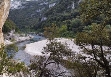
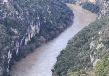
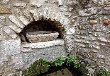
descendre au bord de l'Ardèche
suivre la rive jusque la plage en face Roc Pointu
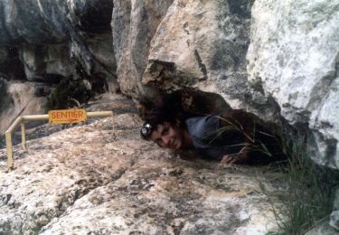
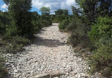
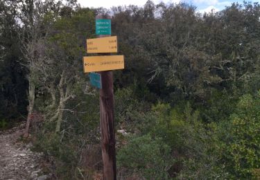
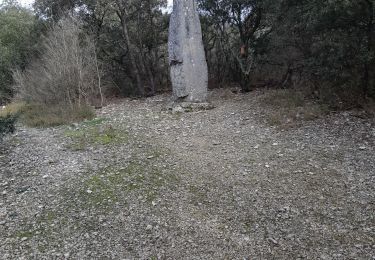
remonter par un petit sentier pour rejoindre le GR4
retour vers aiguèze et Saint Martin
Plaatsbepaling
Opmerkingen
Wandeltochten in de omgeving
![Tocht Stappen Saint-Martin-d'Ardèche - GR4 Aigueze - Photo](https://media.geolcdn.com/t/375/260/ext.jpg?maxdim=2&url=https%3A%2F%2Fservices.sitytrail.com%2FGeolivesWS%2FDownloadMedia.ashx%3FTrailID%3D325544%26Media%3Dfix__20140709163308.jpg)
![Stappen Stappen](https://static1.geolcdn.com/sitytour/trail-icons/101.png)
Stappen
![](/images/other/stat-length.png)
![](https://static1.geolcdn.com/siteimages/upload/files/16400158638029165_repeat_loop_refresh_sync_direction_icon.png)
![Tocht Stappen Aiguèze - 30 aigueze ribeirol - Photo](https://media.geolcdn.com/t/375/260/a5de248d-2217-49e5-9c57-d3e37cd5f6c4.jpg&format=jpg&maxdim=2)
![Stappen Stappen](https://static1.geolcdn.com/sitytour/trail-icons/101.png)
Stappen
![](/images/other/stat-length.png)
![](https://static1.geolcdn.com/siteimages/upload/files/16400158638029165_repeat_loop_refresh_sync_direction_icon.png)
![Tocht Stappen Saint-Martin-d'Ardèche - Aigueze rocher de Castelviel - Photo](https://media.geolcdn.com/t/375/260/416d7ebd-2359-4463-8249-a90d2272e98d.jpg&format=jpg&maxdim=2)
![Stappen Stappen](https://static1.geolcdn.com/sitytour/trail-icons/101.png)
Stappen
![](/images/other/stat-length.png)
![](https://static1.geolcdn.com/siteimages/upload/files/16400158638029165_repeat_loop_refresh_sync_direction_icon.png)
![Tocht Stappen Saint-Martin-d'Ardèche - Sauze bivouac de Gournier - Photo](https://media.geolcdn.com/t/375/260/baac8ebe-8937-4db4-b6c4-7e0bd115b9f1.jpg&format=jpg&maxdim=2)
![Stappen Stappen](https://static1.geolcdn.com/sitytour/trail-icons/101.png)
Stappen
![](/images/other/stat-length.png)
![](https://static1.geolcdn.com/siteimages/upload/files/16400158638029165_repeat_loop_refresh_sync_direction_icon.png)
![Tocht Stappen Saint-Martin-d'Ardèche - 07 st martin d ardeche gorge ardeche - Photo](https://media.geolcdn.com/t/375/260/fdc113c1-1a01-412d-be10-a6b4f2c87d8a.jpg&format=jpg&maxdim=2)
![Stappen Stappen](https://static1.geolcdn.com/sitytour/trail-icons/101.png)
Stappen
![](/images/other/stat-length.png)
![](https://static1.geolcdn.com/siteimages/upload/files/16400158638029165_repeat_loop_refresh_sync_direction_icon.png)
![Tocht Stappen Aiguèze - Aigueze - Photo](https://media.geolcdn.com/t/375/260/e7b8de9a-d915-48ca-baac-0319f593dc54.jpg&format=jpg&maxdim=2)
![Stappen Stappen](https://static1.geolcdn.com/sitytour/trail-icons/101.png)
![Tocht Stappen Saint-Martin-d'Ardèche - Saint Martin d’Ardéche - Photo](https://media.geolcdn.com/t/375/260/b543bd48-15f1-4b47-a933-7d4f79f7128e.jpg&format=jpg&maxdim=2)
![Stappen Stappen](https://static1.geolcdn.com/sitytour/trail-icons/101.png)
Stappen
![](/images/other/stat-length.png)
![](https://static1.geolcdn.com/siteimages/upload/files/16400158638029165_repeat_loop_refresh_sync_direction_icon.png)
![Tocht Stappen Saint-Marcel-d'Ardèche - rando octobre rose - Photo](https://media.geolcdn.com/t/375/260/501d2ffe-4bd2-45c8-898e-66f9a74c15e7.jpg&format=jpg&maxdim=2)
![Stappen Stappen](https://static1.geolcdn.com/sitytour/trail-icons/101.png)
Stappen
![](/images/other/stat-length.png)
![](https://static1.geolcdn.com/siteimages/upload/files/16400158638029165_repeat_loop_refresh_sync_direction_icon.png)
![Tocht Te voet Aiguèze - FR-PR 24 - Photo](https://media.geolcdn.com/t/375/260/adb231a8-9d03-4c90-9261-a3c9f3c8fd1c.jpeg&format=jpg&maxdim=2)
![Te voet Te voet](https://static1.geolcdn.com/sitytour/trail-icons/100.png)