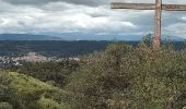

Les Maurras Les Garduères rduaires

Migueldefrance
Gebruiker

Lengte
4 km

Max. hoogte
569 m

Positief hoogteverschil
111 m

Km-Effort
5,7 km

Min. hoogte
395 m

Negatief hoogteverschil
174 m
Boucle
Neen
Datum van aanmaak :
2022-04-24 13:31:21.774
Laatste wijziging :
2022-04-24 15:44:21.969
2h00
Moeilijkheid : Heel gemakkelijk

Gratisgps-wandelapplicatie
Over ons
Tocht Stappen van 4 km beschikbaar op Provence-Alpes-Côte d'Azur, Var, Saint-Julien. Deze tocht wordt voorgesteld door Migueldefrance.
Beschrijving
Partir des Maurras (non tracé au départ) et prendre le sentier de droite jusqu'au départ de la trace juste avant les Garduères (ruines du village).
Retour en boucle par la grande piste.
Plaatsbepaling
Land:
France
Regio :
Provence-Alpes-Côte d'Azur
Departement/Provincie :
Var
Gemeente :
Saint-Julien
Locatie:
Unknown
Vertrek:(Dec)
Vertrek:(UTM)
733812 ; 4845827 (31T) N.
Opmerkingen
Wandeltochten in de omgeving
20220612 - Gréoux les Bains - Découverte


Stappen
Medium
(1)
Gréoux-les-Bains,
Provence-Alpes-Côte d'Azur,
Alpes-de-Haute-Provence,
France

6,2 km | 7,8 km-effort
2h 5min
Ja
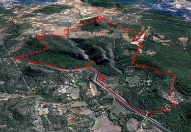
Saint Julien le Montagnier par Aqueduc et Grotte de Malaurie


Stappen
Medium
(1)
Saint-Julien,
Provence-Alpes-Côte d'Azur,
Var,
France

15,4 km | 21 km-effort
6h 0min
Ja
De Gréoux les Bains au Lac d'Esparron


Mountainbike
Medium
(2)
Gréoux-les-Bains,
Provence-Alpes-Côte d'Azur,
Alpes-de-Haute-Provence,
France

22 km | 30 km-effort
2h 0min
Ja
2022-11-11 Balcon de Saint Julien au lac d'Esparon


Stappen
Medium
Saint-Julien,
Provence-Alpes-Côte d'Azur,
Var,
France

16,9 km | 23 km-effort
4h 5min
Ja
20220617 - Gréoux 6.5 Km


Stappen
Medium
Gréoux-les-Bains,
Provence-Alpes-Côte d'Azur,
Alpes-de-Haute-Provence,
France

6,5 km | 7,9 km-effort
2h 0min
Ja
20220616 - Gréoux-les-Bains - Visite château


Stappen
Medium
Gréoux-les-Bains,
Provence-Alpes-Côte d'Azur,
Alpes-de-Haute-Provence,
France

6,9 km | 9 km-effort
2h 34min
Ja
08-04-2022 Gréoux - Les Maurras


Stappen
Gemakkelijk
Gréoux-les-Bains,
Provence-Alpes-Côte d'Azur,
Alpes-de-Haute-Provence,
France

15,2 km | 21 km-effort
3h 43min
Ja
06-04-2022 Gréoux - St Martin de Brômes


Stappen
Moeilijk
Gréoux-les-Bains,
Provence-Alpes-Côte d'Azur,
Alpes-de-Haute-Provence,
France

13,8 km | 19,2 km-effort
3h 44min
Ja

VTT Single spirit - Gréoux les Bains


Mountainbike
Moeilijk
(2)
Gréoux-les-Bains,
Provence-Alpes-Côte d'Azur,
Alpes-de-Haute-Provence,
France

18,2 km | 25 km-effort
1h 30min
Ja


 SityTrail


