![](/images/other/stat-length.png)
![Tocht Stappen Le Marin - Beauchêne - Anse Grosse roche - Photo](https://media.geolcdn.com/t/1900/400/ext.pjpeg?maxdim=2&url=https%3A%2F%2Fstatic1.geolcdn.com%2Fsiteimages%2Fupload%2Ffiles%2F1553511878bg_sport_marche.png)
Beauchêne - Anse Grosse roche
ThereseH
Gebruiker
![Lengte](/images/other/stat-length.png)
![Max. hoogte](https://static1.geolcdn.com/siteimages/upload/files/1508320355ic_sort_altitude_max_24dp.png)
![Positief hoogteverschil](https://static1.geolcdn.com/siteimages/upload/files/1508320355ic_sort_den_pos_24dp.png)
![Km-Effort](/images/other/stat-length.png)
![Min. hoogte](https://static1.geolcdn.com/siteimages/upload/files/1508320355ic_sort_altitude_min_24dp.png)
![Negatief hoogteverschil](https://static1.geolcdn.com/siteimages/upload/files/1508320355ic_sort_den_neg_24dp.png)
![Boucle](https://static1.geolcdn.com/siteimages/upload/files/16400158638029165_repeat_loop_refresh_sync_direction_icon.png)
![Stappen](https://static1.geolcdn.com/sitytour/trail-icons/101.png)
3h05
Moeilijkheid : Gemakkelijk
![Scan deze QR-code om de tocht te openen in de SityTrail-applicatie](https://capi.geolives.com/qq0zvz2zws4bq2lad0pu/sitytour/trails/3211073/qr.png?size=200)
Gratisgps-wandelapplicatie
Over ons
Tocht Stappen van 6 km beschikbaar op Martinique, Onbekend, Le Marin. Deze tocht wordt voorgesteld door ThereseH.
Beschrijving
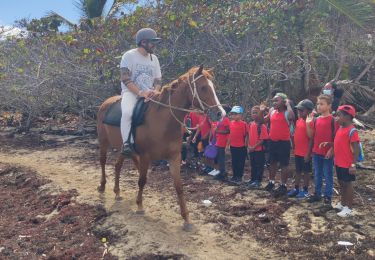
Boucle dans le cadre d'une prestation de médiation animale auprès d'un jeune public autiste (7 de 16 à 21 ans) non sportif.
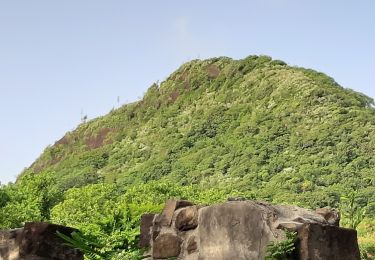
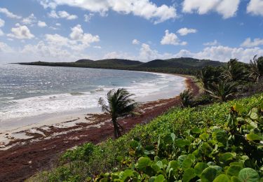
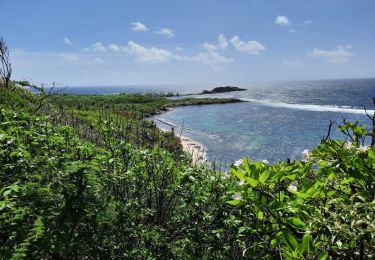
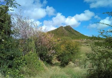
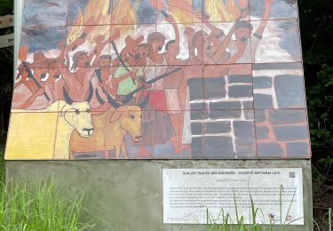
Boucle sans difficulté majeure offrant point de vue sur le littoral atlantique vers le Vauclin et après Grosse Roche vers Saint Anne. Chemin de croix jusque la chapelle des marins offrant panorama sur la montagne du Vauclin et le morne Carrière avec les éoliennes malheureusement couchées actuellement. Végétation de littoral sèche avec cactus cierge et palette, raisinier bord de mer et cocotiers. Pause bord de mer Près du "coeur" de Grosse roche, lancer de balle avec les chiens. Retour par le Morne avec Agaves et point de vue sur la Chapelle et la belle mare que nous visitons avant de partir. Bain des chiens l'eau rafraichissante. Temps un peu chaud malgré les alizés.
Plaatsbepaling
Opmerkingen
Wandeltochten in de omgeving
![Tocht Stappen Sainte-Anne - du piton crève-coeur vers Le Cap chevalier - Photo](https://media.geolcdn.com/t/375/260/6749dbdc-4c58-4322-bb83-2441fae87cce.jpg&format=jpg&maxdim=2)
![Stappen Stappen](https://static1.geolcdn.com/sitytour/trail-icons/101.png)
Stappen
![](/images/other/stat-length.png)
![](https://static1.geolcdn.com/siteimages/upload/files/16400158638029165_repeat_loop_refresh_sync_direction_icon.png)
![Tocht Stappen Sainte-Anne - petit Versailles vers cap chevalier. - Photo](https://media.geolcdn.com/t/375/260/80bbb222-4b9d-4e8c-9d73-6683250d106d.jpg&format=jpg&maxdim=2)
![Stappen Stappen](https://static1.geolcdn.com/sitytour/trail-icons/101.png)
Stappen
![](/images/other/stat-length.png)
![](https://static1.geolcdn.com/siteimages/upload/files/16400158638029165_repeat_loop_refresh_sync_direction_icon.png)
![Tocht Stappen Le Marin - GabyG. Cap Macré/Cap beauchêne. - Photo](https://media.geolcdn.com/t/375/260/ext.jpg?maxdim=2&url=https%3A%2F%2Fservices.sitytrail.com%2FGeolivesWS%2FDownloadMedia.ashx%3FTrailID%3D586588%26Media%3Dfix__20160619102019.jpg)
![Stappen Stappen](https://static1.geolcdn.com/sitytour/trail-icons/101.png)
Stappen
![](/images/other/stat-length.png)
![](https://static1.geolcdn.com/siteimages/upload/files/16400158638029165_repeat_loop_refresh_sync_direction_icon.png)
![Tocht Stappen Le Vauclin - Boucle de petit Macabou et grand macabou. - Photo](https://media.geolcdn.com/t/375/260/512c44c5-7306-4ef6-bd9c-030bc4c8c4b4.jpg&format=jpg&maxdim=2)
![Stappen Stappen](https://static1.geolcdn.com/sitytour/trail-icons/101.png)
Stappen
![](/images/other/stat-length.png)
![](https://static1.geolcdn.com/siteimages/upload/files/16400158638029165_repeat_loop_refresh_sync_direction_icon.png)
![Tocht Stappen Le Vauclin - Randonnée scolaire - Photo](https://media.geolcdn.com/t/375/260/355de9f6-e0cf-496c-9f2e-61b56f53532f.jpg&format=jpg&maxdim=2)
![Stappen Stappen](https://static1.geolcdn.com/sitytour/trail-icons/101.png)
Stappen
![](/images/other/stat-length.png)
![](https://static1.geolcdn.com/siteimages/upload/files/16400158638029165_repeat_loop_refresh_sync_direction_icon.png)
![Tocht Stappen Sainte-Anne - Quartier ferré vers Cap Chevalier avec modification du parcours en cas de problème à Anse aux bois ! - Photo](https://media.geolcdn.com/t/375/260/4864220d-0120-46b6-b6f3-cc694374d95a.jpg&format=jpg&maxdim=2)
![Stappen Stappen](https://static1.geolcdn.com/sitytour/trail-icons/101.png)
Stappen
![](/images/other/stat-length.png)
![](https://static1.geolcdn.com/siteimages/upload/files/16400158638029165_repeat_loop_refresh_sync_direction_icon.png)
![Tocht Stappen Sainte-Anne - parcours sportif de Petite Versailles vers le Cap Chevalier - Photo](https://media.geolcdn.com/t/375/260/2b6752d8-e159-4441-901a-b88c99955e15.jpg&format=jpg&maxdim=2)
![Stappen Stappen](https://static1.geolcdn.com/sitytour/trail-icons/101.png)
Stappen
![](/images/other/stat-length.png)
![](https://static1.geolcdn.com/siteimages/upload/files/16400158638029165_repeat_loop_refresh_sync_direction_icon.png)
![Tocht Stappen Le Vauclin - Petit parcours Macabou - Photo](https://media.geolcdn.com/t/375/260/c067cce8-5144-49fb-8b93-50d81e97a77c.jpg&format=jpg&maxdim=2)
![Stappen Stappen](https://static1.geolcdn.com/sitytour/trail-icons/101.png)
Stappen
![](/images/other/stat-length.png)
![](https://static1.geolcdn.com/siteimages/upload/files/16400158638029165_repeat_loop_refresh_sync_direction_icon.png)
![Tocht sport Sainte-Anne - Piton CRÈVE cœur - Photo](https://media.geolcdn.com/t/375/260/96a2e4cb-8b4c-4ce5-aa39-68e45b252165.jpg&format=jpg&maxdim=2)
sport
![](/images/other/stat-length.png)
![](https://static1.geolcdn.com/siteimages/upload/files/16400158638029165_repeat_loop_refresh_sync_direction_icon.png)