


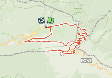

19,1 km | 30 km-effort


Gebruiker


Gratisgps-wandelapplicatie
 SityTrail
IGN / Geografische instituten
SityTrail World
De wereld gaat voor u open
Tocht Stappen van 13,2 km beschikbaar op Provence-Alpes-Côte d'Azur, Vaucluse, Beaumont-du-Ventoux. Deze tocht wordt voorgesteld door morganee.
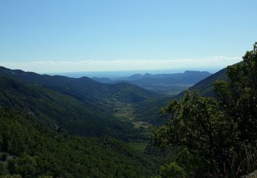
un petit passage un peu trop engagé pour moi lors de la montée, d'où une redescente par la route, puis en sous-bois

Stappen

Stappen

Mountainbike

Mountainbike

Mountainbike

Stappen

Stappen

Stappen
Stappen