![](/images/other/stat-length.png)
![Tocht Stappen Cappy - Les Marais de Suzanne - Cappy - Photo](https://media.geolcdn.com/t/1900/400/ext.pjpeg?maxdim=2&url=https%3A%2F%2Fservices.sitytrail.com%2FGeolivesWS%2FDownloadMedia.ashx%3FTrailID%3D318046%26Media%3D17516_6.jpg)
Les Marais de Suzanne - Cappy
tracegps
Gebruiker
![Lengte](/images/other/stat-length.png)
Lengte
11,2 km
![Max. hoogte](https://static1.geolcdn.com/siteimages/upload/files/1508320355ic_sort_altitude_max_24dp.png)
Max. hoogte
97 m
![Positief hoogteverschil](https://static1.geolcdn.com/siteimages/upload/files/1508320355ic_sort_den_pos_24dp.png)
Positief hoogteverschil
145 m
![Km-Effort](/images/other/stat-length.png)
Km-Effort
13,2 km
![Min. hoogte](https://static1.geolcdn.com/siteimages/upload/files/1508320355ic_sort_altitude_min_24dp.png)
Min. hoogte
37 m
![Negatief hoogteverschil](https://static1.geolcdn.com/siteimages/upload/files/1508320355ic_sort_den_neg_24dp.png)
Negatief hoogteverschil
145 m
![Boucle](https://static1.geolcdn.com/siteimages/upload/files/16400158638029165_repeat_loop_refresh_sync_direction_icon.png)
Boucle
Ja
Datum van aanmaak :
2014-12-10 00:00:00.0
Laatste wijziging :
2014-12-10 00:00:00.0
![Stappen](https://static1.geolcdn.com/sitytour/trail-icons/101.png)
2h45
Moeilijkheid : Medium
![Scan deze QR-code om de tocht te openen in de SityTrail-applicatie](https://capi.geolives.com/qq0zvz2zws4bq2lad0pu/sitytour/trails/318046/qr.png?size=200)
Gratisgps-wandelapplicatie
Over ons
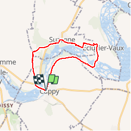
Tocht Stappen van 11,2 km beschikbaar op Hauts-de-France, Somme, Cappy. Deze tocht wordt voorgesteld door tracegps.
Beschrijving
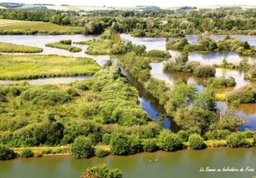
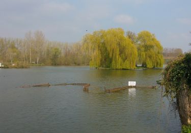
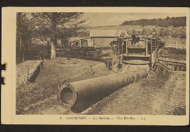
La fête de l'Anguille réunit toutes les années paires les pêcheurs et les chasseurs à Eclusier-Vaux. En attendant, montez au Belvédère pour observer les anguillères.....
Plaatsbepaling
Land:
France
Regio :
Hauts-de-France
Departement/Provincie :
Somme
Gemeente :
Cappy
Locatie:
Unknown
Vertrek:(Dec)
Vertrek:(UTM)
482443 ; 5530611 (31U) N.
Opmerkingen
Wandeltochten in de omgeving
![Tocht Stappen Frise - La Montagne de Frise - Photo](https://media.geolcdn.com/t/375/260/ext.jpg?maxdim=2&url=https%3A%2F%2Fservices.sitytrail.com%2FGeolivesWS%2FDownloadMedia.ashx%3FTrailID%3D191478%26Media%3D15070_3.jpg)
![Stappen Stappen](https://static1.geolcdn.com/sitytour/trail-icons/101.png)
La Montagne de Frise
Stappen
Medium
(1)
Frise,
Hauts-de-France,
Somme,
France
![](/images/other/stat-length.png)
2,2 km | 2,8 km-effort
49min
![](https://static1.geolcdn.com/siteimages/upload/files/16400158638029165_repeat_loop_refresh_sync_direction_icon.png)
Ja
![Tocht Te voet Cappy - Les Royards - Photo](https://media.geolcdn.com/t/375/260/61c5a7bb-5adb-45c2-89f4-300458b09b65.jpeg&format=jpg&maxdim=2)
![Te voet Te voet](https://static1.geolcdn.com/sitytour/trail-icons/100.png)
Les Royards
Te voet
Gemakkelijk
Cappy,
Hauts-de-France,
Somme,
France
![](/images/other/stat-length.png)
8,9 km | 10,4 km-effort
2h 22min
![](https://static1.geolcdn.com/siteimages/upload/files/16400158638029165_repeat_loop_refresh_sync_direction_icon.png)
Ja
![Tocht Stappen Curlu - tour des étangs de curlu - Photo](https://media.geolcdn.com/t/375/260/2b57625a-664a-4009-9f8e-b4056a815ff7.jpg&format=jpg&maxdim=2)
![Stappen Stappen](https://static1.geolcdn.com/sitytour/trail-icons/101.png)
tour des étangs de curlu
Stappen
Heel gemakkelijk
Curlu,
Hauts-de-France,
Somme,
France
![](/images/other/stat-length.png)
10,5 km | 11,6 km-effort
2h 41min
![](https://static1.geolcdn.com/siteimages/upload/files/16400158638029165_repeat_loop_refresh_sync_direction_icon.png)
Ja
![Tocht Stappen Curlu - Autour des étangs de Curlu et Feuillères - Photo](https://media.geolcdn.com/t/375/260/ext.jpg?maxdim=2&url=https%3A%2F%2Fservices.sitytrail.com%2FGeolivesWS%2FDownloadMedia.ashx%3FTrailID%3D991523%26Media%3Dfix__20180622190908.jpg)
![Stappen Stappen](https://static1.geolcdn.com/sitytour/trail-icons/101.png)
Autour des étangs de Curlu et Feuillères
Stappen
Gemakkelijk
(1)
Curlu,
Hauts-de-France,
Somme,
France
![](/images/other/stat-length.png)
11,6 km | 12,7 km-effort
3h 11min
![](https://static1.geolcdn.com/siteimages/upload/files/16400158638029165_repeat_loop_refresh_sync_direction_icon.png)
Ja
![Tocht Andere activiteiten Éclusier-Vaux - Vaux - Marais de la Somme - Photo](https://media.geolcdn.com/t/375/260/ext.jpg?maxdim=2&url=https%3A%2F%2Fservices.sitytrail.com%2FGeolivesWS%2FDownloadMedia.ashx%3FTrailID%3D697712%26Media%3D20170213172513.jpg)
![Andere activiteiten Andere activiteiten](https://static1.geolcdn.com/sitytour/trail-icons/900.png)
Vaux - Marais de la Somme
Andere activiteiten
Heel gemakkelijk
Éclusier-Vaux,
Hauts-de-France,
Somme,
France
![](/images/other/stat-length.png)
8,7 km | 10,1 km-effort
2h 13min
![](https://static1.geolcdn.com/siteimages/upload/files/16400158638029165_repeat_loop_refresh_sync_direction_icon.png)
Ja
![Tocht Stappen Cappy - Les Champs Muraine - Cappy - Photo](https://media.geolcdn.com/t/375/260/ext.jpg?maxdim=2&url=https%3A%2F%2Fservices.sitytrail.com%2FGeolivesWS%2FDownloadMedia.ashx%3FTrailID%3D316902%26Media%3D15996_1.jpg)
![Stappen Stappen](https://static1.geolcdn.com/sitytour/trail-icons/101.png)
Les Champs Muraine - Cappy
Stappen
Medium
Cappy,
Hauts-de-France,
Somme,
France
![](/images/other/stat-length.png)
9,9 km | 11,9 km-effort
2h 15min
![](https://static1.geolcdn.com/siteimages/upload/files/16400158638029165_repeat_loop_refresh_sync_direction_icon.png)
Ja
![Tocht Stappen Frise - montagne de frise - Photo](https://media.geolcdn.com/t/375/260/ext.jpg?maxdim=2&url=https%3A%2F%2Fstatic1.geolcdn.com%2Fsiteimages%2Fupload%2Ffiles%2F1553511878bg_sport_marche.png)
![Stappen Stappen](https://static1.geolcdn.com/sitytour/trail-icons/101.png)
montagne de frise
Stappen
Medium
(1)
Frise,
Hauts-de-France,
Somme,
France
![](/images/other/stat-length.png)
2 km | 2,5 km-effort
1h 0min
![](https://static1.geolcdn.com/siteimages/upload/files/16400158638029165_repeat_loop_refresh_sync_direction_icon.png)
Ja
![Tocht Stappen Curlu - Le chemin des Automitrailleuses - Curlu - Photo](https://media.geolcdn.com/t/375/260/ext.jpg?maxdim=2&url=https%3A%2F%2Fservices.sitytrail.com%2FGeolivesWS%2FDownloadMedia.ashx%3FTrailID%3D172267%26Media%3D13579_6.jpg)
![Stappen Stappen](https://static1.geolcdn.com/sitytour/trail-icons/101.png)
Le chemin des Automitrailleuses - Curlu
Stappen
Medium
(1)
Curlu,
Hauts-de-France,
Somme,
France
![](/images/other/stat-length.png)
11 km | 12 km-effort
3h 19min
![](https://static1.geolcdn.com/siteimages/upload/files/16400158638029165_repeat_loop_refresh_sync_direction_icon.png)
Ja
![Tocht Stappen Chuignolles - CHUIGNOLLES - 80 Circuit du gros canon - Photo](https://media.geolcdn.com/t/375/260/9b9d871f-5b11-44ae-ade1-6d8bca7d07de.jpg&format=jpg&maxdim=2)
![Stappen Stappen](https://static1.geolcdn.com/sitytour/trail-icons/101.png)
CHUIGNOLLES - 80 Circuit du gros canon
Stappen
Medium
Chuignolles,
Hauts-de-France,
Somme,
France
![](/images/other/stat-length.png)
9,3 km | 11,2 km-effort
2h 33min
![](https://static1.geolcdn.com/siteimages/upload/files/16400158638029165_repeat_loop_refresh_sync_direction_icon.png)
Ja
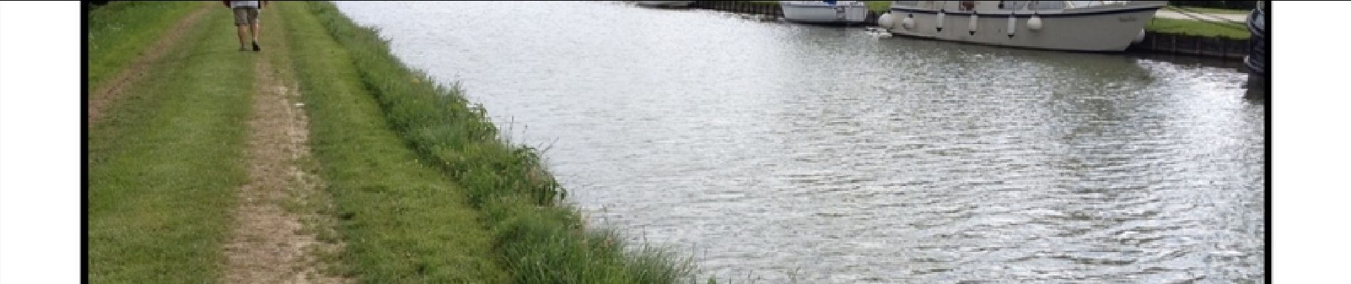
agréable petite randonnée attention au Bois Fauvel le sentier est barré.