![](/images/other/stat-length.png)
![Tocht Stappen Liffré - La Fontaine de Saint-Raoul - Liffré - Photo](https://media.geolcdn.com/t/1900/400/ext.pjpeg?maxdim=2&url=https%3A%2F%2Fservices.sitytrail.com%2FGeolivesWS%2FDownloadMedia.ashx%3FTrailID%3D317704%26Media%3D17007_5.jpg)
La Fontaine de Saint-Raoul - Liffré
tracegps
Gebruiker
![Lengte](/images/other/stat-length.png)
![Max. hoogte](https://static1.geolcdn.com/siteimages/upload/files/1508320355ic_sort_altitude_max_24dp.png)
![Positief hoogteverschil](https://static1.geolcdn.com/siteimages/upload/files/1508320355ic_sort_den_pos_24dp.png)
![Km-Effort](/images/other/stat-length.png)
![Min. hoogte](https://static1.geolcdn.com/siteimages/upload/files/1508320355ic_sort_altitude_min_24dp.png)
![Negatief hoogteverschil](https://static1.geolcdn.com/siteimages/upload/files/1508320355ic_sort_den_neg_24dp.png)
![Boucle](https://static1.geolcdn.com/siteimages/upload/files/16400158638029165_repeat_loop_refresh_sync_direction_icon.png)
![Stappen](https://static1.geolcdn.com/sitytour/trail-icons/101.png)
1h40
Moeilijkheid : Gemakkelijk
![Scan deze QR-code om de tocht te openen in de SityTrail-applicatie](https://capi.geolives.com/qq0zvz2zws4bq2lad0pu/sitytour/trails/317704/qr.png?size=200)
Gratisgps-wandelapplicatie
Over ons
Tocht Stappen van 6,7 km beschikbaar op Bretagne, Ille-et-Vilaine, Liffré. Deze tocht wordt voorgesteld door tracegps.
Beschrijving
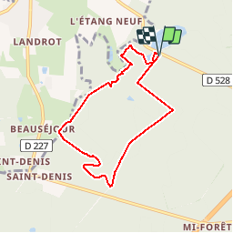
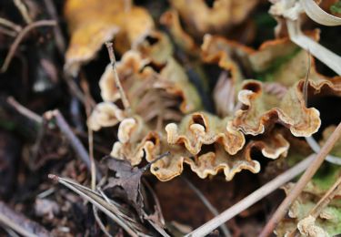
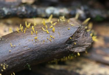
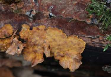
Cette balade, au départ des étangs des Malfrais de Liffré, en forêt de Rennes, classée Zone Naturelle d’Intérêt Faunistique et Floristique, est assez courte mais fort agréable. Elle emprunte tour à tour des petits chemins sinueux et de larges allées forestières. Ouvrez l’œil : cet itinéraire emprunte des tronçons de chemins balisés de différentes manières: traits jaunes, ronds blancs, voir le détail dans la rubrique balisage sur la carte téléchargeable. Retrouvez le circuit sur le site du Tourisme en Haute-Bretagne Ille-et-Vilaine. ou sur le site «balades.bretagne35.com» du Comité départemental du Tourisme Haute Bretagne Ille-et-Vilaine. Cette balade fait partie d'une sélection des "Plus belles balades" du département, réalisé par le Comité Départemental du Tourisme Haute Bretagne Ille-et-Vilaine.
Plaatsbepaling
Opmerkingen
Wandeltochten in de omgeving
![Tocht Te voet Liffré - Circuit du Bâton Roulant - Photo](https://media.geolcdn.com/t/375/260/0517ddbf-81fb-42ed-8a02-375f1086ac5d.jpeg&format=jpg&maxdim=2)
![Te voet Te voet](https://static1.geolcdn.com/sitytour/trail-icons/100.png)
Te voet
![](/images/other/stat-length.png)
![](https://static1.geolcdn.com/siteimages/upload/files/16400158638029165_repeat_loop_refresh_sync_direction_icon.png)
![Tocht Te voet Liffré - Les Jacinthes - Photo](https://media.geolcdn.com/t/375/260/35ec6f36-f8e1-4b21-8387-27758e43194a.jpeg&format=jpg&maxdim=2)
![Te voet Te voet](https://static1.geolcdn.com/sitytour/trail-icons/100.png)
Te voet
![](/images/other/stat-length.png)
![](https://static1.geolcdn.com/siteimages/upload/files/16400158638029165_repeat_loop_refresh_sync_direction_icon.png)
![Tocht Te voet Liffré - Circuit des Écures - Photo](https://media.geolcdn.com/t/375/260/600933ca-89e7-4cc4-b51c-a9e67d5387ef.jpeg&format=jpg&maxdim=2)
![Te voet Te voet](https://static1.geolcdn.com/sitytour/trail-icons/100.png)
Te voet
![](/images/other/stat-length.png)
![](https://static1.geolcdn.com/siteimages/upload/files/16400158638029165_repeat_loop_refresh_sync_direction_icon.png)
![Tocht Te voet Liffré - Circuit du Gué Renaie - Photo](https://media.geolcdn.com/t/375/260/111b5b56-01da-4126-8af6-7ac53a7a7eed.jpeg&format=jpg&maxdim=2)
![Te voet Te voet](https://static1.geolcdn.com/sitytour/trail-icons/100.png)
Te voet
![](/images/other/stat-length.png)
![](https://static1.geolcdn.com/siteimages/upload/files/16400158638029165_repeat_loop_refresh_sync_direction_icon.png)
![Tocht Te voet Saint-Sulpice-la-Forêt - L'Orée de la Forêt - Photo](https://media.geolcdn.com/t/375/260/8654be0d-afb1-4187-a941-813b541da943.jpeg&format=jpg&maxdim=2)
![Te voet Te voet](https://static1.geolcdn.com/sitytour/trail-icons/100.png)
Te voet
![](/images/other/stat-length.png)
![](https://static1.geolcdn.com/siteimages/upload/files/16400158638029165_repeat_loop_refresh_sync_direction_icon.png)
![Tocht Te voet Liffré - Circuit de l'Aqueduc - Photo](https://media.geolcdn.com/t/375/260/af2b4c2a-6a9d-4141-9588-eacee99725f4.jpeg&format=jpg&maxdim=2)
![Te voet Te voet](https://static1.geolcdn.com/sitytour/trail-icons/100.png)
Te voet
![](/images/other/stat-length.png)
![](https://static1.geolcdn.com/siteimages/upload/files/16400158638029165_repeat_loop_refresh_sync_direction_icon.png)
![Tocht Te voet Liffré - Les Juteauderies - Photo](https://media.geolcdn.com/t/375/260/600933ca-89e7-4cc4-b51c-a9e67d5387ef.jpeg&format=jpg&maxdim=2)
![Te voet Te voet](https://static1.geolcdn.com/sitytour/trail-icons/100.png)
Te voet
![](/images/other/stat-length.png)
![](https://static1.geolcdn.com/siteimages/upload/files/16400158638029165_repeat_loop_refresh_sync_direction_icon.png)
![Tocht Te voet Liffré - Les landes de Beaugé - Photo](https://media.geolcdn.com/t/375/260/0a6f6323-8865-4073-8f33-0afff05c6bce.jpeg&format=jpg&maxdim=2)
![Te voet Te voet](https://static1.geolcdn.com/sitytour/trail-icons/100.png)
Te voet
![](/images/other/stat-length.png)
![](https://static1.geolcdn.com/siteimages/upload/files/16400158638029165_repeat_loop_refresh_sync_direction_icon.png)
![Tocht Te voet Liffré - La fontaine Saint-Raoul - Photo](https://media.geolcdn.com/t/375/260/8654be0d-afb1-4187-a941-813b541da943.jpeg&format=jpg&maxdim=2)
![Te voet Te voet](https://static1.geolcdn.com/sitytour/trail-icons/100.png)
Te voet
![](/images/other/stat-length.png)
![](https://static1.geolcdn.com/siteimages/upload/files/16400158638029165_repeat_loop_refresh_sync_direction_icon.png)