![](/images/other/stat-length.png)
![Tocht Stappen Aiguebelette-le-Lac - Par les cols du Crucifix et de Saint-Michel, Aiguebelette le Lac - Photo](https://media.geolcdn.com/t/1900/400/ext.pjpeg?maxdim=2&url=https%3A%2F%2Fservices.sitytrail.com%2FGeolivesWS%2FDownloadMedia.ashx%3FTrailID%3D317585%26Media%3D16847_1.jpg)
Par les cols du Crucifix et de Saint-Michel, Aiguebelette le Lac
tracegps
Gebruiker
![Lengte](/images/other/stat-length.png)
![Max. hoogte](https://static1.geolcdn.com/siteimages/upload/files/1508320355ic_sort_altitude_max_24dp.png)
![Positief hoogteverschil](https://static1.geolcdn.com/siteimages/upload/files/1508320355ic_sort_den_pos_24dp.png)
![Km-Effort](/images/other/stat-length.png)
![Min. hoogte](https://static1.geolcdn.com/siteimages/upload/files/1508320355ic_sort_altitude_min_24dp.png)
![Negatief hoogteverschil](https://static1.geolcdn.com/siteimages/upload/files/1508320355ic_sort_den_neg_24dp.png)
![Boucle](https://static1.geolcdn.com/siteimages/upload/files/16400158638029165_repeat_loop_refresh_sync_direction_icon.png)
![Stappen](https://static1.geolcdn.com/sitytour/trail-icons/101.png)
2h30
Moeilijkheid : Medium
![Scan deze QR-code om de tocht te openen in de SityTrail-applicatie](https://capi.geolives.com/qq0zvz2zws4bq2lad0pu/sitytour/trails/317585/qr.png?size=200)
Gratisgps-wandelapplicatie
Over ons
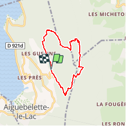
Tocht Stappen van 5,8 km beschikbaar op Auvergne-Rhône-Alpes, Savoie, Aiguebelette-le-Lac. Deze tocht wordt voorgesteld door tracegps.
Beschrijving
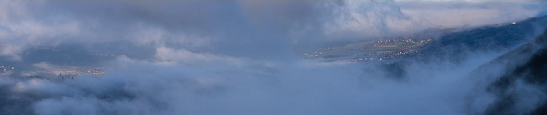
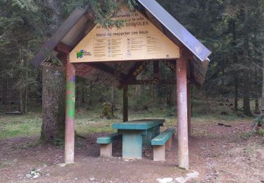
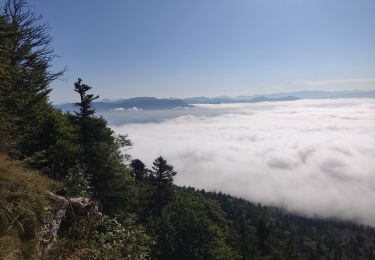
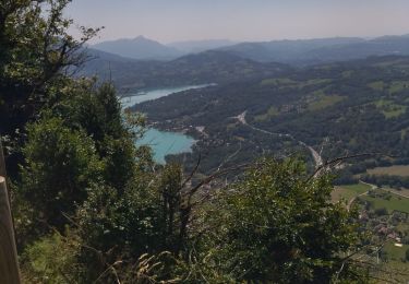
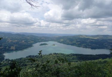
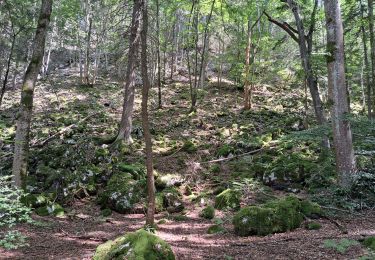
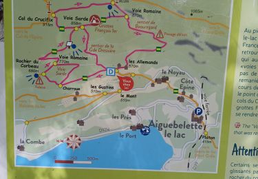
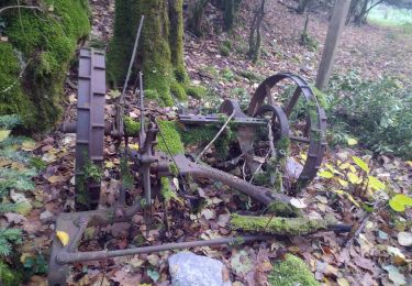
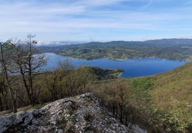
Itinéraire de montagne. Le réseau des sentiers des Voies de l'Épine permet de dessiner des circuits de randonnée chargés de l'histoire des anciennes communications entre la France et l'Italie. Depuis le parking des Allemands, lieu-dit d'Aiguebelette-le-Lac, l'itinéraire emprunte l'ancienne voie romaine impériale, remaniée par les Sardes, pour monter au Col du Crucifix et traverser vers le Col Saint-Michel. Par le Sentier de Beauregard, on retrouvera le point de départ. Ne pas manquer le belvédère du Rocher du Corbeau qui offre une variante sauvage, alternative à son classique aller et retour. Description complète sur sentier-nature.com : Par les cols du Crucifix et de Saint-Michel, Aiguebelette-le-Lac Avertissement [Franchissement 1/3 ; Pénibilité 1/3]. Pour votre sécurité, nous vous invitons à respecter les règles suivantes : être bien chaussé, ne pas s'engager par mauvais temps, ne pas s'écarter de l'itinéraire ni des sentiers. Il apparaît souhaitable de réaliser cette course par temps sec.
Plaatsbepaling
Opmerkingen
Wandeltochten in de omgeving
![Tocht Trail La Motte-Servolex - Château Richard et croix du Signal - Photo](https://media.geolcdn.com/t/375/260/3752241f-e62c-4bc8-86ee-aa981979bc96.jpg&format=jpg&maxdim=2)
![Trail Trail](https://static1.geolcdn.com/sitytour/trail-icons/104.png)
Trail
![](/images/other/stat-length.png)
![](https://static1.geolcdn.com/siteimages/upload/files/16400158638029165_repeat_loop_refresh_sync_direction_icon.png)
![Tocht Stappen Aiguebelette-le-Lac - Mont grêle - Photo](https://media.geolcdn.com/t/375/260/ext.jpg?maxdim=2&url=https%3A%2F%2Fstatic1.geolcdn.com%2Fsiteimages%2Fupload%2Ffiles%2F1553511878bg_sport_marche.png)
![Stappen Stappen](https://static1.geolcdn.com/sitytour/trail-icons/101.png)
Stappen
![](/images/other/stat-length.png)
![](https://static1.geolcdn.com/siteimages/upload/files/16400158638029165_repeat_loop_refresh_sync_direction_icon.png)
![Tocht Stappen La Motte-Servolex - 73 Croix du signal via Château Renard - Photo](https://media.geolcdn.com/t/375/260/b1ac2841-4f6c-4818-af5e-d71b85094992.jpg&format=jpg&maxdim=2)
![Stappen Stappen](https://static1.geolcdn.com/sitytour/trail-icons/101.png)
Stappen
![](/images/other/stat-length.png)
![](https://static1.geolcdn.com/siteimages/upload/files/16400158638029165_repeat_loop_refresh_sync_direction_icon.png)
![Tocht Stappen Aiguebelette-le-Lac - 73 aiguebelette zel - Photo](https://media.geolcdn.com/t/375/260/ab86e02e-83d8-47aa-9f9b-0d6ea22ba856.jpg&format=jpg&maxdim=2)
![Stappen Stappen](https://static1.geolcdn.com/sitytour/trail-icons/101.png)
Stappen
![](/images/other/stat-length.png)
![](https://static1.geolcdn.com/siteimages/upload/files/16400158638029165_repeat_loop_refresh_sync_direction_icon.png)
![Tocht Stappen Aiguebelette-le-Lac - Montagne de l'Epine 2.6.24 - Photo](https://media.geolcdn.com/t/375/260/58f813b2-778e-45f5-aeaf-4a7a3dba23b4.jpg&format=jpg&maxdim=2)
![Stappen Stappen](https://static1.geolcdn.com/sitytour/trail-icons/101.png)
Stappen
![](/images/other/stat-length.png)
![](https://static1.geolcdn.com/siteimages/upload/files/16400158638029165_repeat_loop_refresh_sync_direction_icon.png)
![Tocht Stappen Aiguebelette-le-Lac - Mont Grêle - Photo](https://media.geolcdn.com/t/375/260/4dc3a178-8cfd-47eb-bb85-9b4370a887ab.jpg&format=jpg&maxdim=2)
![Stappen Stappen](https://static1.geolcdn.com/sitytour/trail-icons/101.png)
Stappen
![](/images/other/stat-length.png)
![](https://static1.geolcdn.com/siteimages/upload/files/16400158638029165_repeat_loop_refresh_sync_direction_icon.png)
![Tocht Stappen Saint-Sulpice - st Sulpice - croix de crucifix - Aiguebelette - Photo](https://media.geolcdn.com/t/375/260/6f4855e6-ef2a-4072-968f-26eff92ed454.jpg&format=jpg&maxdim=2)
![Stappen Stappen](https://static1.geolcdn.com/sitytour/trail-icons/101.png)
Stappen
![](/images/other/stat-length.png)
![](https://static1.geolcdn.com/siteimages/upload/files/16400158638029165_repeat_loop_refresh_sync_direction_icon.png)
![Tocht Stappen Nances - ballade vers Nances - Photo](https://media.geolcdn.com/t/375/260/08823fc1-7084-40fb-98e3-3a7cfdd25397.jpg&format=jpg&maxdim=2)
![Stappen Stappen](https://static1.geolcdn.com/sitytour/trail-icons/101.png)
Stappen
![](/images/other/stat-length.png)
![](https://static1.geolcdn.com/siteimages/upload/files/16400158638029165_repeat_loop_refresh_sync_direction_icon.png)
![Tocht Stappen Aiguebelette-le-Lac - Belvédère du Rocher du Corbeau - Photo](https://media.geolcdn.com/t/375/260/ce4a0898-93e9-4db9-96e7-643f23060884.jpg&format=jpg&maxdim=2)
![Stappen Stappen](https://static1.geolcdn.com/sitytour/trail-icons/101.png)
Stappen
![](/images/other/stat-length.png)
![](https://static1.geolcdn.com/siteimages/upload/files/16400158638029165_repeat_loop_refresh_sync_direction_icon.png)